
Sydney's coldest day of the year
Sydney is tracking towards its coldest day of 2025 to date, thanks to a combination of a polar airmass, gusty winds and persistent showers.
At 9am on Wednesday, Sydney was 10.4°C with an apparent or "feels like" temperature of just 5.3°C. (The apparent temperature is a measure of how cold the air actually feels to the human body when you factor in humidity and wind speed.)
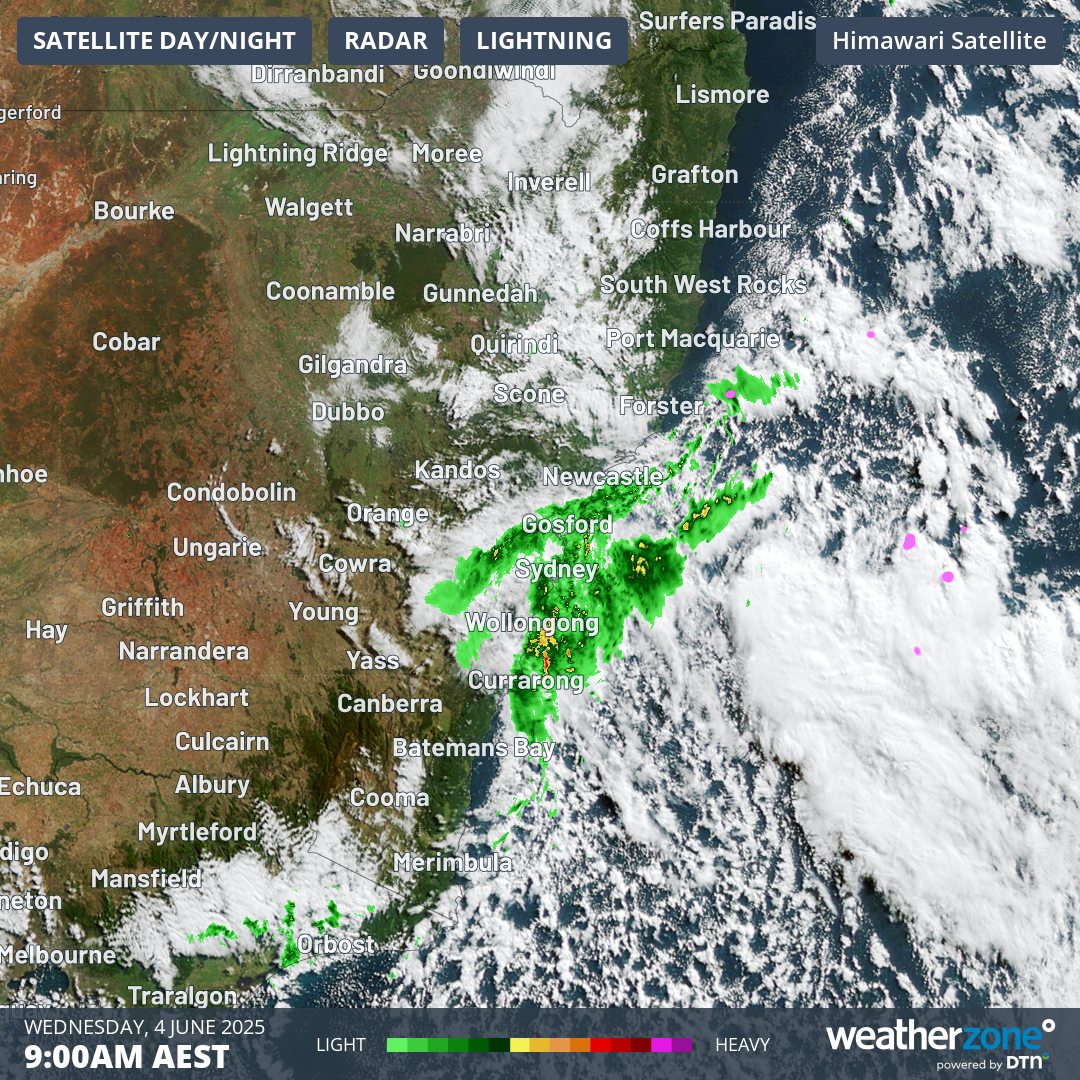
Image: Combined radar and satellite image for eastern NSW and Victoria at 9am on Wednesday, June 4, 2025, showing the tell-tale speckled cloudmass often associated with cold outbreaks in southern Australia.
Today’s predicted Sydney maximum is 15°C, which would be two degrees below the June average maximum of 17.0°C. But sometimes when showers are regular enough on days like this, the mercury can fall well short of expectations. We’ll keep you posted.
Beyond the CBD, Sydney region temperatures were considerably chillier this Wednesday morning, with light snow reported on parts of the Blue Mountains.
- Mount Boyce, at an elevation of 1080m in the Blue Mountains, was just 2.5°C at 9:30am with an apparent temperature of –2.9°C in gusty S to SW winds.
- Terrey Hills, a suburb at 199m above sea level on the hills just west of Sydney’s Northern Beaches, was 8.7°C at 9:30am with an apparent temp of 4.8°C.
While Sydney’s suburbs are shivering through the sorts of temperatures that residents of capital cities like Melbourne, Canberra or Hobart would consider unremarkable, for Sydneysiders they’re almost as cold as it gets in daylight hours.
Meanwhile that powerful low pressure system over the Tasman Sea – currently situated about halfway between the NSW coast and New Zealand’s North Island – is generating big swells for the NSW coast along with the wind and showers.
A hazardous surf warning is in place for the Byron Coast, Coffs Coast, Macquarie Coast, Hunter Coast, Sydney Coast and Illawarra Coast, with gale or strong wind warnings for the entire NSW coast.
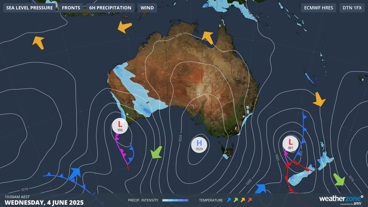
Image: Synoptic chart for Wednesday, June 4, 2025, showing the cold southerly stream affecting eastern Australia and the position of the low over the Tasman Sea.
While this Wednesday’s system is predominantly affecting the NSW coast and nearby ranges, enough moisture has made it inland to coat the alpine region of NSW and Victoria with up to 2cm of snow, with light falls continuing through mid-morning.
Snow showers should ease off later today, with a brief dry period in the mountains to round out the working week. Signficant snowfalls will then arrive this weekend, just in time for the official start to the 2025 Australian snow season.
Don’t forget to bookmark the Weatherzone snow page throughout the 2025 winter for the latest forecasts, live resort cams, and much more.