
Sydney southerly buster helps save the grid from a bust
The southerly buster is back with a vengeance. Back to save Sydney and its electricity grid under pressure from blistering summer heat. Recently, the glorious old southerly wasn’t busting through the Harbour city but there have been two in the past week, on Saturday 9th and Thursday 14th. And it looks like there could be another on Tuesday 19th.
Sydney has coasted along without a southerly buster for 14 months - ABC News
A southerly buster is a southerly change that brings wind gusts exceeding 54km/h and causes the mercury to drop at least 5°C in 3 hours. A southerly buster turned up right in time to help on Thursday 14th when a very hot day prompted the Australian Energy Market Operator and the NSW Energy and Climate Change Minister to urge people to reduce their electricity use between 5pm and 9pm due to the expected stress on the grid.
Small steps to make a big difference to energy reserve in the heat | NSW Government
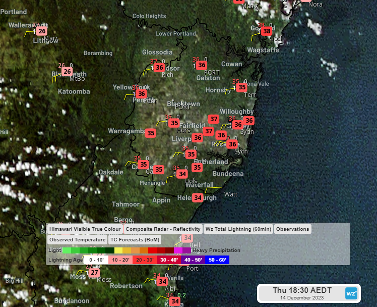
Image: Himiwari-9 visible satellite imagery and temperatures at 6:30pm AEDT
Some nights can be very hot and require some to use air conditioning to sleep, so why was the peak forecast energy demand until 9pm and not later? That was thanks to the southerly buster whose widespread burst of cool air through the city is ‘free to the greatest and least’ as Henry Lawson put it.
Westerly winds that dominated during the day started to give way to southerly winds when the southerly buster arrived at about 8:30pm bringing wind gusts of 50-70 km/h.
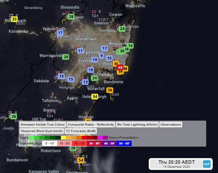
Image: Himiwari-9 infrared satellite imagery and wind gusts (km/h) at 8:20pm
By about 9pm it had spread across the city, and was flushing out the heat with cooler winds from the south.
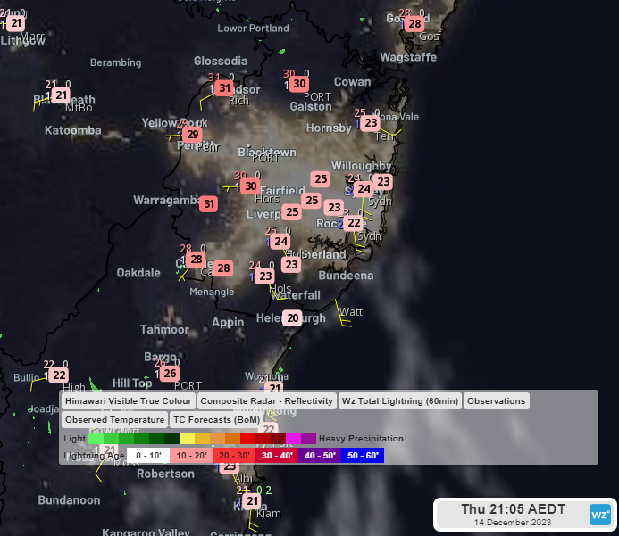
Image: Himiwari-9 infrared satellite imagery and temperatures at 9:05pm
At the Observatory Hill site, the mercury dropped from 32.8°C at 8:30pm to 24.7°C at 9pm, which is a drop of 8.1°C in 30 minutes.
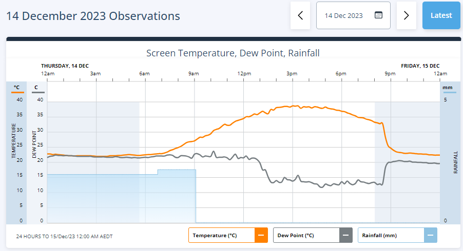
Image: 24-hour observations at Sydney’s Observatory Hill on 14 December 2023
The southerly buster has a long history of bursting into the harbour city with cool, gusty winds which Henry Lawson praised in his 1909 poem ‘The Southerly Buster’. Here’s the first stanza:
There's a wind that blows out of the South in the drought,
And we pray for the touch of his breath
When siroccos come forth from the North-West and North,
Or in dead calms of fever and death.
With eyes glad and dim we should sing him a hymn,
For depression and death are his foes,
And he gives us new life for the bread-winning strife—
When the glorious Old Southerly blows.
Old Southerly Buster! your forces you muster
Where seldom a wind bloweth twice,
And your ‘white-caps’ have hint of the snow caps, and glint of
The far-away barriers of ice.
No wind the wide sea on can sing such a poean
Or do the great work that you do;
Our own wind and only, from seas wild and lonely—
Old Southerly Buster!—To you!
Siroccos are hot, dry winds that blow over the Mediterranean from the deserts of North Africa. It’s a good comparison for the hot winds blowing from the west, northwest and north that precede the southerly change.
Another hot day is forecast on Tuesday 19th with the mercury expected to rise to 35°C in the city and into the high 30s in the west.
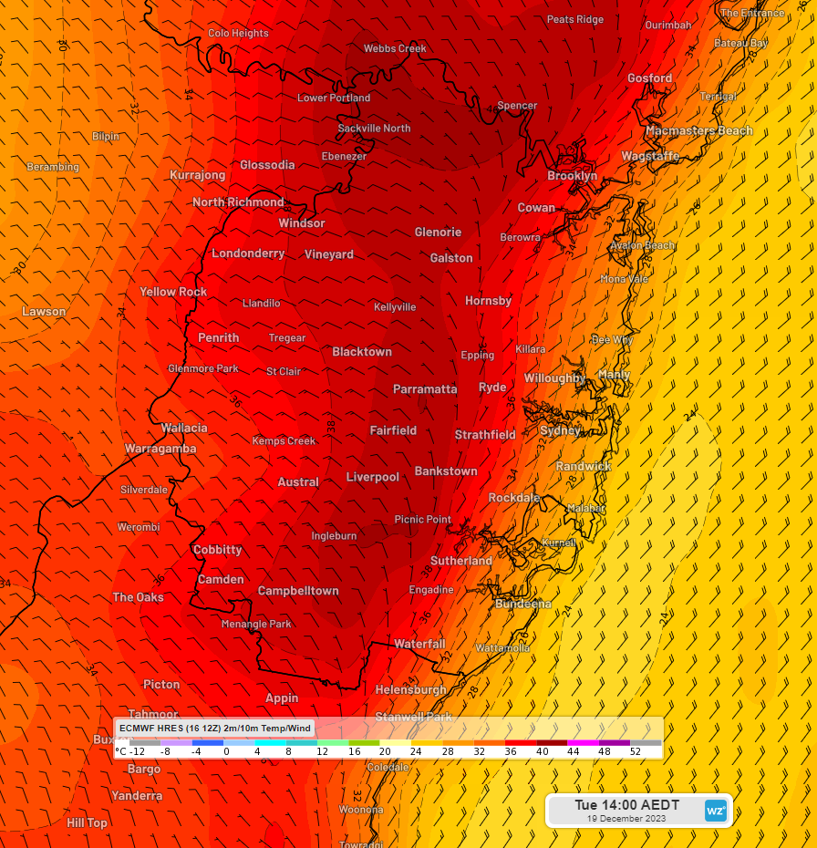
Image: 2m temperature and 10m wind barbs at 2pm AEDT on Tuesday 19th December according to the ECMWF model
And then another southerly is appearing on forecast models between about 10pm and midnight, bringing a burst of gusty winds with peak gusts of 60-75 km/h and potentially a temperature drop of 10°C in 3 hours.
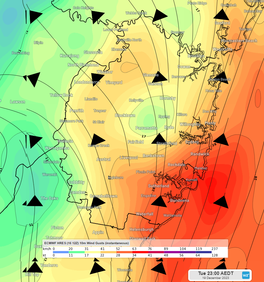
Image: 10m wind gusts at 11pm AEDT on Tuesday 19th December according to the ECMWF model
Unlike the previous one, this one looks like it will bring showers and thunderstorms with it.
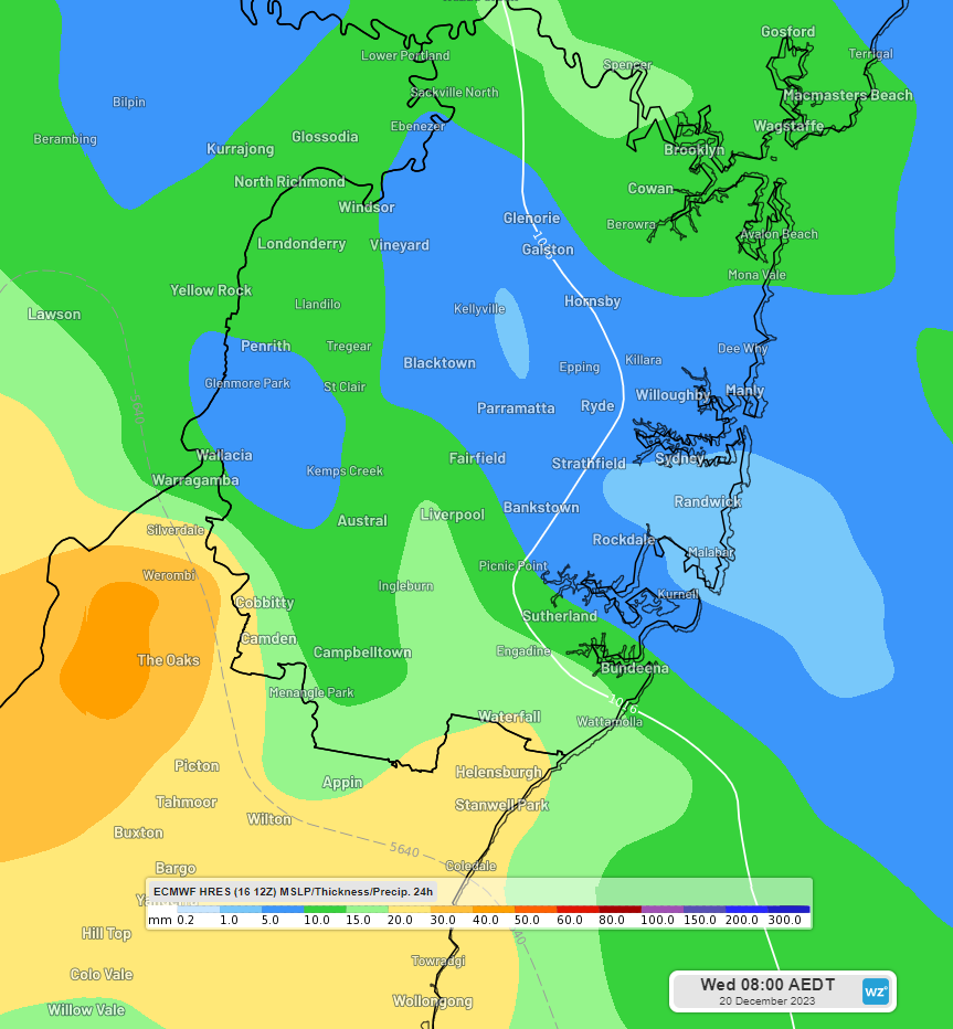
Image: 24-hour rainfall to 8am AEDT on Wednesday 20th December according to the ECMWF model
For more about southerly busters check out:
The big bust—southerly busters explained! - Social Media Blog - Bureau of Meteorology (bom.gov.au)