
Sydney scorcher as parts of city hit 41 degrees
Summer is just two weeks away and in Sydney this Monday afternoon, it definitely feels like it.
Temperatures in the Harbour City can vary dramatically between suburbs due to the cooling sea breeze effect in coastal areas, but most Sydney suburbs are uncomfortably hot this afternoon.
Just after 2 pm, Penrith in the outer western suburbs reached a sizzling 41 degrees, while temperatures reached the high 30s in much of Sydney's west. Closer to the coast, it was 34 degrees at Sydney Airport at 2 pm, and 30 degrees at Sydney's "official" weather station at Observatory Hill, adjacent to the Sydney Harbour Bridge.
Penrith is consistently Sydney's hottest location. On January 4 this year, the suburb recorded the hottest ever temperature of any location in an Australian capital city, when it reached 48.9 degrees.
Hello 40 degrees centigrade here in Penrith, of Western Sydney Australia or as we call it “heat bowl.”
— Rachel Wyld🖖 #medicalsciencestudent (@rawyld) November 16, 2020
"Sydney's western suburbs are in an ideal spot for extreme heat on a day like this," Weatherzone meteorologist Ben Domensino explained.
"Penrith is far enough away from the coast to escape the cooling influence of the sea breeze, and it also gets hit by air coming down the eastern side of the Blue Mountains, which warms up as it descends."
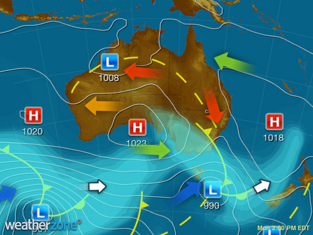
The influx of hot air across eastern NSW today is being caused by a strong northwesterly airflow, indicated by the red arrow on the 2 pm synoptic chart.
As we told you earlier today, a tongue of extreme spring heat has been making its way across Australia. Oodnadatta in South Australia – which is famous for holding Australia's all-time highest temperature record, of 50.7ºC in 1960 – had its hottest ever spring day of 47.4 degrees.
That was also the highest spring temperature anywhere in Australia for 11 years.
Meanwhile the good news for Sydney residents is that a southerly change is due this evening, along with a slight chance of a shower or thunderstorm.
The first signs of the change probably won't arrive till around 9 pm, with cooler air due around midnight, so if you're working in an air-conditioned office and need to pull a few hours of overtime, this might be the day to do it.
Sydney is heading for a much cooler maximum of 22 degrees on Tuesday. A mostly dry week should follow with temperatures staying well below the 30-degree mark.