
Sydney on track for hottest October on record
Sydney’s daytime temperatures during the first half of October have been so hot that they would be above average in January, at the height of summer. This unseasonable heat has put the city on track to register its hottest October on record, with a maximum temperature anomaly that could even eclipse any other month in the city’s 168-year history.
October off to a summer-like start
While October is usually a month of warming daytime temperatures in Sydney, this month has been exceptionally warm for the middle of spring.
Sydney’s average maximum temperature during the first 15 days of October was around 27.2°C, which is well above the city’s long-term monthly average of 22.2°C. This hot start to the month, which included four days above 30°C and none cooler than 22.7°C, was Sydney’s hottest first half of October on record.
Why has it been so warm in Sydney?
One of the main reasons for Sydney’s record-breaking hot start to October was an abundance of westerly and north-westerly winds. These offshore winds – meaning they blow from land to sea – have been carrying warm air from western NSW towards the coast over the past two weeks.
This warm offshore wind pattern has also been dry, with the city only receiving 4.2 mm of rain in the first half of the month. For context, Sydney would usually see about 78 mm of rain during a typical October.
The prominence of westerly winds over eastern NSW this month has been driven by a prolonged negative phase of the Southern Annular Mode (SAM). Under a negative SAM, westerly winds usually become more prominent over NSW and the easterly winds that cause cloud and rain along the coast become weaker and less frequent.
The stubborn negative SAM that has underpinned Sydney’s abnormally hot start to October has been a response to a rare episode of stratospheric warming that unfolded high above Antarctica in late September and early October. These stratospheric warming events are rare in the Southern Hemisphere and their influence on Australian weather is still an active area of research.
More warm weather on the way for Sydney
Sydney will continue to see abnormally warm weather in the back half of October under the ongoing influence of the negative SAM.
In the coming week alone, two bursts of heat will impact Sydney and other areas of NSW as very hot inland air spreads towards the east ahead of low pressure troughs and cold fronts.
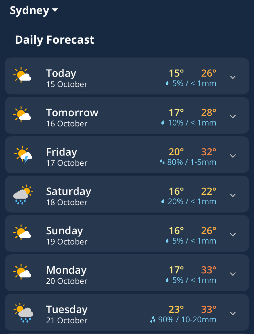
Image: Sydney’s daily forecasts in the Weatherzone app showing more warm days ahead.
Friday should see the mercury climb to about 31 to 32°C in Sydney, but cloud cover and possible thunderstorms in the afternoon could cool the city off quite rapidly. This burst of heat will be short-lived, with an evening southerly change bringing more definite cooling into the weekend.
Another hot inland airmass will then be drawn into NSW at the start of next week. This surge of hot and dry northwesterly winds could see temperatures on Monday reaching around 33 to 34°C in Sydney’s CBD and closer to 37 to 38°C in the western suburbs.
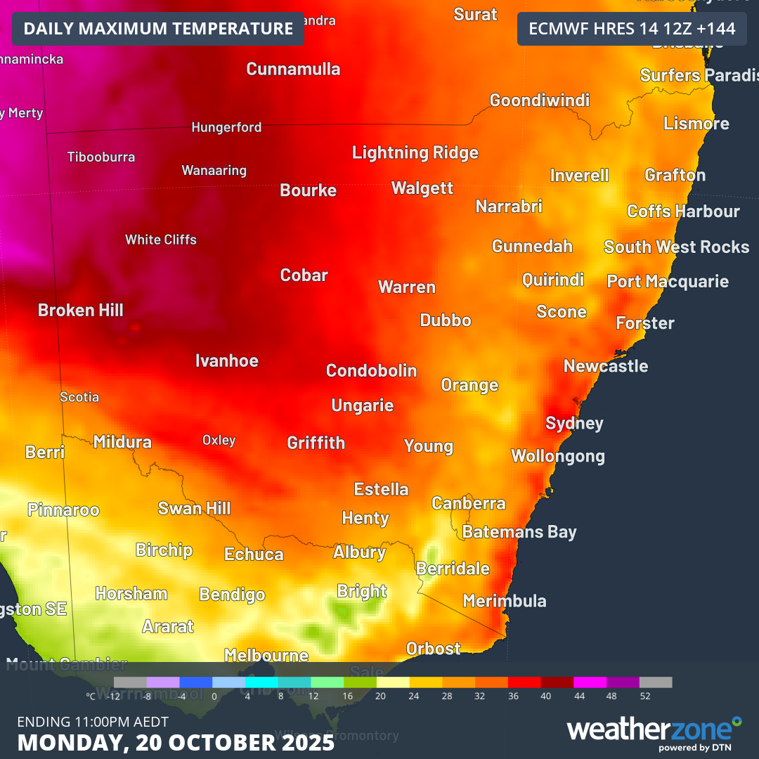
Image: Forecast maximum temperatures on Monday, October 20, 2025.
Unlike Friday, cooling relief will be delayed as cloud cover moves over eastern NSW later on Monday, bringing a very warm night extending into Tuesday morning. Temperatures should remain in the high-20s until late Monday and will only drop to about 22 to 23°C on Tuesday morning, before a cooling southerly arrives later in the day.
On track to break records
Daytime maximum temperatures in Sydney will most likely remain near or above average for the remainder of October.
Based on current computer model guidance, Sydney’s average maximum temperature for the month could come in somewhere around 26.5°C, which is 4.3°C above the long-term average.
If this happens, it will break the record for the warmest October on record in Sydney, beating 26.2°C from 1988. This would also become the largest monthly maximum temperature anomaly ever recorded in Sydney, surpassing +4.2°C from September 2013.
Sydney’s maximum temperature records date back to 1859.