
Sydney had Australia’s highest temperature just before midday
At 11:50am this Wednesday, February 18, the weather station at Sydney Airport hit 35.3°C. At that moment, it was the hottest temperature anywhere in Australia.
It’s not often that an Australian capital city has Australia's warmest reading at a given moment in time. Normally, rural or outback areas can claim that crown.
One notable exception was on January 4, 2020, in the scorching heart of the Black Summer of bushfires, when Penrith in Western Sydney reached a site record high of 48.9°C.
That was not just the highest temperature in Australia that day, but in the world! It also remains the highest recorded temperature for a weather station located anywhere in the city or suburbs of an Australian capital.
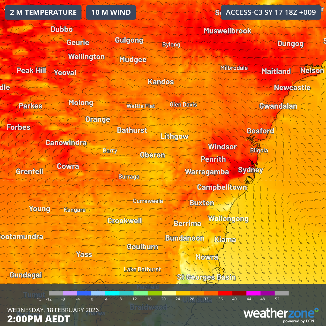
Image: Temperatures and wind speed and direction near ground level in NSW as the cool change approaches the Sydney region.
Why was Sydney Australia’s hottest place briefly this Wednesday?
There were four main reasons:
In terms of the broad-scale weather pattern, the Sydney basin was in the "sweet spot" to receive a feed of hot northwesterly winds from the continent’s interior, ahead of a cool change which has already moved through Victoria and much of western and southern NSW.
As Weatherzone meteorologist Ben Domensino explains, those westerly winds added extra warmth to the Sydney basin as air descending down the eastern side of the Blue Mountains heated up due to a meteorological phenomenon called the "Foehn effect".
"The urban heat island effect also contributed, with the built-up landscape of the Greater Sydney region becoming hotter faster than the surrounding vegetated landscape," Domensino added.
Lastly, Sydney was briefly hotter than other parts of Australia because it was still early morning in Western Australia, where numerous locations will top 40°C today.
Parts of Qld, the NT and northern SA will also eventually exceed Sydney’s maximum today but were slightly slower to warm up.
Southerly imminent change with potential for showers and storms later
Just after 1pm, numerous Sydney suburbs had reached 36°C and the mercury even exceeded 37°C at Sydney Olympic Park and at Holsworthy in the city's southwest.
But the heat has started to dissipate. A southerly change roaring up the coast reached Sydney's southern suburbs just before 2pm and is pushing northwards.
Bellambi, in Wollongong, (only an hour’s drive from southern Sydney) peaked at 34.5°C at 12:05 pm, but quickly plummeted to 23.4°C by 12:30pm as the cool change moved through.
No significant shower activity has accompanied the cool change thus far, however showers or storms may develop in Sydney and nearby areas later on Wednesday afternoon.