
Sweltering build-up nights for the Top End
As the last day of October approaches, Darwin's overnight temperatures for the month are still breaking records.
After the warmest October night on record was measured on the 20th, the average minima across the month now looks set to break a similar record. For October 2021 so far, Darwin nights have averaged a sticky 26.6°C, nearly 2°C above the long-term average. This is a huge margin for the tropics where annual temperature variability is very small. Average monthly temperatures, for example, vary only 6 degrees across the entire year, from 19°C in July to 25°C in November and December.
With only one night to go, October minima are set to be the warmest in the 80 year record for the Darwin airport site. The next warmest was October, 1987.
Maxima have also been high, currently sitting at 34.4 degrees averaged over the month, just over 1 degree above the long-term average.
Growing up in the nineties in the northern capital, I remember long strings of days of 33°C, and a look at records from the time bears this out. A string of more than 2 days together over 35°C degrees was rare in the 90’s, occurring just 5 times over the decade. In the last decade, it's happened 12 times, including one stretch of 7 consecutive days in 2019.
October, and also November, are typically sticky and awful as moisture builds ahead of the wet season. There's a reason that if you're going to "go troppo," it's during these months. But the temperatures in recent years are unusual, even for seasoned locals.
It's not just Darwin either. Batchelor, down the track in Litchfield Park, and Jabiru, near Kakadu, also have minimum temperatures sitting over a degree above average for this month--the warmest since records began for those centres in 1994 and 1971 respectively.
As October merges into November, sticky build-up conditions are set to continue. Showers and thunderstorms will become likely on Tuesday and Wednesday, bringing intermittent cooling, but each day this week is still forecast at 35°C or higher.
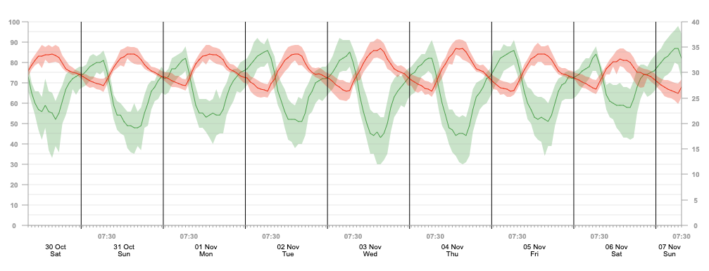 Image: Projected temperature (red) and relative humidity (green) for the next 7 days for Darwin, according to Weatherzone.