
Sweaty night in Vic and SA
The severe heatwave gripping South Australia and Victoria has brought record-breaking conditions today.
Melbourne almost set a new minimum temperature as overnight, it failed to cool below 27.1°C, which is 0.6°C warmer than the March record set in 2013, with 168 years of records. However, since the official minimum temperature is defined as the coolest temperature in the 24 hours from 9am to 9am, 21.2°C is the official minimum for Sunday (being recorded at 9am on Saturday morning). While this is significantly cooler than the overnight temperature, its still the city's hottest March night in 5 years.
Melbourne wasn’t the only location to sweat through a very hot March night. Locations throughout Victoria recorded some impressive minimums, including:
- Essendon (26.1°C) – hottest March minimum in 53 years of records
- Sheoaks (26.9°C) – hottest March minimum in 32 years of records (also the hottest minimum of any month in 10 years)
- Charlton (25.3°C) and Hopetoun (24.2°C) – hottest March minimum in 19 years of records
- Edenhope (23.7°C) – hottest March minimum in 18 years of records
- Scoresby (25.4°C) – hottest March minimum in 5 years
- Rhyll (20.6°C) – hottest March minimum in 5 years
- Mount Nowa Nowa (22.7°C) – hottest March minimum in 5 years
The heat continued in South Australia, too. After the hottest March morning in 5 years for Adelaide yesterday, some locations followed Victoria into record-breaking territory this morning, including:
- Kingscote (21.1°C) – the equal hottest March minimum in 28 years of records
- Yunta (25.1°C) – the hottest March minimum in 25 years of records at the current site
You can see just how hot it was in the temperature observation map below. At 7:30am AEDT, temperatures were still hovering around 30°C in some parts of southern Victoria and South Australia as persistent northerly component winds funnelled heat into the nation’s southeast.
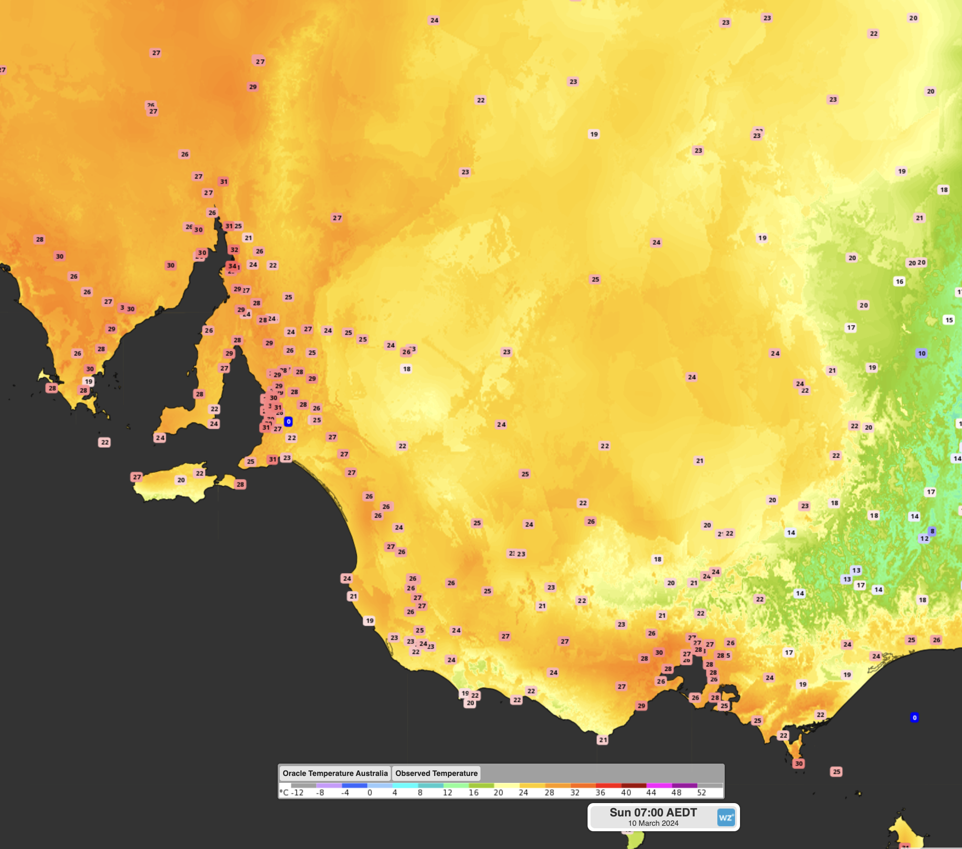
Image: Observed temperature at 7:00am AEDT
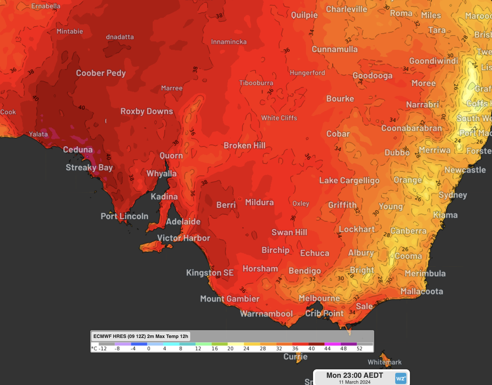
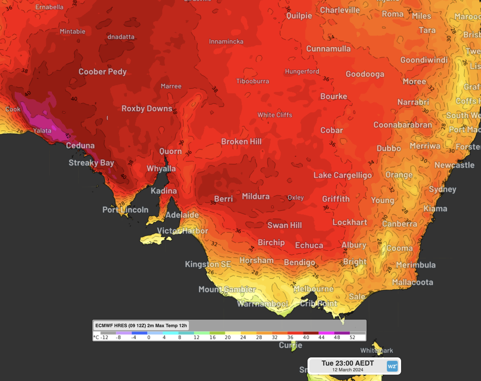
As Joel Pippard reported last Friday, the reason for this severe heatwave is a blocking high in the Tasman Sea, fuelled by hot tropical air funnelled east by the jetstream, which will continue to generate extreme temperatures into the early parts of this week. Maximum temperatures in Adelaide and Melbourne are forecast to reach 40°C and 37°C respectively today.
Similar temperatures are expected tomorrow, with another very warm morning for Adelaide. But, as you can see in the images below, a cool southerly wind change on Tuesday should help to bring temperatures back into more comfortable territory, at least in the south. This is particularly true for Melbourne, which is currently expecting a maximum of 25°C on Tuesday, while Adelaide can continue to expect temperatures in the mid-30s for a couple more days until a stronger southerly change comes through on Thursday.
While the temperature remains hot and bothersome, remember to stay hydrated; stay indoors with a fan, air-conditioner, or cooling towels where possible; remember to check in on any friends and family who may be vulnerable to heat stress; and stay up to date with the latest heatwave warnings.