
Surf building as Tropical Cyclone Oma looms

Waves are building along Queensland's southeast coast this morning as Tropical Cyclone Oma edges closer to eastern Australia.
At 4am Queensland time on Thursday, Oma was located just under 1,000km to the northeast of Brisbane. The system is moving slowly towards the southwest and will continue to approach Australia during the next two days.
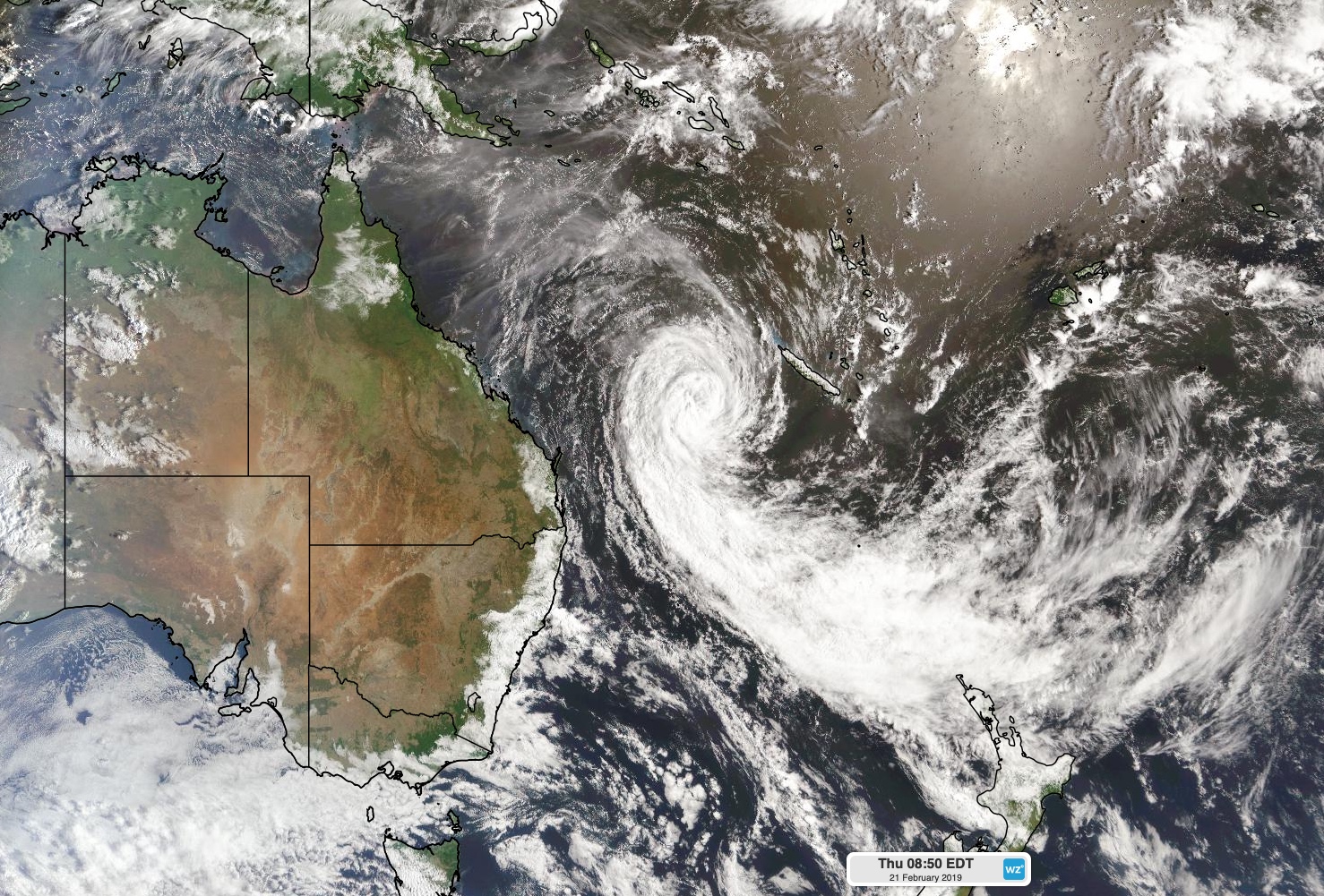
Image: Satellite image of Tropical Cyclone Oma on Thursday morning.
Maximum wave heights were reaching around four metres near Mooloolaba and Tweed Heads on Thursday morning. These waves will continue to build over the next 48 hours and are likely to contribute to beach erosion and localised coastal flooding.
Water levels near high tide may exceed the highest astronomical tide of the year by one metre in southeast Queensland on Thursday and Friday, and by half a metre in northeast NSW on Friday.
Wind will also increase along the coast of southeast Queensland from Friday as Tropical Cyclone Oma gets closer. Gale warnings have been issued for waters between the Capricornia Coast and Byron Coast on Friday.
Most computer models indicate that Cyclone Oma will get within 500km of southeast Queensland by Saturday, before turning towards the northwest on the weekend. What happens beyond this remains difficult to figure out.
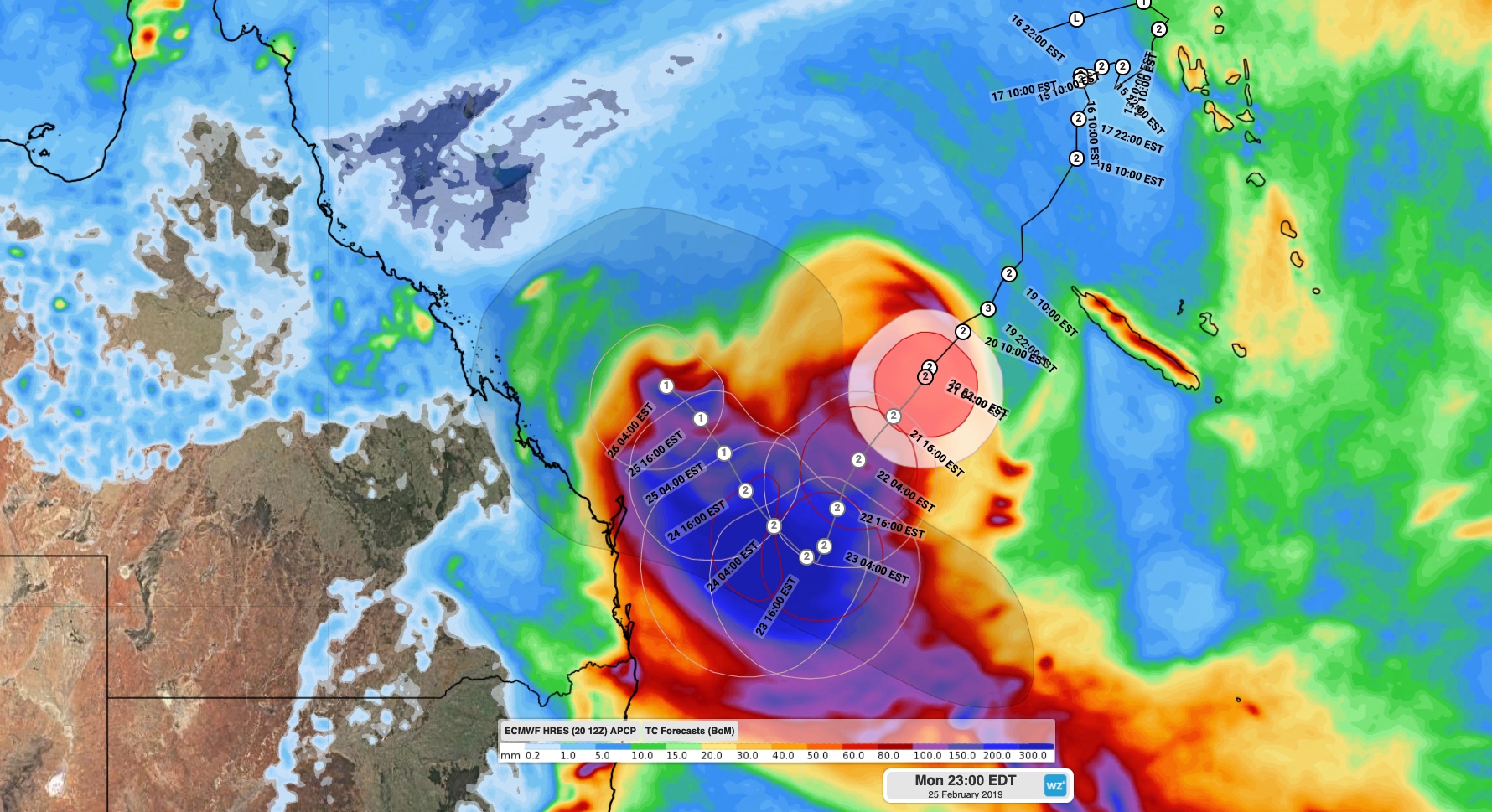
Image: Bureau of Meteorology forecast track map for Tropical Cyclone Oma overlying predicted accumulated rainfall between now and Monday, according to the ECMWF-HRES model.
Some models suggest that Oma will continue moving in a northwesterly direction from Sunday into next week, roughly parallel to the Queensland coast. Other models think the system will loiter a few hundred kilometres off the coast of southeast Queensland for a few days, before heading south late next week.
The uncertainty surrounding Oma's future make it's likely impacts difficult to predict. If it gets close enough to the coast, wind damage and heavy rain could affect parts Australia's eastern seaboard. A flood watch has been issued for Queensland coastal catchments south of Gladstone as a precautionary measure.
A coastal crossing still can't be ruled out either, although there's not enough model consensus to predict when or where this might occur.
People living in eastern Queensland and northeast NSW should remain on alert during the coming days and keep up to date with the latest forecasts and warnings. Information relating to Tropical Cyclone Oma is likely to change on a daily basis.