
Sunday spring rumbling in New South Wales
A broad trough brought an abrupt wet and thundery turn to the weekend this afternoon.
The first half of this Sunday was warm and summery. Warm northerly winds ahead of a trough brought an early maximum to Sydney, reaching 26°C around 10:30am. Further inland, out of reach of the early seabreeze, Richmond reached 33°C, making it the warmest day since last March. Further north, Taree Airport reached a peak of 35°C, about 10 degrees above average for this time of year, with many other locations across northern NSW reaching the 30-degree mark. But these warm conditions quickly came to an end over the course of the late morning and afternoon.
A broad trough loaded with tropical moisture has pushed over much of New South Wales over the weekend, leading to widespread rainfall, and storms rumbling into Sydney on Sunday. The previously mentioned Richmond dropped by over 11 degrees in the 2 hours to 3pm, while other locations in the Sydney Basin saw drops of about 5 degrees in a short period of time as storms and showers pushed over the region. Since 9am on Sunday, (as of 5pm), Sydney Observatory Hill and Bankstown accumulated 7mm of rain each, while further north, Norah Head gathered nearly 12mm in the span of an hour from 4pm.
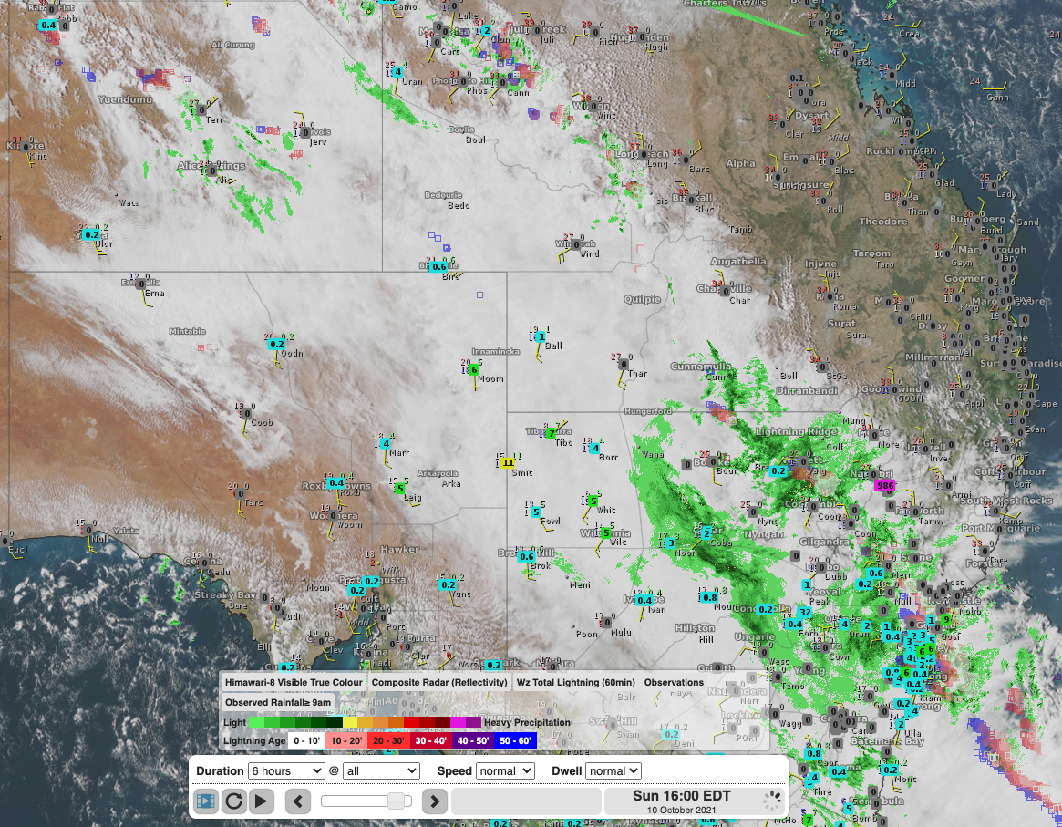
Satellite imagery (Himawari-8 Visible True Colour) showing an expansive area of thick cloud with this trough stretching from the Northern Territory into NSW. Radar and Observation (rainfall from 9am to 4pm) overlay show widespread rainfall over much of the state.
Over fifty-seven thousand strikes were detected within an 800km radius of central NSW on Sunday, with over 14000 within 100km of Sydney.
This trough will push over northeastern NSW into Monday, bringing rain and the risk of storms to the Mid North Coast and Northern Slopes, Tablelands and Rivers overnight into Monday. Another frontal system crossing the southeast later this week should bring a renewed risk of thunderstorms across the Sydney Basin around Thursday and Friday.