
Stormy Saturday for South Australia
Storm season has well and truly arrived, with a more than lively couple of days ahead.
Low-pressure troughs in recent days have already led to an abundance of lightning across a significant chunk of Australia, and the coming days will be no exception. A low moving to the south of South Australia and then Victoria, with a cold front and low-pressure trough extending north across the interior will bring storms to South Australia, Victoria, the Northern Territory, New South Wales, and Queensland over the weekend.
South Australia will be the first state significantly impacted by this system today, with the NT, QLD, Vic and NSW also affected – the latter three of which will see the most explosive storms on Sunday.
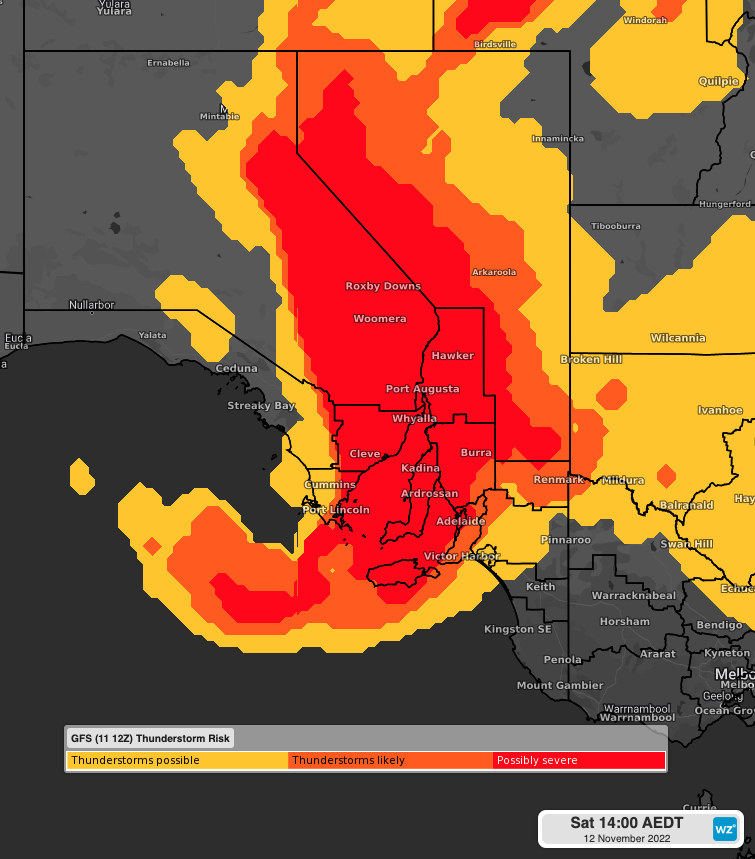
The image below, showing the GFS Thunderstorm Risk, gives an idea of the vast area over SA that will be affected by this weekend's system, with severe thunderstorms a high chance for most of the states' forecast districts, including Adelaide.
A very brief look at some of the parameters used to determine the likelihood and severity of storms gives an idea of the significance of this event. As with all thunderstorms, three main ingredients are needed, all of which are present for today’s event – moisture, a trigger (generating lift) and instability.
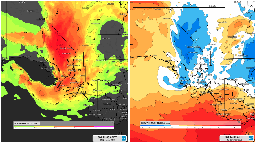
The image on the left shows what is called the SWEAT Index, used to help determine the severity of thunderstorms – at its simplest, values of over 300 indicate the potential for severe thunderstorms.
The image on the right shows the Lifted Index (LI) and is an indication of how unstable the atmosphere is. Other factors come into play but generally, the greater the instability, the greater the chance of thunderstorms - the more negative the LI (darker shades of blue) the greater the instability.
As South Australia winds down the momentum will continue east, moving into Victoria, New South Wales, and Queensland before clearing the east coast into late Monday. Queensland will be last to escape the grip of this system, with the trough lingering in the far east into Tuesday.
With severe thunderstorms likely across multiple states, you can keep up-to-date with all the latest warnings here - https://www.weatherzone.com.au/warnings