
Stormy night ahead in WA
Rain, thunderstorms and blustery winds will hit the west coast of WA tonight as a cold front barrels in from the Indian Ocean.
The satellite image below shows the cold front sitting about 300-400 km to the west of WA on Wednesday afternoon, marked by a thick band of cloud.
The image above also shows some pre-frontal showers passing over the state's South West Land Division on Wednesday, although these showers are just a tase of what's on the way.
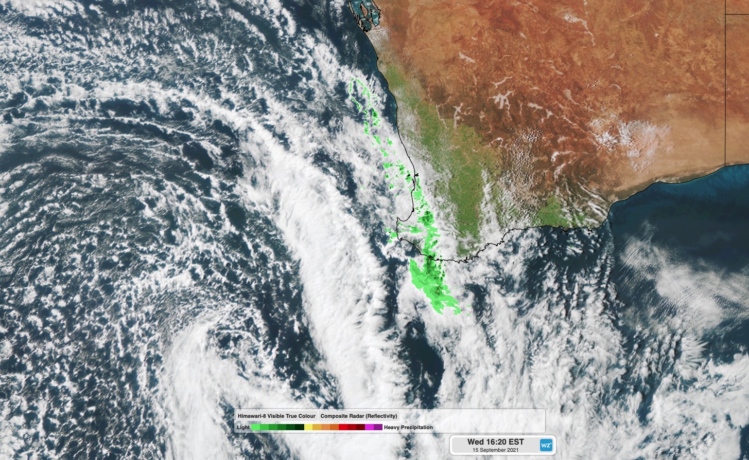
Image: Composite satellite and radar image showing a cold front approaching WA on Wednesday afternoon.
Rain and wind will increase over WA's South West Capes around 7-8 pm WST as the front moves in. This wet and windy weather will then spread further north and east tonight, reaching Perth between about 9pm and midnight.
Showers and blustery west to southwesterly winds will then persist over the state's southwestern districts into Thursday morning as a low pressure system passes by behind the front.
The west coast and adjacent inland to the south of about Perth could see 10-30mm of rain by Thursday morning. Some areas along the south and southwest coasts could also see hail falling on Thursday, in the cold air behind the front.
Rain could even reach up to Carnarvon and east to Southern Cross overnight Wednesday into Thursday morning, although falls will get lighter that far inland and up the coast.