Stormy end to March for northern Australia
An active end to March is on the forecast for the Australian tropics as the Madden Julian Oscillation (MJO) lingers in the Australian region.
An increase in tropical activity has already been seen in the Indian Ocean this week, with Tropical Cyclone Charlotte becoming the eighth cyclone named by Australia so far this season.
This enhanced cyclone activity in the eastern Indian Ocean is in response to the MJO moving across the region in the past few days.
As a reminder, the MJO is a pulse of increased cloud, rainfall and thunderstorm activity that moves around the world near the equator every 30 to 60 days, on average. When the MJO is near northern Australia, monsoonal rain and thunderstorms typically increase and tropical cyclones become more likely.
With the MJO currently near Australian longitudes, thunderstorms, heavy rain and tropical cyclones are an increased risk during the next one to two weeks over northern Australia.
Forecast models are suggesting the MJO will weaken a bit in the next fortnight. However, it should still have an influence on Australia’s weather during the second half of March and possibly into the start of April.
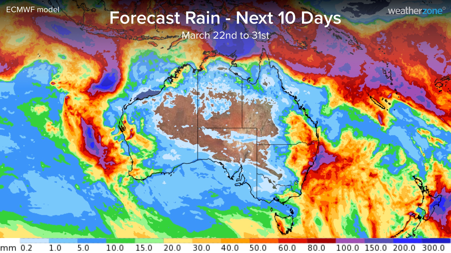
The map below shows one model’s forecast rainfall during the final 10 days of March.

Image: Forecast accumulated rain during the 10 days ending on March 31, 2022, according to the ECMWF-HRES model.
Significant rainfall totals are forecast across some parts of northern Australia during the coming 10 days, particularly over the Top End and far north QLD.
There may also be an increased risk of tropical cyclones during the next couple of weeks in response to the MJO. Some models are giving early indications of a low-pressure system forming near the Top End from as early as this weekend.
Weatherzone will be monitoring the tropics closely over the next couple of weeks and giving more updates as things unfold.