
Storms stretching 2,500 kilometres across NT and QLD
A massive line of thunderstorms has developed between the NT's Top End and southeast QLD this afternoon, stretching 2,500 km across northern and eastern Australia.
The storms are forming along a low pressure trough that is interacting with a mass of very humid air in an unstable atmosphere.
Shortly before 4pm AEST on Thursday, lighting strikes were being detected near the trough as far north as Jabiru in the NT's Top End, and as far east North Stradbroke Island in southeast QLD.
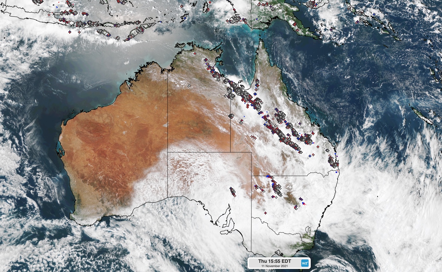
Image: A long line of thunderstorms streching across the NT and QLD shortly before 4pm AEDT on Thursday, November 11, 2021.
This huge line of storms is part of a large weather system that is also producing rain and thunderstorms in parts of NSW, SA and VIC on Thursday afternoon.
Between 9am and 3pm AEDT on Thursday, the heaviest rain in Australia occurred in central and southern QLD. A couple of rain gauges near Charleville collected 59mm during this time, while a gauge at Dalby picked up 54mm.
There have also been some impressive short-duration rainfall totals in QLD this afternoon, including 12mm in 10 minutes at Dalby at around 11am, and 19mm in 10 minutes at Archerfield just before 3pm local time.
The Charleville and Dalby areas have now received more than their monthly averages for November, only 11 days into the month. In fact, Dalby has collected roughly two months worth of rain in the last five days.
Flood watches are currently in place in every state and territory except WA and Tas, while severe weather warnings and severe thunderstorm warnings have also been issued in QLD, SA, NSW and VIC.