
Storms on the menu in SE Queensland tonight
Densely populated areas of southeast Queensland could be hit by severe thunderstorms this evening.
Relatively warm and moisture-laden air feeding into a pool of cold upper-level air is creating an ideal environment for thunderstorms in southeast Queensland and far northeast NSW today.
A few storms developed in this unstable environment during the morning, although the afternoon is seeing these storms become more widespread and intense as they gain energy from warmer air near the ground.
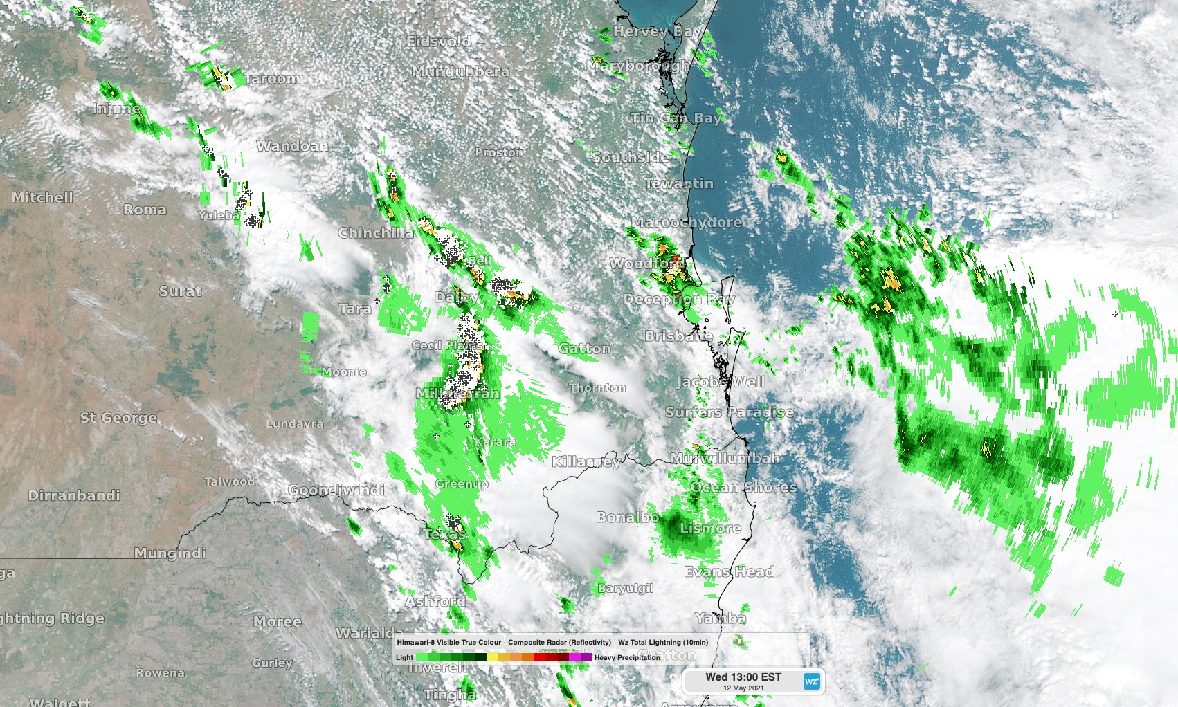
Image: Storms over southeast Queensland at 1pm AEST on Wednesday.
At 1pm AEST on Wednesday, thunderstorms were occurring over the parts of the Central Highlands and Coalfields, Wide Bay and Burnett, Maranoa and Warrego, Darling Downs and Granite Belt and Southeast Coast forecast districts. These dangerous storms prompted warnings for damaging winds, heavy rain and large hail.
Today's storms are moving towards the east southeast and gradually getting closer to the coast.
Based on the latest forecast models, storms should become more organised into a band and approach densely populated areas in southeast Queensland in the late afternoon or early evening.
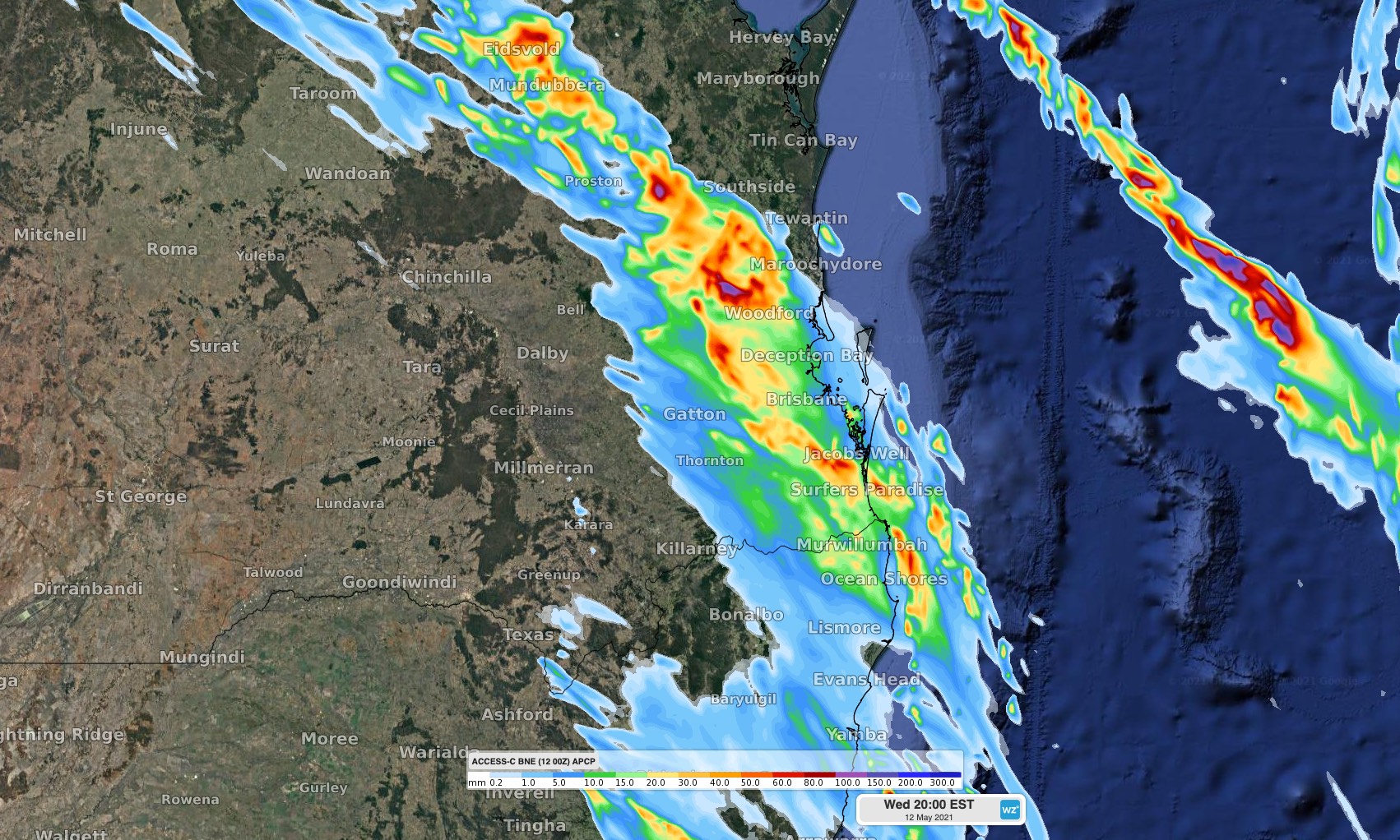
Image: Forecast accumulated three-hour rain up to 8pm AEST on Wednesday, showing the general area that's likely to see showers or thunderstorms during this timeframe.
Keep an eye on the latest warnings during the rest of Wednesday because they will be updated frequently.