
Storms in southeastern Queensland bring a month's worth of rain
Severe thunderstorms developed on Wednesday afternoon across inland parts of southeastern Queensland delivering in some towns more than 100mm in less than 90 minutes.
Amberley collected 112mm during the 24 hours to 9am on Thursday, although the vast majority was registered between 6pm and 7.30pm. This resulted in the wettest day since March 2017 and represents the average monthly total. Other notable rain included 85mm in Beaudesert, 49mm in Oakey, 47mm in Gatton, and 41mm in Toowoomba.
Rain was more modest along the coast. Brisbane and Gold Coast only picked up 3mm, and Sunshine Coast airport a meagre 2mm.
The Weatherzone Total Lightning Detection Network (WZTLN) recorded more than 70,000 lightning strikes within 100km radius of Amberley, over 8,000 of which hit the ground.
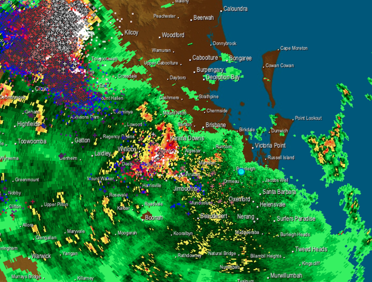 Image: Lightning with radar overlay showing heavy rain west of Brisbane on Wednesday at 7pm EST
A severe thunderstorm warning was issued for parts of Darling Downs & Granite Belt, Wide Bay & Burnett, and Southeast Coast, alerting of damaging winds and heavy rainfall.
A low pressure trough crossing the region combined with high humidity triggered the lightning show and torrential rain. Brisbane felt like 37 degrees around midday on Wednesday, 4 degrees warmer than the actual temperature due to high moisture and light winds.
The trough will continue to move north over the coming days clearing the storm risk in the southeast of Queensland.