
Storms developing around Sydney
A few thunderstorms have developed to the west of Sydney and the Central Coast this afternoon, with ominous clouds moving east towards the city.
Dry westerly winds clashing with warmer and moisture-laden air over the Sydney Basin have triggered the storms.
One storm cell produced lightning near Warragamba Dam between 2pm and 3pm, before weakening as it moved further east.
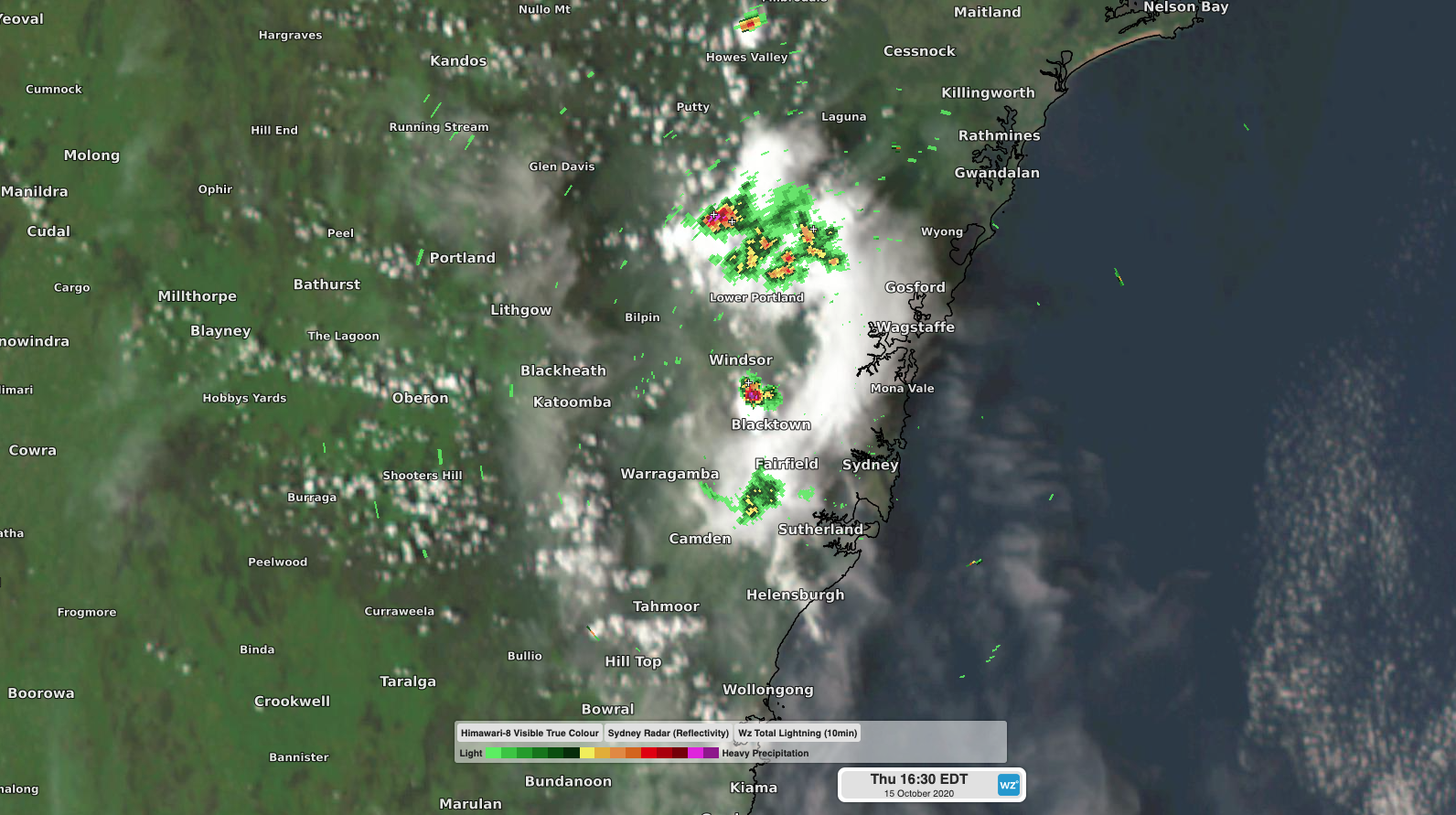
Image: Composite radar, satellite and lightning tracker showing the thunderstorms in and around Sydney at 4:30pm.
Another storm developed around Colo Heights shortly after 3pm. As of 4:30pm this storm was still causing lightning as it moved east towards the Central Coast region.
Storms are possible anywhere between about Sydney and Newcastle during the next several hours. These storms will mostly be non-severe, although it's worth keeping an eye on the latest warnings if you'll be commuting during the evening peak hour.