
Storms bring flash-flooding across Qld
Thunderstorms combined with moisture from Ex-Tropical Cyclone Kirrily have dumped a month’s worth of rain in just a few hours on Sunday morning, with plenty more rain on the way.
Ex-Tropical Cyclone Kirrily is spinning over the northwest of Queensland, delivering heavy rainfall. At the same time, it is funnelling moisture down into the southeast of the state, allowing for intense rainfall falling with thunderstorms.
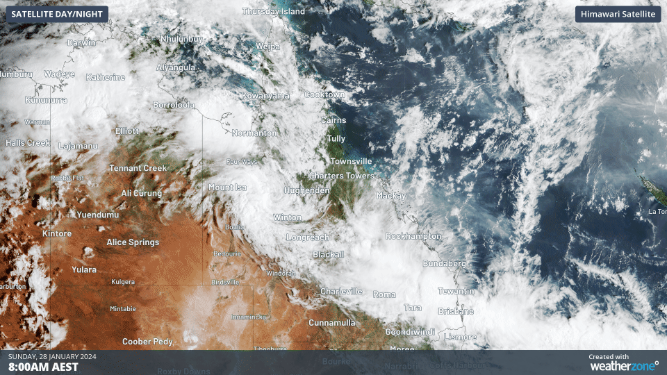
Image: Satellite showing Ex-TC Kirrily spinning in the northwest, and a stream of cloud flowing towards the southeast coast this morning
Nearly 800,000 lightning strikes lit up the skies during the 24 hours from midday Saturday to midday Sunday, as storms developed throughout the Central West and Southeast, including Brisbane.
A massive 170mm fell at Mt Berryman Road in the 3 hours to 3am, ending up with 234mm in the 24 hours to 9am. Nearby Thorton also picked up some heavy falls of 184mm. In fact, the vast majority of rain gauges in the Southeast district recorded at least 50mm, including Brisbane and Ipswich.
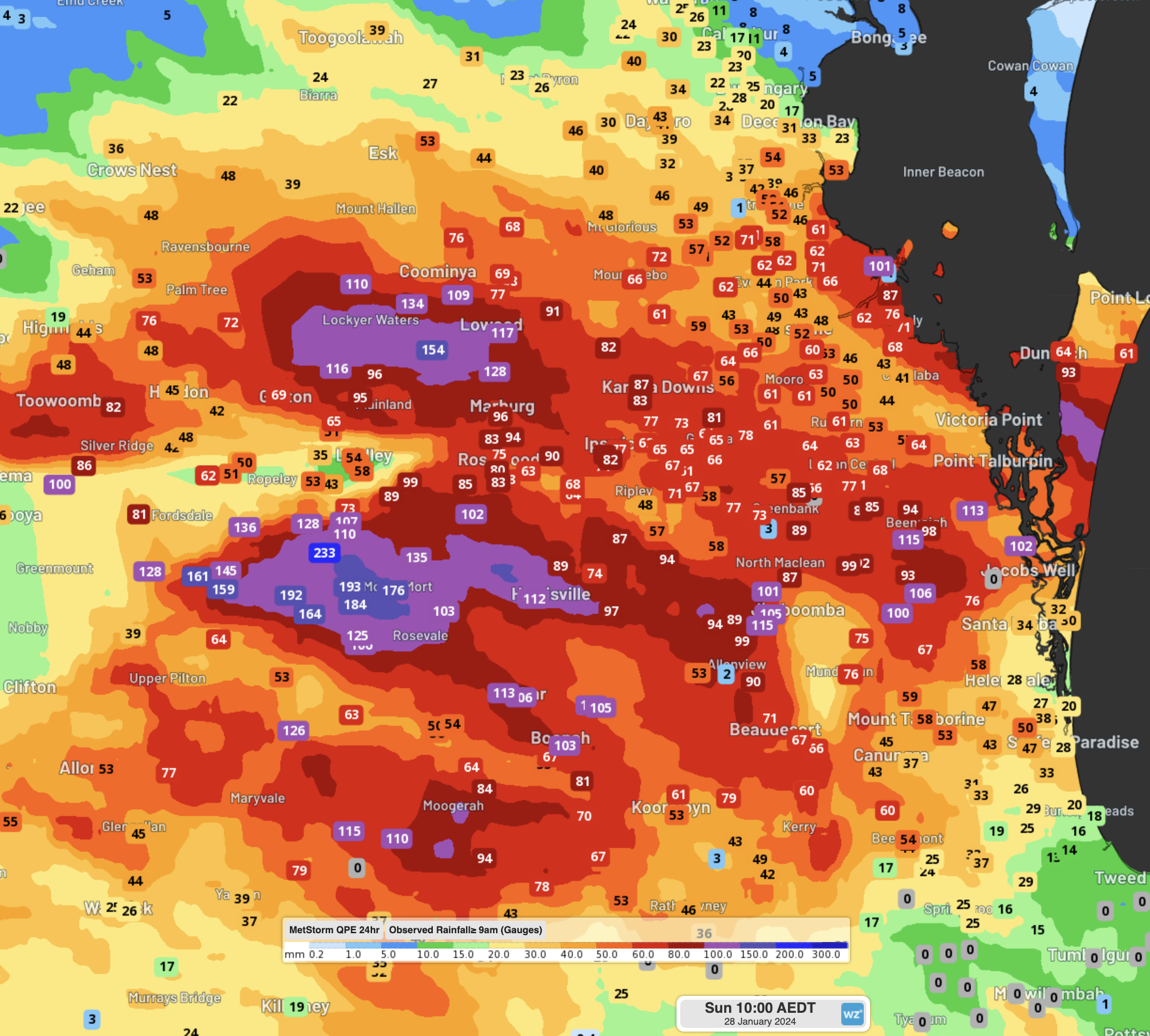
Image: Observed 24-hour rainfall to 9am EST Sunday over the southeast, showing how widespread the falls were.
As expected with such heavy falls, rivers have risen across the region, even reaching and exceeding the major flood levels for Warrill Creek and the Bremer River.
Rollingstone saw more than a month's worth of rain and their wettest January day in 135 years of rainfall records, with 131mm falling in the gauge, largely falling overnight between 8pm and 3am. The heaviest falls in the state were found nearby at Glenora Road, just south of Emerald, recording a 243mm deluge from nearly persistent storms overnight.
Further inland, the 66mm recorded at Charleville was their wettest January day in 16 years and their wettest day since 2020.
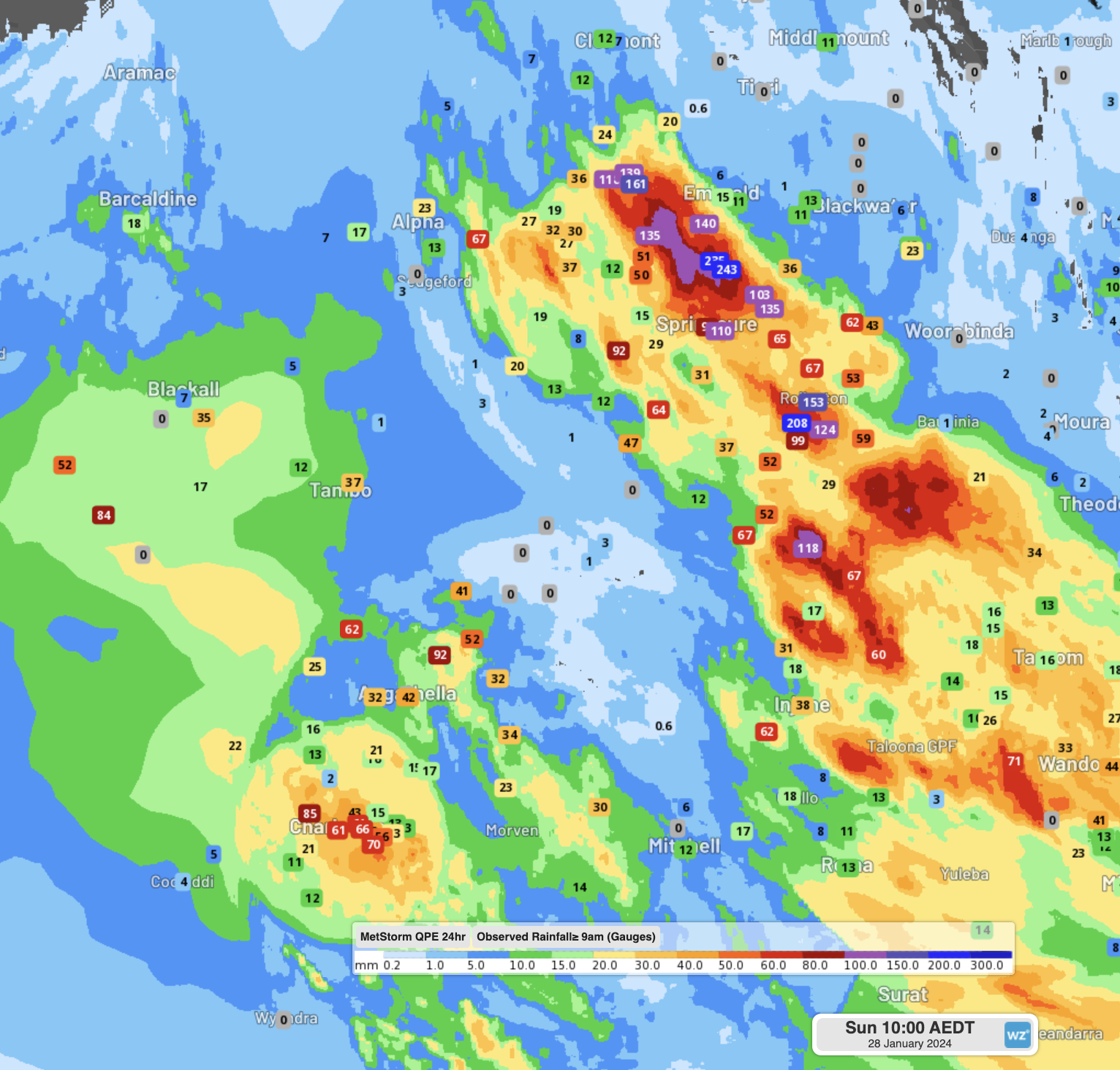
Image: Observed 24-hour rainfall to 9am EST Sunday over the central west, with heavy falls near Charleville and Rollingstone
Over the coming days, Ex-Tropical Cyclone Kirrily will continue to linger around the northwest of the state, and feed moisture into a trough through the central west and into the southeast. The map below shows the forecast rainfall to Tuesday evening from these systems.
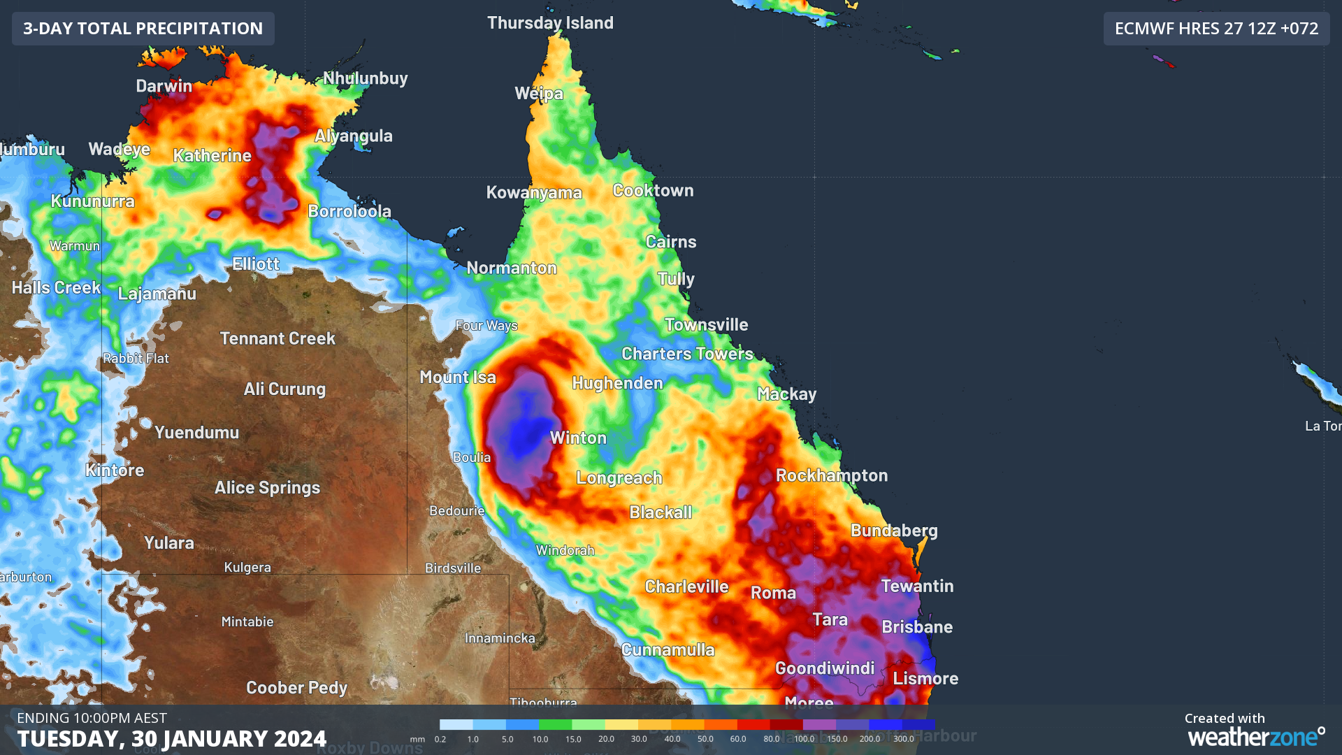
Image: Forecast rainfall in the 72 hours to Tuesday night. Heavy falls are possible near Ex-TC Kirrily and in the southeast.
Tuesday is looking like a potentially very wet day in the southeast, as a coastal trough looks to form, followed by a low-pressure system over the water. Some models are suggesting widespread rainfall of 100-200mm, isolated 300+mm falling in just one day. So best to keep an eye on the warnings and Weatherzone news feed for more updates on the upcoming rain.