
Storms, blustery winds to hit southern Australia
A burst of wet and windy weather will sweep across southern Australia later this week, with thunderstorms and an abrupt temperature drop also on the cards for several states.
A complex low pressure system moving to the south of Australia will cause a cold front and low pressure trough to cross the country’s south from Friday to Sunday.
The system will move from west to east, causing showers, thunderstorms and blustery winds over the south of Western Australia on Friday, South Australia on Saturday and Victoria, Tasmania, New South Wales and the Australian Capital Territory on Saturday and Sunday.
Following a spell of dry and unusually warm weather across much of southern Australia this week, the upcoming system will cause an abrupt change in conditions, including a big drop in temperature.
The map below shows how much rain is expected to fall over the next seven days, although most of this is likely to happen between Friday and Sunday.
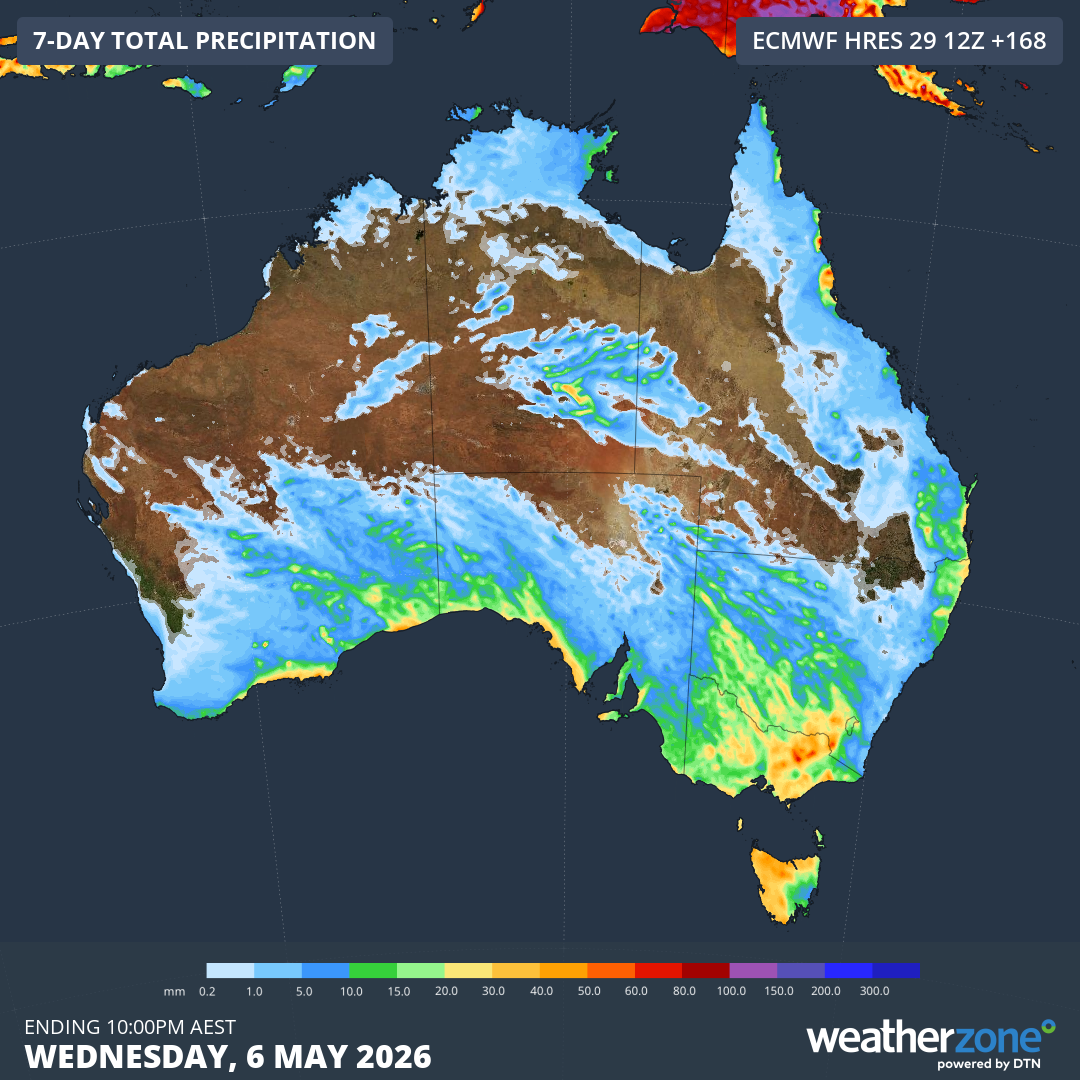
Image: Forecast accumulated rain during the seven days ending on Wednesday, May 6, 2026. Source: Weatherzone.
The rain from this system will affect a broad area of southern Australia stretching from WA to NSW. However, falls are likely to be hit and miss for many areas, as opposed to widespread uniform rainfall. This means some areas will see decent falls of around 10 to 20mm, possibly over 40mm, while others will get little if any rain. This rainfall disparity will be particularly stark where thunderstorms are involved.
Wind will also be a notable feature this week as northerly winds strengthen ahead of the approaching front and cooler west to southwesterly winds arrive in its wake. Damaging winds may develop in some areas, most likely over SA and parts of western Vic on Saturday, and possibly elevated areas of eastern Vic and southeast NSW on Sunday.
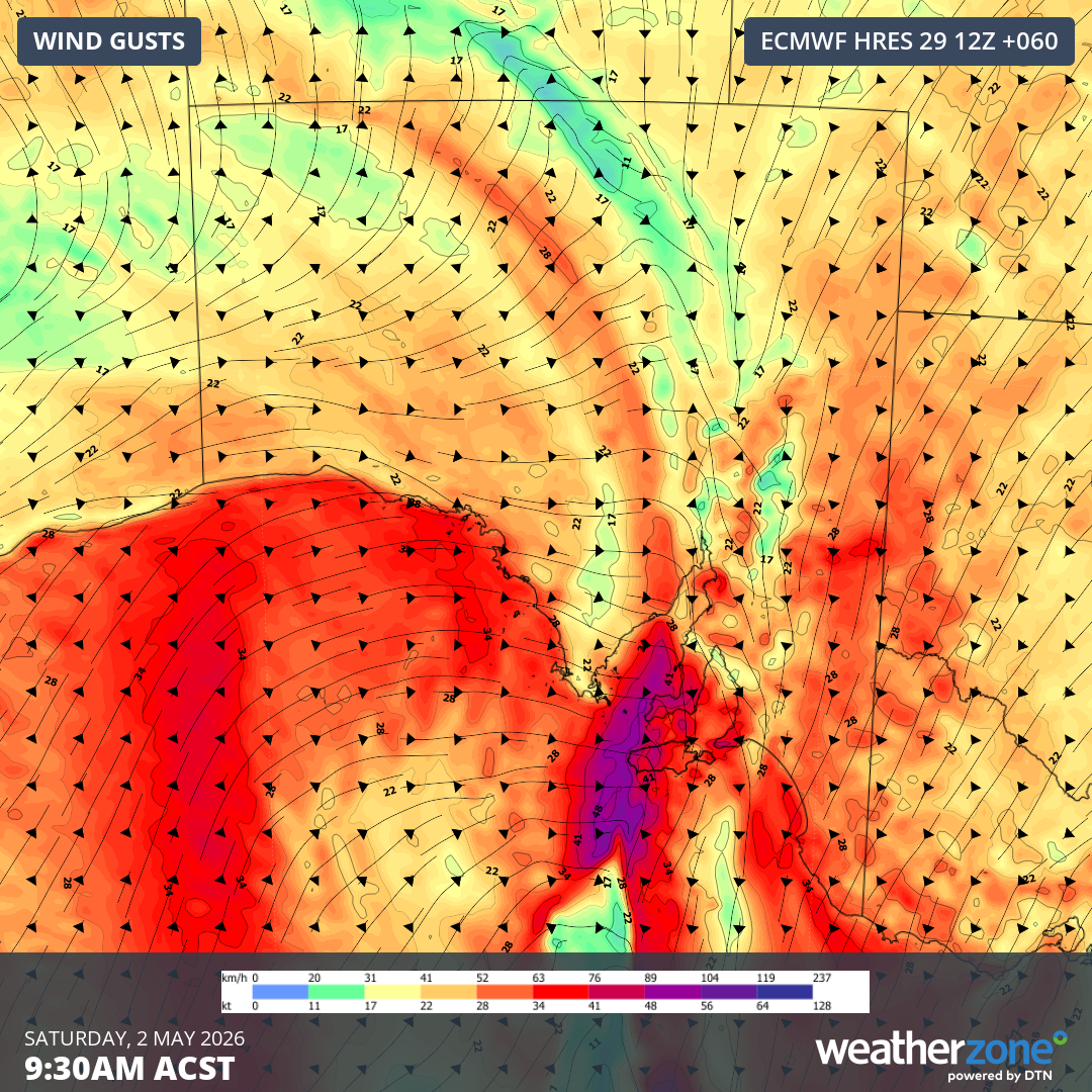
Image: Forecast wind gusts over SA on Saturday morning. Source: Weatherzone.
Temperatures should also cool by around 5 to 10°C with the passage of this system:
- Adelaide is forecast to reach as high as 19°C on Sunday and Monday, much cooler than the 28 to 29°C maximum temperatures in the city from Wednesday to Friday.
- Melbourne is predicted to reach around 26°C on Friday and only 22°C by Sunday.
- Hobart should reach 24 to 25°C on Friday and Saturday, then 19°C on Monday.
- Canberra is forecast to reach 23°C on Saturday and Sunday, and 17°C on Tuesday.
Warnings for damaging winds, heavy rain and severe thunderstorms may be issued in parts of southern Australia this week, so be sure to check the latest warnings in your area over the next few days.