
Spring storms trigger 250,000 lightning strikes over SE Australia
An outbreak of early-spring thunderstorms has caused prolific lightning over Australia’s southeastern states during the last 24 hours.
The animation below shows lightning spreading across central and southeastern Australia on Thursday and Friday morning. These storms were triggered by a large pool of cold air from the Southern Ocean clashing with much warmer air over the Australian continent.
Video: Lightning strikes detected between Thursday morning and Friday morning.
Weatherzone’s Total Lightning Network detected around 245,000 lightning strikes within an 800 km radius of Bourke during the 24 hours ending at 9am AEST on Friday. The bulk of these strikes were over NSW, although lightning also occurred in Qld, Vic, the ACT, Tas, SA and the NT on Thursday and Friday.
This week’s thunderstorms are a taste of the stormy weather that will becomes more prominent over eastern and northern Australia sin the coming months. The image below shows the average lightning density over Australia during spring, with seasonal lightning hotspots typically found in northeast NSW, southeast Qld and the northern tropics.
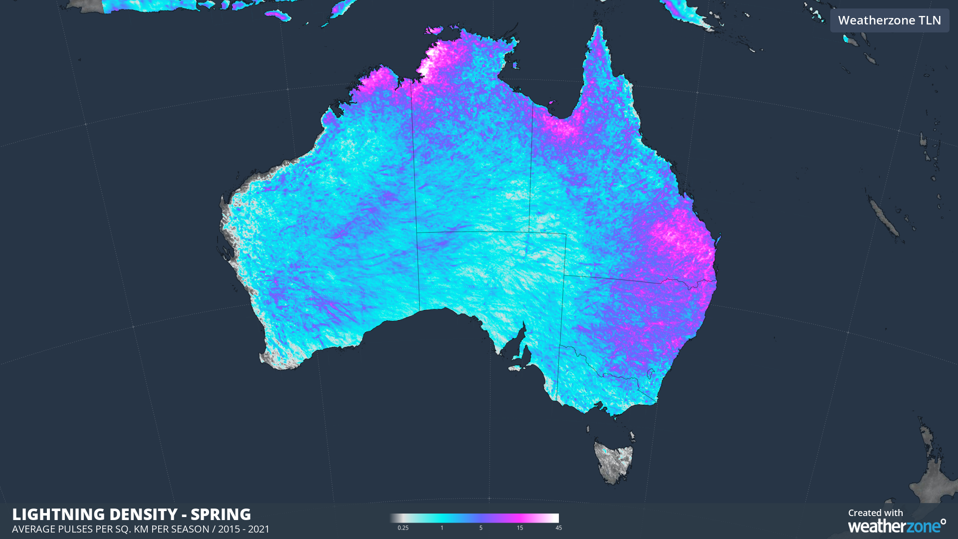
Image: Average lightning density in spring, based on all lightning detected in September, October and November between 2015 and 2021.
Thunderstorms will continue to affect parts of northeast NSW and southeast and central Qld on Friday. While storms have now cleared for most other areas of southeastern Australia, a wintry mix of showers, blustery winds small hail and snow will affect parts of Tas, Vic and southern NSW on Friday. Severe weather warnings have been issued in each of these states.