
Spring see-saw brings wildly fluctuating temperatures
At 3am on Monday morning, Hobart was a very balmy 15.3°C, just a few days after its daily maximum twice fell short of 11 degrees. That’s just one illustration of the temperature see-saw currently impacting millions of people across southeastern Australia.
Spring is a time when the mercury oscillates strongly between warm and cold, with plenty of locations likely to experience wild temperature fluctuations this week.
For example, Sydney should reach 29°C this Monday but by Thursday, an influx of much cooler air from the south in association with a short-lived but dynamic low pressure system off the NSW coast will keep maximums to 18°C or even slightly lower.
Hobart’s maximum will plummet back to 12°C on Tuesday after reaching around 18°C today, while snow will also return to kunanyi/Mt Wellington, where the temperature last night bottomed out at a comparatively mild 3.8°C after a week of sub-zero minimums.
With a minimum of 11.6°C last night, Canberra saw its first double-digit overnight low since May.
Melbourne’s minimum of 13.1°C to 9am was also its warmest night since autumn. But the maximum will be lucky to reach that level by midweek, with a top of 13°C forecast for Wednesday.
Perth is heading for a chilly maximum of just 16°C this Monday, in the cool air behind a cold front which is now tracking east, pulling in cold air that will affect southeastern Australia midweek. But by the end of the week, a fresh burst of warmth will push daytime temperatures in southwest WA into the mid-20s.
What’s causing the temperature fluctuations?
This week’s highly changeable weather in southern Australia is a reflection of the natural seasonal shift in weather patterns in our region.
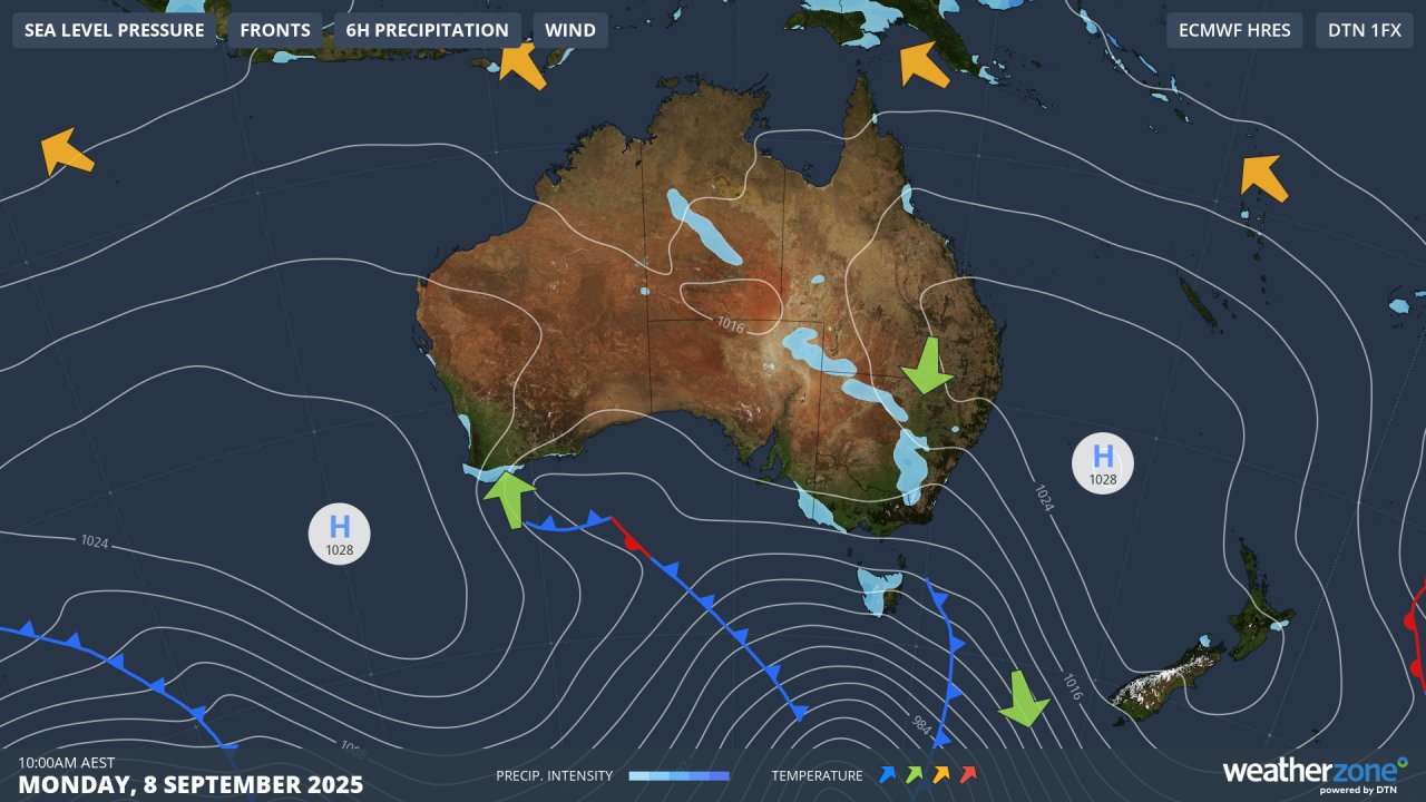
Image: Synoptic chart for Monday, September 8, 2025.
In winter, high pressure systems tend to be centred further north over the continent, allowing more frequent bursts of cold, moisture-laden air from the polar region to reach southern Australia.
In spring, the highs begin to drift south, enabling warm air from the interior to reach southern Australia as it circulates anti-clockwise around the highs. You can see an example of that in the synoptic chart above.
As temperatures swing from warm to cold and back to warm throughout this week, bursts of wind, rain, thunderstorms and snow in the alpine region can all be expected at various times.
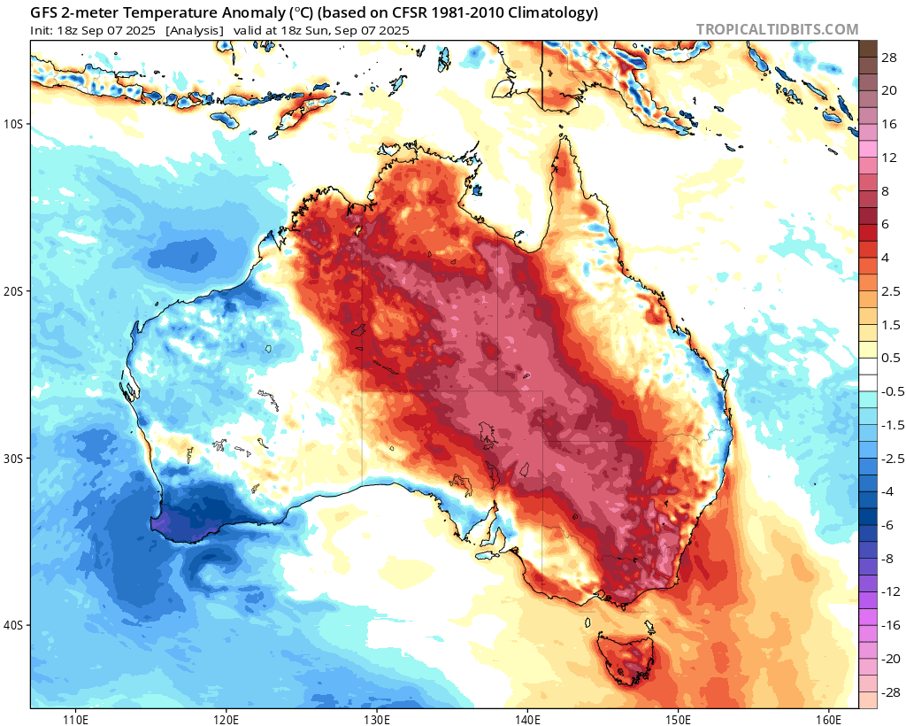
Image: Temperature anomalies across Australia at 4am (AEST) show a large area of much warmer than average temperatures. Source: Tropical Tidbits.
This promises to be a dynamic week of spring weather, so please check the Weatherzone warnings page for the latest info for your area – especially midweek as the warm and cool airmasses clash, triggering thunderstorms across a wide area of southeastern Australia.