
Sparky Skies Flash over QLD

Queesland skies lit up on Saturday afternoon after storms flared up, bringing blankets of hail and gusty winds.
Nearly 50,000 lightning strikes illuminated the skies around Gympie on Saturday as several large storm cells tracked over the region.
One storm near Beerwah split, indicating a possible supercell, and dumped blankets of snow-like hail on the small town, along with 19mm of rain. This storm prompted a thunderstorm warning to be issued by the BoM for large hail and damaging winds.
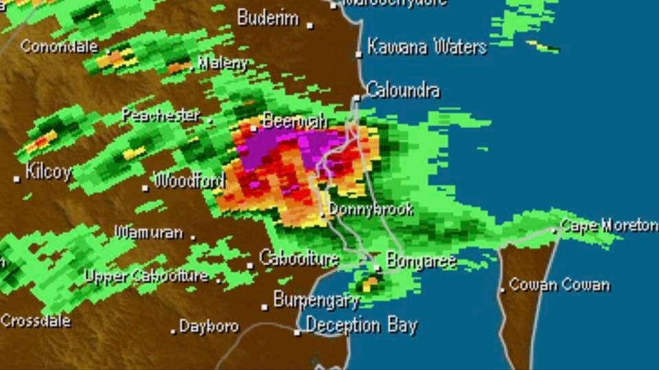
Image: Radar of a powerful storm crossing Beerwah on Saturday evening. Purple indicates heavy rain and hail.
The most rainfall from the system fell at Cooroy, with a direct hit from a storm delivering 42mm. Bells Creek, 20km south of Maroochydore, also picked up 32mm in a short space of time.
The strongest wind gust recorded was 59km/h at Gayndah, with likely stronger winds in more isolated locations close to the storms.
The storm outbreak was due to a passing trough, with warm, humid air in front of it. While the trough responsible has moved out to sea, Sunday and Monday are expected to be just as warm as Saturday, meaning some more storms are still possible. However, it is unlikely that they will be as severe as those seen on Saturday.