
Southern Plains heatwave to continue through end of August
Continuous days up over 100 degrees Fahrenheit have been a hallmark of this August for Oklahoma and Texas and the weather pattern continues to favor this heat through the end of the month.
A relentless heatwave has gripped the South-Central U.S. throughout August, with Oklahoma and Texas bearing the brunt – recording triple-digit temperatures on nearly every day of the month.
Heat advisories and warnings have been continuous and the forecast going forward maintains this type of heat through the end of August and into early September.
Unusually hot, even for areas that are no stranger to 100 F days
The states of Oklahoma and Texas are no stranger to 100-degree temperatures. With average highs for August in the mid- to upper 90s Fahrenheit, getting up to 100 degrees is not that difficult and it happens somewhat frequently during the month for several sites in these areas.
However, this year has seen that threshold consistently surpassed throughout the entire month, and the intense heat has reached into nearby states across the South-Central U.S. as well.
By the end of August, some locations in Texas and Oklahoma will have registered 20 to 30 days at or above 100 degrees. For many of these places, the average number of August days reaching 100 F is around 5 to 10, so this month has produced about 15 to 20 extra 100 F days compared to normal for some locations.
Why has it been so hot this month?
The cause of the heat has been a steady upper-level ridge that has been sitting across the South-Central U.S. all month long.
This feature has been incredibly stout, disallowing fronts from crossing into the region that would bring in some milder temperatures and precipitation to limit the heating.
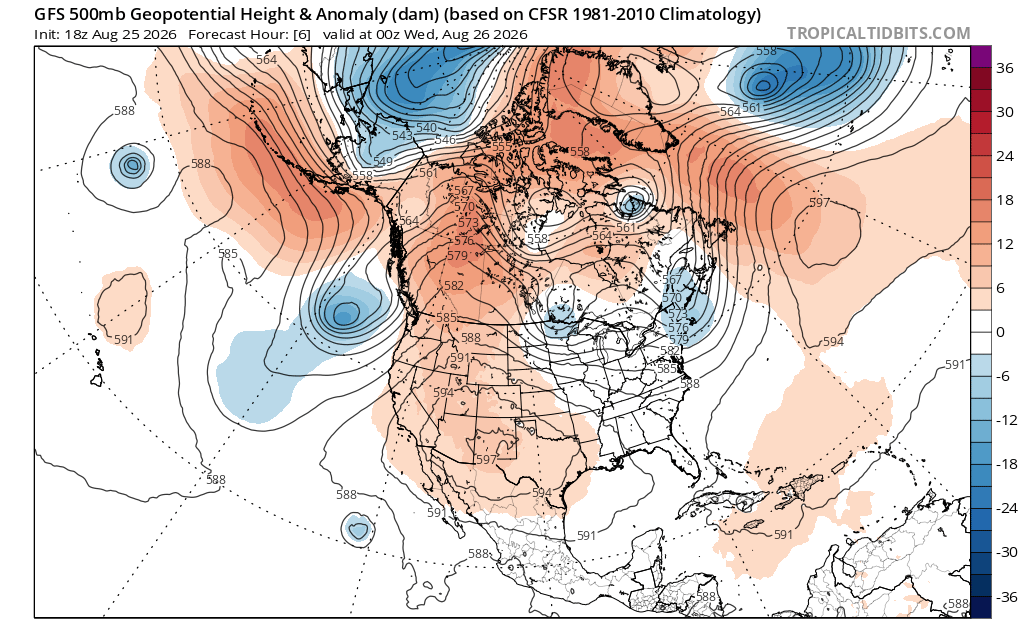
Image: Modelled 500 hPa height anomalies at 12:00am UTC on Wednesday, August 26, 2026, showing the upper-level ridge that has been a persistent feature across the South-Central U.S. this month. Source: Tropical Tidbits.
The upper-level ridge is forecast to remain in the region through the end of the month, and models suggest it will be sticking around in early September as well.
As daylight hours gradually shorten going into September, it becomes much harder to hit the 100-degree mark, even with a strong ridge. But if this feature remains stout, which models suggest it will, it could add a few more 100-degree days in early in the month.