
Sodden and stormy Saturday in NSW
The low pressure system over NSW that has been in the spotlight over the past couple of days has produced a downpour of rain in many locations in eastern NSW. Thunderstorms also helped to generate gusty winds and hail during the day.
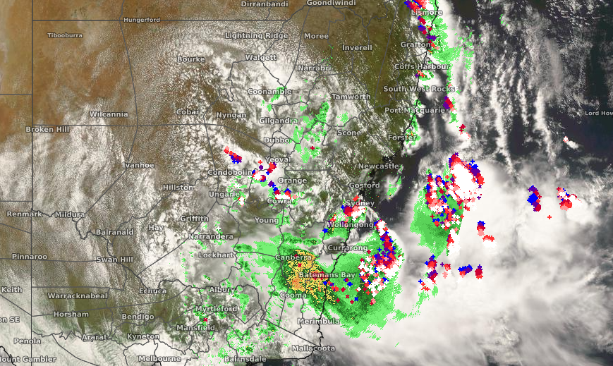
Image: Satellite imagery (Himawari-8) with radar and lightning overlay at 2pm EDT Saturday
Saturday morning's heaviest totals were observed in the Illawarra and Shoalhaven region. At 2pm, Ulladulla had already received almost 120mm since 9am. Even more impressive was that 109mm of this rain was recorded in just 3 hours. Many locations had similar bursts of heavy rainfall. Moruya had 73mm in the same amount of time whereas Young and Wollongong collected 40mm and 39mm respectively in only 30 minutes.
The thunderstorms that have developed from this system have been most severe along the coast, with multiple warnings being issued throughout the day. There have even been reports of hail around the eastern suburbs of Sydney. In terms of winds, the strongest gusts that have been recorded have been at Holsworthy (72km/h), Albion Park (72km/h) and Coffs Harbour (74km/h).
As the low moves offshore, it's effects will be confined to the east on Sunday, with showers and storms possible along the NSW coast. Fortunately, the outlook for the new week is looking a bit quieter. As a broad high pressure system pushes in from the west, Monday and Tuesday should be mostly sunny across the state with only a few lingering showers near the coast.