
Soaking rain and cool days heading to the Red Centre
Significant rain is expected over the coming days across southern parts of the Northern Territory as a slow-moving low pressure trough, fed with tropical moisture, lingers over the region.
Rain and thunderstorms started to develop on Sunday morning in the far southwest of the territory, near the WA and SA borders. The rain band will move northeast during the afternoon and remain almost stationary over the next three days.
Accumulated rainfall between Sunday and Wednesday night is likely to exceed 50 mm for Alice Springs with some models indicating totals above 80 mm. Yulara may collect above 15 mm during this period, with Tuesday being the wettest day. These amounts of rain would represent the best falls in months, and potentially, in years.
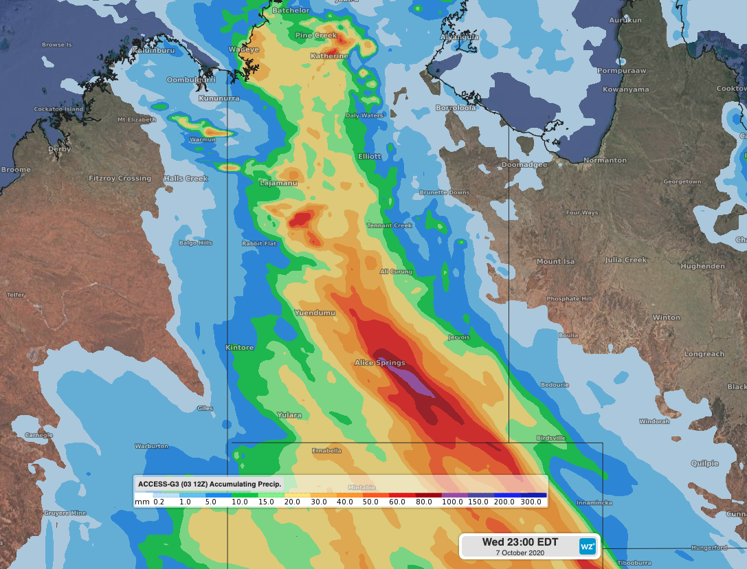 Image: Accumulated rainfall between Sunday and Wednesday night, according to the ACCESS-G model.
The system will also bring the mercury to winter-like maximum temperatures. After registering 38 degrees in Alice Springs on Saturday, maxima should stay around 14-15 degrees on Monday and Tuesday. If either of these figures are eventually observed, they would become the coldest October days since 1968.
These heavy falls may result in significant stream rises and flash-flooding, so be sure to keep up to date with the coming weather warnings.