
Snowing in Victoria on Melbourne Cup Day
It’s a chilly one for those celebrating the Melbourne Cup Day public holiday outdoors on this first Tuesday in November, with snow blanketing the high country of Victoria and New South Wales in the wake of a cold front which crossed southeastern Australia overnight.
Melbourne itself could struggle to reach the BoM's forecast maximum of 17°C and it will feel as much as five degrees cooler for most of the day due to persistent gusty westerly winds.
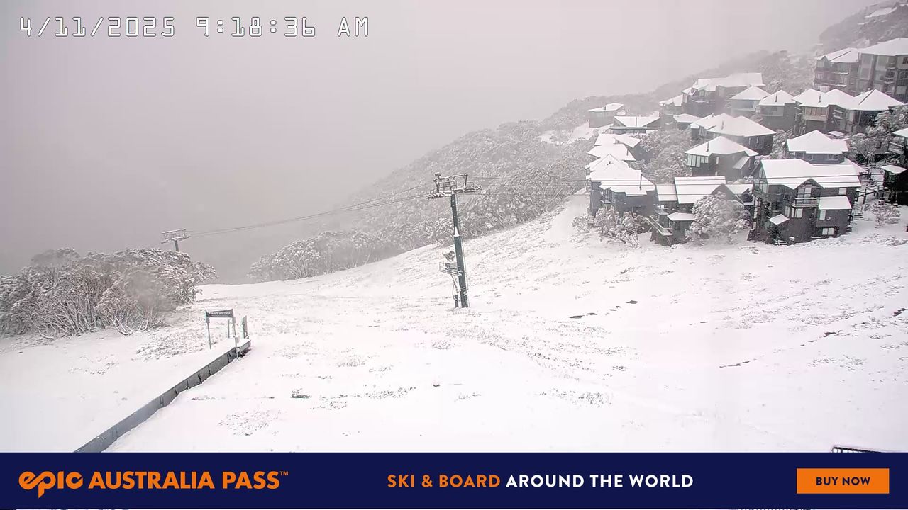
Image: The date stamp on the snow cam image reveals the unseasonable snowfall with the ski runs looking like winter again at Mt Hotham, Victoria. Source: Hotham Alpine Resort.
Those westerlies will be accompanied by intermittent showers and there’s even the possibility of a thunderstorm in the unstable cold airmass. The chance of showers in Melbourne appears to be highest during the mid-afternoon.
- Meanwhile Melbourne received 22.4mm of rainfall in the 24 hours to 9am Tuesday, following 14.6mm the previous day.
- That’s a two-day total of 37mm, which continued the recent wet trend.
- Melbourne has actually had a relatively dry year to date in 2025, with below-average rainfall in seven of the 10 completed months.
- One month which did exceed the average was October, and most locals would be pleased to see the damp spell spilling into early November.
Further south, Hobart has had its wettest day since July, with 25mm in the gauge to 9am this Tuesday.
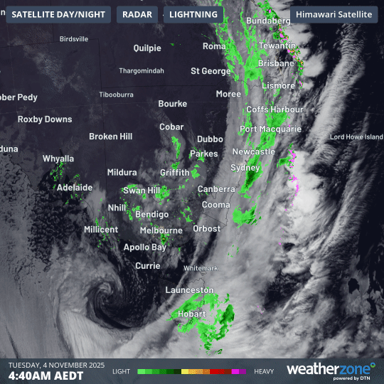
Image: Four-hour combined satellite and radar loop showing persistent rain in SE Tasmania as night turned to day on Tuesday, November 4, 2025.
Interestingly, Tasmania has seen none of the snow that continues to fall in the Victorian Alps and Snowy Mountains of NSW this Tuesday.
That’s due to the position of the dynamic low pressure system west of Tasmania system which is feeding moist, relatively warm northerlies to eastern Tasmania while cold southerlies push onto the southern mainland.