
Snowing in southern Victoria on first day of cricket's long hot summer
The first Ashes cricket Test starts in Brisbane today, and while the Queensland capital should reach a steamy 30°C with a strong likelihood of showers and storms a bit later today, it's a very different story in southern Victoria and Tasmania.
Snow is falling at Mt Baw Baw, about two-and-a-half hours east of Melbourne, as we write this story.
Yes, a light dusting of summer snow – as you can clearly see on the live cam image below, which is date-stamped December 8.
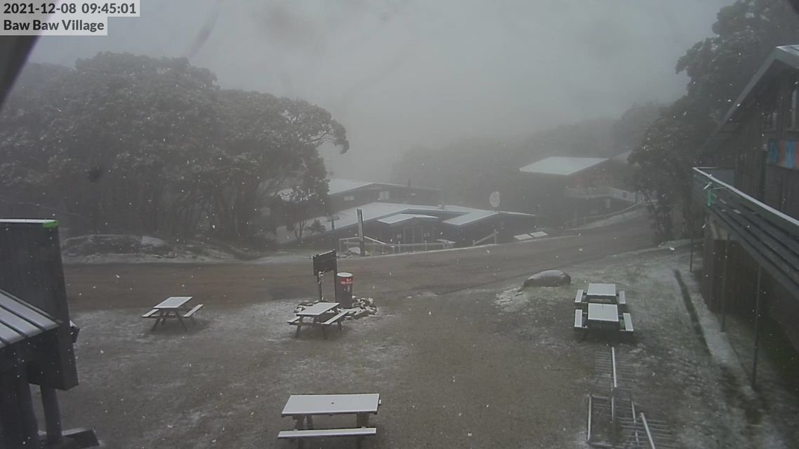
Image: In Brisbane today, it's all about cricket balls. In southern Vic, snow balls. Source: ski.com.au.
- Temperatures at Mt Baw Baw fell below zero just after 1 am early Wednesday morning, and haven't rebounded above freezing since, with a reading of -0.2°C at 9:30 am.
- The Mt Baw Baw weather station is located at the mountain's summit at 1561 metres above sea level.
- By way of comparison, Melbourne's official station at Olympic Park, which is close enough to sea level, was 14.8°C at 9:30 am.
- Snow is also possible above 1000 metres in Tasmania today, which means kunanyi/Mt Wellington above Hobart, at an altitude of 1260 metres, could see a few flakes.
Why the cold outbreak in the second week of summer?
Summer snow is far from a rare occurrence in Tasmania and the High Country of New South Wales and Victoria.
Indeed, you can generally expect at least one fall each summer, as the prevailing summer weather patterns are briefly interrupted by an injection of cold air from the Southern Ocean.
This morning's wintry outbreak is due to a cold front which crossed Tasmania and the southernmost parts of Victoria yesterday. In its wake, a small upper level cold pool is sticking around, generating cool temperatures across much of Victoria.
That cold pool is actually the harbinger of some pretty extreme weather heading towards eastern Victoria and SE NSW on Thursday and Friday, with heavy rain, strong winds and cold temperatures likely as a cut-off low pressure system forms.
Please keep checking the Weatherzone warnings page if you live in those areas.
Meanwhile if you're into the cricket, here's our story about the likely conditions over the five days which we published on Monday. The situation remains pretty much exactly as we called it then.