
Snow to low levels later this week

A mass of cold polar air is likely to cause snow to low levels in southeastern Australia later this week.
One of the coldest air masses of the year will spread over southeastern Australia between Thursday and Sunday, producing a burst of wintry weather and widespread, low-level snow.
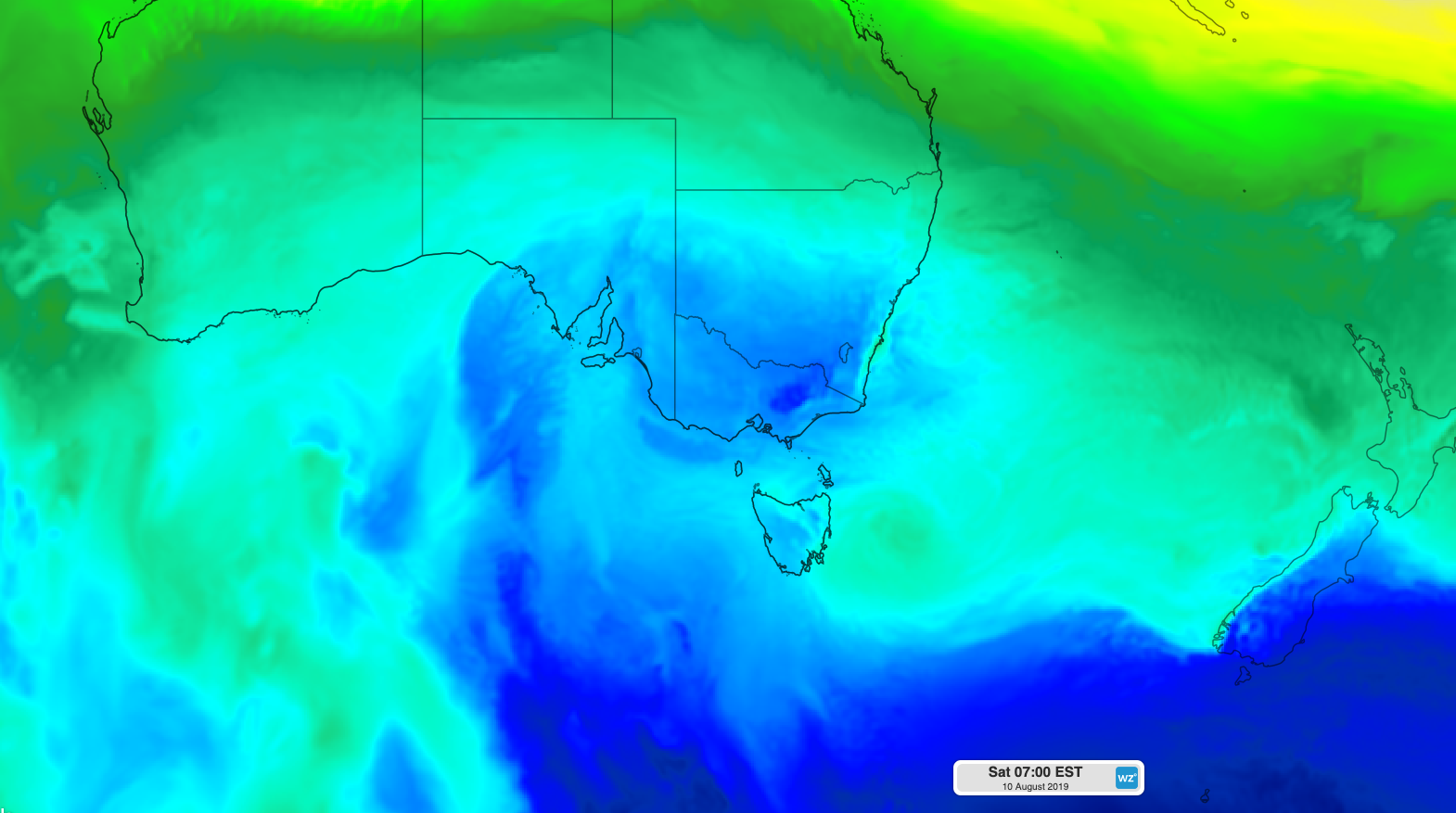
Image: Cold air spreading over southeastern Australia on Saturday morning, according to the ECMWF-HRES model.
On Thursday, snow could fall down to about 600-700 metres above sea level in Victoria, 800 metres in Tasmania and 900 metres in southern NSW.
Temperatures will plummet further on Friday as colder air surges across the nation's southeast, possibly lowering the snow level to around 500-600 metres in Tasmania, Victoria and southern NSW.
On Saturday, even colder air could be pushed over some areas of southeastern Australia by a deep low pressure system in the Tasman Sea. However, there is some disagreement between computer models regarding the position of this low during the weekend. This makes it difficult to predict how low and how much snow is likely to fall on Saturday and Sunday.
At this stage there's potential for snow to reach down to 500 metres above sea level in Tasmania, Victoria and NSW again on Saturday, possibly lower. Snow is also a good chance on parts of the central and northern ranges in NSW on the weekend.
There is still room for forecasts to change over the next few days as computer models put out more accurate information.
This weather event will also feature widespread severe weather in multiple states and territories, so be sure to keep up to date with the latest warnings.