
Snow on the horizon for Tasmania and Victoria
A burst of wintry weather will bring snow to parts of Tasmania and Victoria during the next 48 hours.
While hot and windy weather raised fire danger ratings in southern Australia on Monday, a cold front will bring much colder weather to parts of South Australia, Victoria and Tasmania on Tuesday.
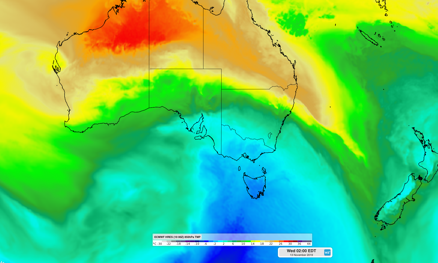
Image: Cold air passing over southeastern Australia on Tuesday night.
The front will drop temperatures by more than 15 degrees in 24 hours in some places, with Adelaide forecast to reach 34 degrees on Monday and just 18 degrees on Tuesday. Melbourne's daily maximums could drop from around 28 to 17 degrees between the two days.
Showers, small hail and snow will also add to the wintry feel in the wake of the front on Tuesday. It should get cold enough for snow to reach about 900 metres elevation in Victoria on Tuesday night and Wednesday morning, while Tasmania's Western and Central Plateau district could see snow to around 600 metres.
Tuesday's snow will occur on the same day that parts of NSW experience Catastrophic fire danger ratings amid dry, hot and windy weather ahead of the approaching front.
In addition to a dramatic temperature change, this cold front will also produce damaging winds in parts of Victoria and NSW on Tuesday. Visit https://www.weatherzone.com.au/warnings.jsp for the latest warnings.