
Snow in central NSW as dangerous low pressure system deepens over Tasman Sea
A pool of cold air passing over NSW has caused a wintry mix of snow, hail, heavy rain and blustery winds during the last 24 hours.
Snow started settling on high ground in the Central Tablelands on Thursday evening as temperatures plummeted under a passing mass of cold air. There were videos of the snow falling at Yetholme, near Bathurst.
Further south, there was also a dusting of snow in the alps on Thursday night, while other parts of the state's southern ranges were covered in a thick layer of small hail.
The freezing air brought a decent layer of snow to parts of the Blue Mountains overnight, including Blackheath. There were also reports of snow and sleet in Katoomba.

Image: Partially melted snow in Blackheath on Friday morning. Source: @bluemountainsmaid65 / Instagram
In addition to cold weather and snow, the cold air passing over NSW on Thursday night also caused a low pressure system to rapidly deepen over the western Tasman Sea. This strong low drove heavy rain, thunderstorms and blustery winds into parts of the NSW coast on Thursday night and Friday morning.
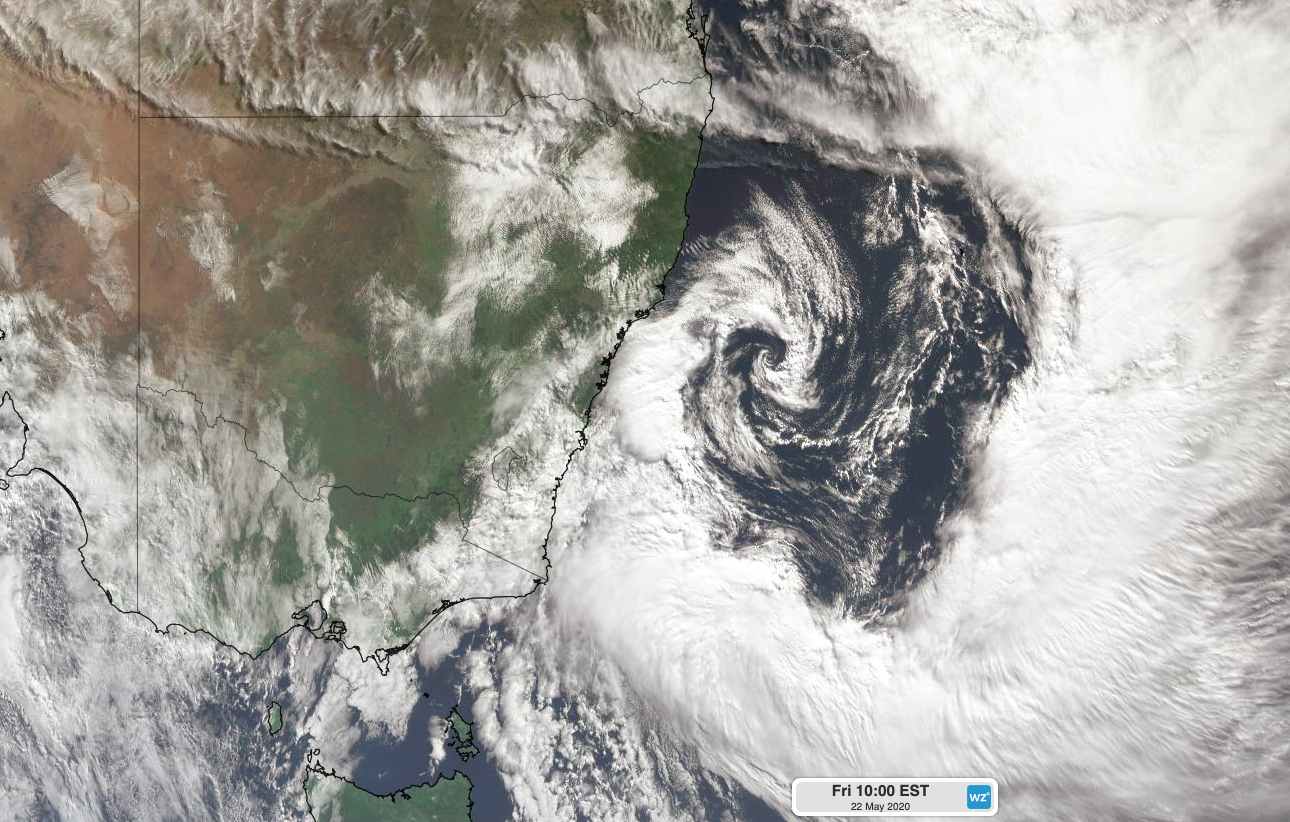
Image: Satellite image showing the low pressure system off the coast of NSW on Friday morning.
Wind gusts reached 82km/h at Point Perpendicular and Montague Island during Friday morning. These powerful winds also whipped up large and dangerous waves along the coastal fringe, with maximum wave heights reaching 10 metres off the coast of Sydney on Friday morning.
A rain gauge at Tomerong Creek, near Jervis Bay received 83mm of rain during the 24 hours to 9am on Friday. Other notable totals included 66mm at Little Bay and 55mm at Cronulla in Sydney, while Penrith's 42.2mm was its highest daily total in May since 1996.
At 10am AEST on Friday, a severe weather warning was in place for damaging winds and damaging surf for parts of the Sydney Metropolitan and Illawarra coasts.
The low will maintain showers, blustery winds and dangerous surf in eastern NSW into the weekend before moving offshore early next week.