
Snow, fire, floods and severe storms in one day

Australia will live up to its reputation of variable and contrasting weather on Tuesday, with snow, bushfires, flooding, severe thunderstorms, damaging winds and dust storms all possible.
A strong front crossing southeastern Australia on Tuesday will bring with it the coldest air to affect this part of the country so far this year.
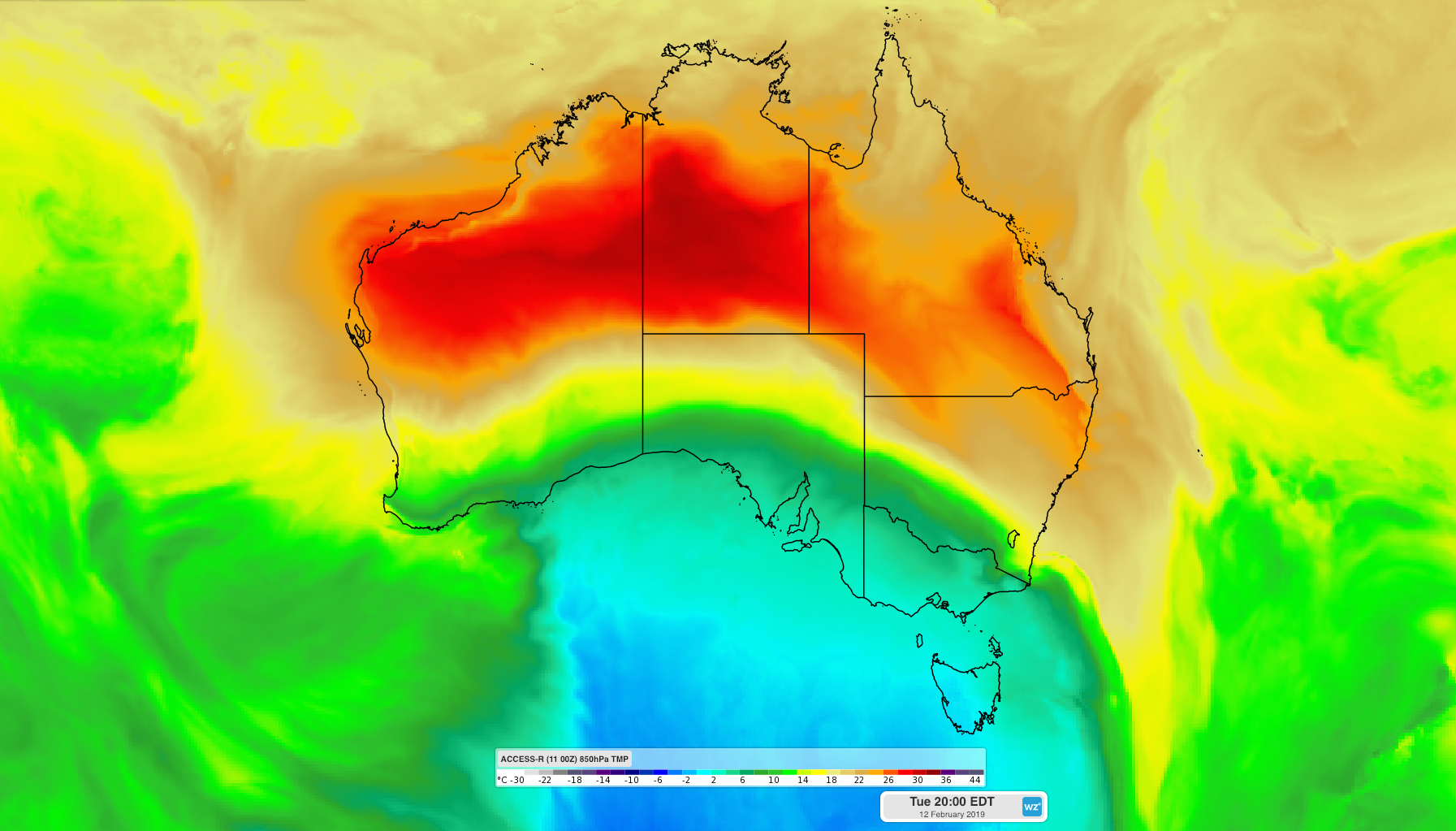
Image: The interaction of cold air passing over southeastern Australia and warm air over the nation's eastern states will fuel a volatile mix of weather on Tuesday.
This air mass air will be cold enough for snow to fall down to about 900 metres above sea level in Tasmania and on alpine peaks in Victoria, mainly during the afternoon and evening.
The front will also produce a burst of blustery wind and showers, along with a few storms and possibly small hail, as it crosses the nation's southeastern states.
A stream of fresh to strong northwesterly winds ahead of the approaching front will send a pulse of warm air over NSW and southern Queensland. These winds may cause damaging gusts in elevated parts of northeast Victoria and southern NSW on Tuesday, prompting severe weather warnings for some areas.
The hot, dry and gusty winds are likely to cause areas of raised dust and and elevate fire danger ratings in drought-weary NSW. The state's Rural Fire Service has issued a statewide total fire ban on Tuesday, with severe to extreme fire danger ratings likely.
As temperatures also rise across southern and central Queensland, the warming of air near the ground will help produce thunderstorms in the state's southeast on Tuesday. Storms should develop in the state's South East Coast and Wide Bay and Burnett Districts during the day, with severe storms likely in some areas, mainly from the afternoon. Severe fire danger ratings are also forecast for parts of central and southern inland Queensland on Tuesday.
Further north, floodwaters from heavy monsoonal rain over the last fortnight will continue to flow through bulging rivers in parts of northern and western Queensland on Tuesday.
Visit http://www.weatherzone.com.au/warnings.jsp for the latest warnings.