
Snow falls to low levels in Tasmania
Heavy snow has fallen across Tasmania, with light snow falling to levels as low as 600 metres, while snowfall totals likely exceeded 20 centimetres at some locations above about 1000 metres.
Tasmania’s highest peak is Mt Ossa at 1617 metres, the iconic Cradle Mountain is 1545 m, while kunanyi/Mt Wellington towers above Hobart at 1271 metres. So any time snow falls to 600 metres, a good proportion of the state will have a coating of white.
This was the scene at Cradle Mountain Visitor Centre on Tuesday morning.
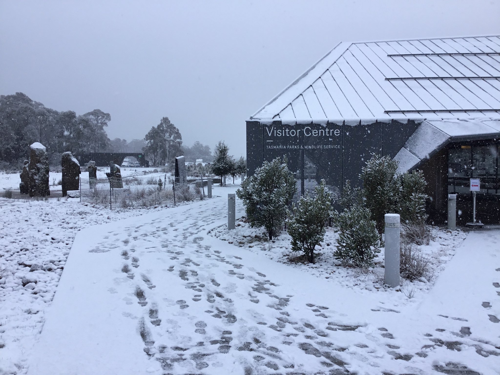
Image: Footsteps in the snow at Cradle Mountain Visitor Centre, Tasmania, on July 14, 2026. Source: Mike Pole.
And this was the very wintry scene high on kunanyi/Mt Wellington above Hobart just after 10 am. At that time, the Pinnacle Road to the summit was closed at The Springs, at an elevation of 720 metres.
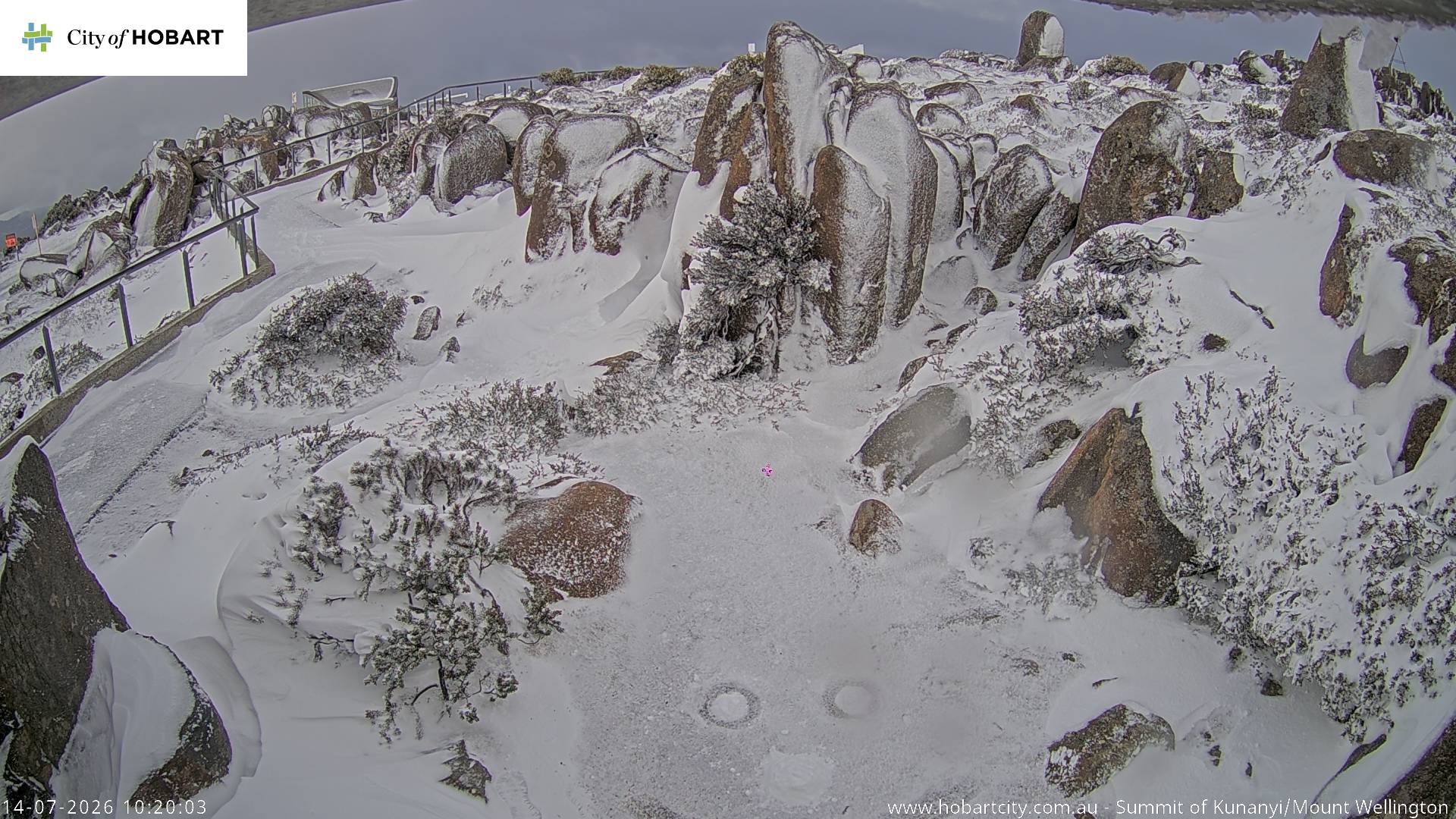
Image: No footsteps in the snow yet at the kunanyi/Mt Wellington summit due to the closed road. Source: hobartcity.com.au.
What caused the heavy snowfall?
A series of troughs embedded in a persistent westerly stream crossed Tasmania overnight, bringing frequent bands of moisture accompanied by frigid air which was driven north from latitudes near Antarctica.
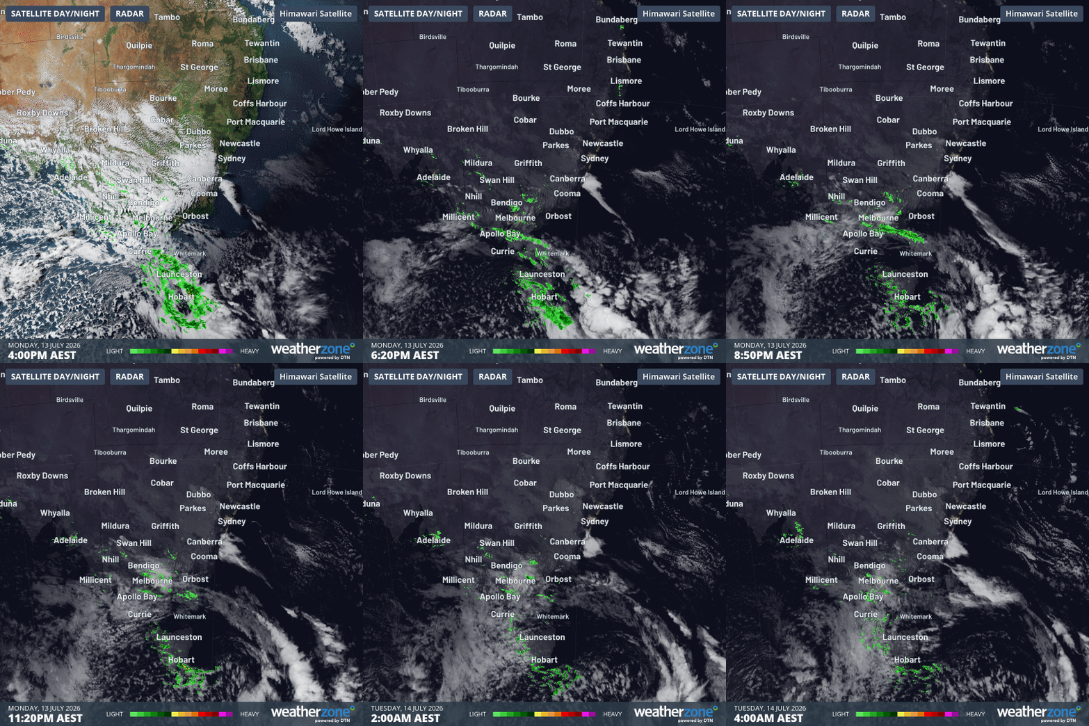
Image: 12-hour satellite and radar loop over Tasmania and nearby mainland areas to 4 am on Tuesday, July 14, 2026. Source: Weatherzone.
Hobart received 19.4 mm of rainfall overnight, which made it the city’s second-wettest day of the year to date, while numerous Tasmanian locations received rainfall totals in the 25 to 50 mm range.
Tasmania’s only commercial ski resort – Ben Lomond near Launceston – reported only 4-5 centimetres of fresh snow overnight, however its location in the northeast of the state is not always conducive to heavy falls from westerly weather systems.
Good and bad news for the mainland snowfields
The image below illustrates how the airmass that passed across Tasmania overnight was significantly colder than the airmass over the ski resorts of Victoria and New South Wales on the southeastern corner of the mainland.
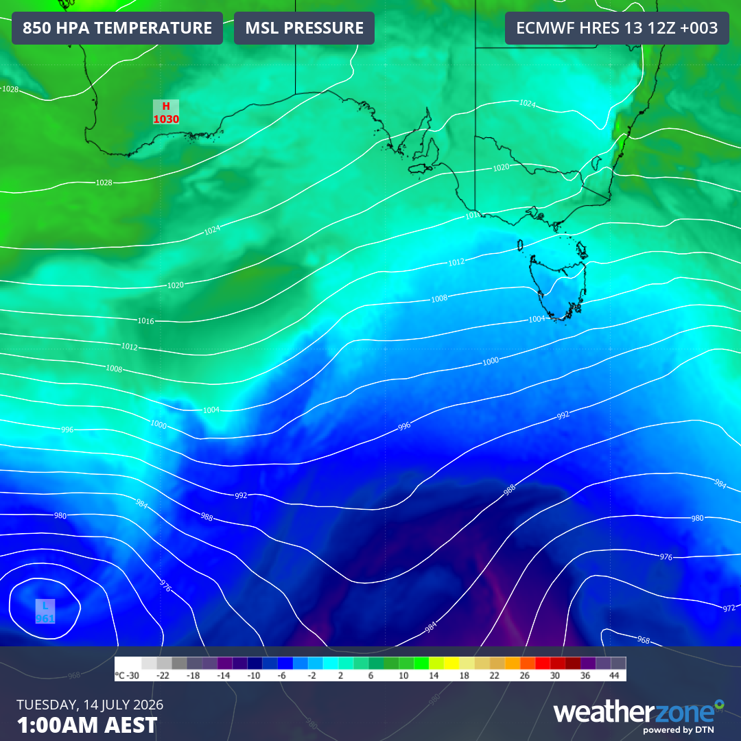
Image: 850 hPa temperatures and mean sea level pressure over southern Australia and nearby waters at 1 am (AEST) on July 14, 2026. Source: Weatherzone.
Overnight, snow fell only on the uppermost slopes of the mainland resorts. At lower levels, rain fell.
Ever since a cold front arrived late on Saturday, ushering in a four-day flow of strong westerly winds and persistent moisture over the Australian Alps, there have been two distinct bursts of snowfall with two periods of rain at all but the highest elevations.
The higher resorts have still benefited from this system. At least 25 centimetres of snow has fallen at both Perisher and Thredbo, and while rain has eroded some of the snowpack, locals are still saying there has been a net gain overall.
As we head towards lunchtime this Tuesday, snow showers are again falling at the ski resorts, with temperatures having dipped ever so slightly. For example, Thredbo Top Station (Australia’s highest weather station) hovered around -0.1°C overnight, which was marginal for snow.
But the mercury had dropped to -0.5°C at 9:30 am and was the same temperature at 10:30 am, as the very tip of the cold air over Tasmania pushed northwards.
Please check the Weatherzone snow page for the latest forecasts, live snow cams and more.
Meanwhile, Canberra and Hobart will be the coldest capitals today, with maximums of 11°C expected. With those persistent westerlies, the apparent or "feels like" temperature will barely break 5°C all day in both cities.