
Signs of drought in northern Murray-Darling Basin
Record-challenging April warmth and scarce rainfall are causing drought conditions to develop in parts of northern New South Wales and southern Queensland.
Warm and dry April
A series of high pressure systems have kept large areas of eastern Australia unusually warm and dry during the last few weeks. Despite some frosty mornings, daytime maximum temperatures in northern NSW and southern Qld have been running around 3°C to 6°C above average so far this month.
Inverell in one of many places in northern NSW that is currently running above its April record for daytime warmth. Inverell’s average maximum temperature for the first 21 days of this month was 28.0°C, well above its monthly average of 23.7°C and its April record of 27.2°C.
Many weather stations in northern inland NSW and southern inland Qld have also received little or no rainfall this month. Rain gauges at Guyra, Glenn Innes, Inverell, Tenterfield, Moree and Walgett have all remained completely dry so far during April.
Drought developing
This April continues a warm and dry start to the year that is causing vegetation moisture stress to worsen in parts of the northern Murray-Darling Basin.
Rainfall across parts of northeast NSW and southern Qld was in the lowest 10 percent of historical records during the first three months of 2026, with some areas in northern NSW having their driest start to a year on record.
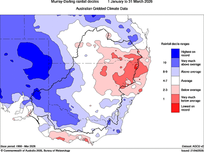
Image: Observed rainfall deciles in and around the Murray-Darling Basin from January to March. Red areas show where rainfall was below average in this three-month period, while blue is above average rain. Source: Bureau of Meteorology.
Every month so far this year has also featured above average maximum temperatures in northeast NSW and southern Qld.
This recent run of warm and dry weather has caused a spike in evaporative stress, which indicates that moisture is being lost from vegetation and the underlying landscape faster than it is being replenished.
The map below shows the Evaporative Stress Index (ESI) for the four weeks ending on March 31, 2026. The red shading in NSW and southern Qld shows where vegetation moisture stress is elevated, which is an indicator of agricultural and ecological drought.
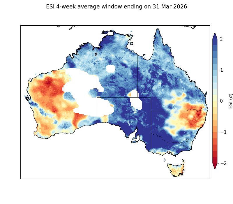
Image: Evaporative Stress Index (ESI) for the 4 weeks ending on March 31, 2026. Source: Bureau of Meteorology.
The negative ESI values that represent drought over parts of NSW and Qld have intensified over the last couple of months and are likely worsening further in April. A rapid change in the ESI towards higher moisture stress, as we have seen recently, can indicate the onset of ‘flash drought’.
Unlike traditional drought that sets in over a prolonged period, flash drought refers to a drought that appears or intensifies quickly.
Is there rain on the way?
Late autumn and winter are typically a relatively dry time of year for Australia’s eastern inland, with more rain typically falling in the summer months.
Unfortunately, this winter may be even drier than usual for the northern Murray-Darling Basin due to the likely development of El Niño through the middle of 2026.
Most seasonal forecast models indicate that rainfall will be lower than average for much of southern Qld and NSW during the 3-month period from May to July. Daytime temperatures are also tipped to be warmer than average through this period.
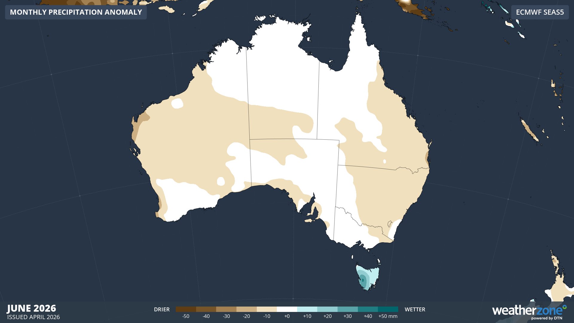
Image: Monthly precipitation anomaly forecast for June 2026. Source: Weatherzone.
Visit the Bureau of Meteorology’s drought page to monitor Australian drought conditions, including information on rainfall deficiencies, soil moisture and evaporative stress.