
Significant weekend snowfalls to boost Aussie ski season
The first significant snow-bearing system of August 2025 will develop over the Australian alpine region on Friday and into the weekend, providing a much-needed top-up for our alpine resorts.
Accumulated snowfall totals of between 15cm and 30cm are likely on the higher slopes by the end of Monday, with light snow showers possibly continuing all the way through to Wednesday.
Thankfully, no repeat of August 2023 and 2024
In the first half of this month, it started to look like the 2025 snow season would follow the unfavourable pattern of both 2023 and 2024, when early season peaks in July were followed by a warm (and at times wet) August which severely diminished the snow cover.
In both 2023 and 2024, some minor ski areas ceased operations as early as August, while even normally reliable resorts like Perisher and Thredbo in NSW – Australia’s two highest resorts – didn’t last until their scheduled closure on the October long weekend.
But the 2025 snow season does not appear to be tumbling off the same August cliff.
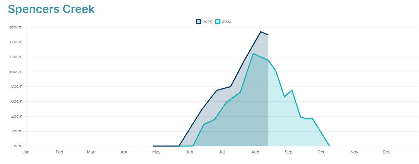
Image: Comparison of 2024 (light blue) and 2025 (dark blue) snow depths at Spencers Creek, NSW, roughly halfway between Perisher and Thredbo at an elevation of 1830m. Source: Snowy Hydro.
While the base has diminished slightly this month with only a centimetre or two of fresh snow recorded at the higher resorts thus far, temperatures have been closer to average than in recent seasons, preserving the existing snowpack. For example:
- In 2023, Perisher Valley’s average August maximum of 6.4°C was 2.7°C above the long-term average.
- In 2024 Perisher Valley’s average August maximum of 5.8°C was 2.1°C above the long-term average.
- To date in August 2025, Perisher Valley’s running average August maximum of 4.4°C has been only 0.7°C above the long-term average – a minor anomaly considering the high number of sunny days.
And now, as mentioned, fresh snow is on its way. The satellite image below shows a cold front in the Great Australian Bight on Thursday afternoon with a field of speckled cloud in its wake, indicating a polar airmass.
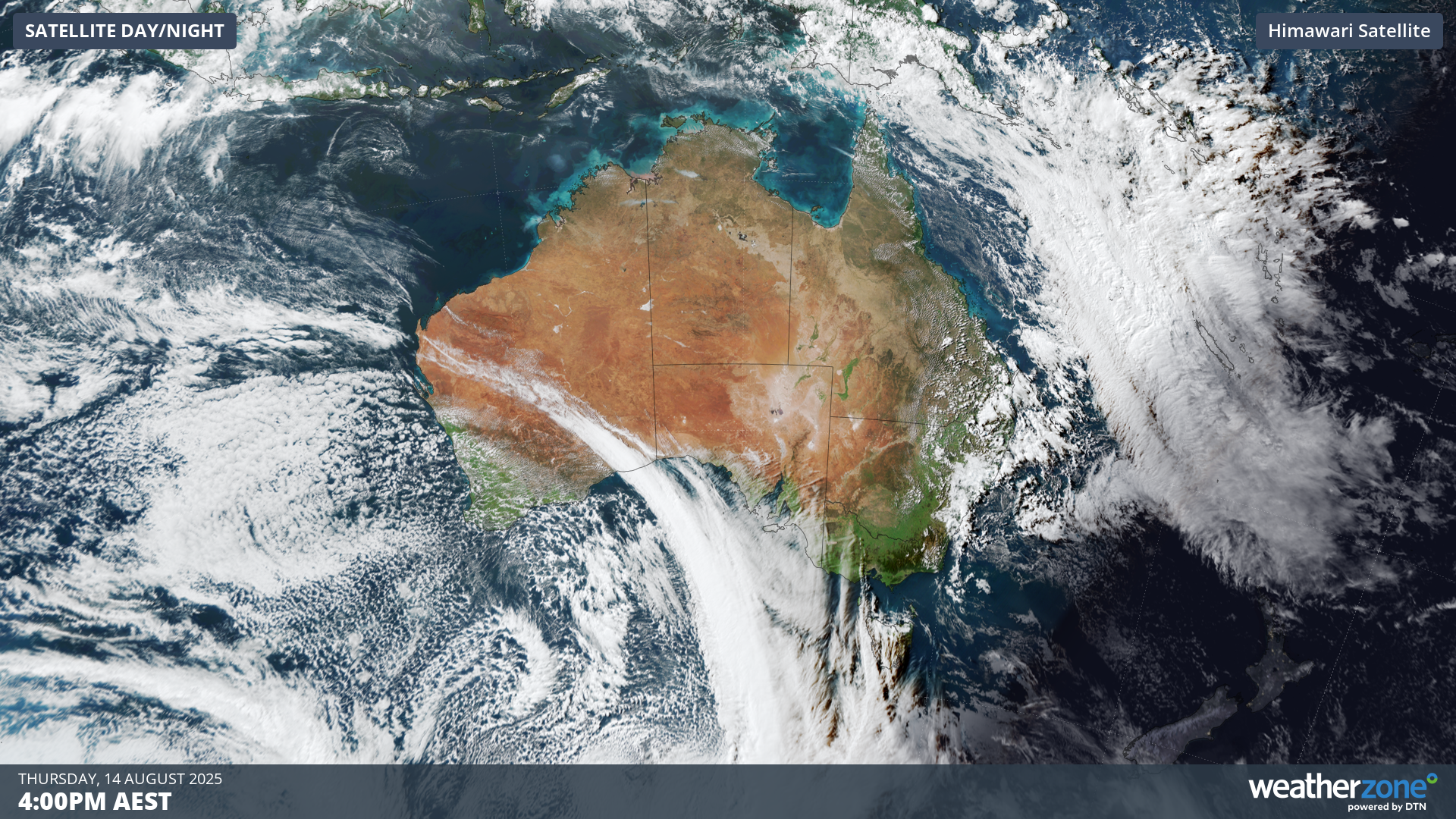
Image: Cold front crossing the Great Australian Bight at 4pm (AEST) on Thursday, August 14, 2025.
That front will lose some of its punch by the time it arrives over the alpine region, and there could even be some rain ahead of it at all but the highest elevations of the mountains.
But a follow-up front and associated low pressure system will provide a second injection of moisture as well as much colder air over the weekend, enhancing the potential for significant snowfalls.
Sunday looks like an interesting day for snow lovers in and around the alpine region, with a chance of thundersnow (thunderstorms accompanying snowfalls). The snow level will be very low by Australian standards at around 700m. For perspective, most of Canberra sits at about 600m.
Snow is possible on the Central Tablelands of NSW on Sunday, as well as in the Blue Mountains just 90 minutes west of Sydney in towns like Blackheath and Katoomba.
READ MORE: Thundersnow is go! Our June 2023 story about a thundersnow event
Don’t forget to check the Weatherzone snow page for the latest forecast, cams and much more throughout the 2025 Australian snow season.