
Showers behind the heat in the southeast
While significant heat is affecting central and southeastern parts of the country, showers are likely to fall on the other side of the low pressure trough drawing in the heat.
The system should generate some decent rain totals over the weekend, with some areas potentially receiving more than 25 mm. The heaviest falls are expected across the far southeast of South Australia, coastal Victoria and the Furneaux group of Islands in Bass Strait. However, light falls may be felt across inland areas of South Australia, Victoria and southeastern parts of New South Wales.
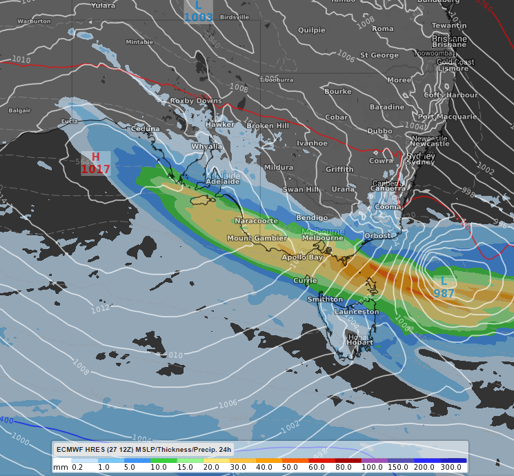
Image: 24hr accumulated rain totals to 2pm EDT on Sunday 29th November. White lines are mean sea level pressure and the red line is the thickness of the atmosphere in metres. Displayed using the ECMWF model.
In addition to the rainfall, thunderstorms are also likely to occur, with some already being triggered in eastern Victoria as of Saturday morning. The areas most likely to see storm activity include central areas of SA, central and eastern VIC and southeastern parts of NSW. Some of the storms have the potential to become severe, with damaging wind gusts, heavy rainfall and large hail a risk.
Keep an eye on weather warnings here: https://www.weatherzone.com.au/warnings.jsp