
Short-lived typhoon to develop in the West Pacific
Tropical Storm Kajiki (Isang) is the 23rd tropical depression in the Pacific region in 2025, and the 14th to develop into at least a tropical storm this season. It is currently 400km west of the Philippines northern island of Luzon is moving west towards Southeast Asia at a speed of 18.5km/h.
With optimally warm sea surface temperatures of 30 degrees, abundant moisture to keep it fuelled and no significant wind events to tear it down, conditions seem primed for Kajiki to develop into a full-scale Typhoon.
But there is one problem- it's heading for land. At its current speed and trajectory, Kajiki only has 60 hours until it reaches the shores of Vietnam. With forecasts indicating winds reaching Typhoon strength late tomorrow evening (local time), this gives the potential Typhoon about fourteen hours of life before it loses steam on the mainland. That is, if it does not weaken, as it passes over China's island Province of Hainan.
Forecast rainfall associated with this system as well as its maximum winds are expected over the waters of the South China Sea as well as Vietnam's northern coast before landfall. Sustained winds up to 140km/h are expected, gusting up to 167km/h, whilst accumulated rainfall from now to the system's landfall during Monday afternoon or early evening couldneach 400mm offshore and up to 350mm in Vietnam and eastern Laos.
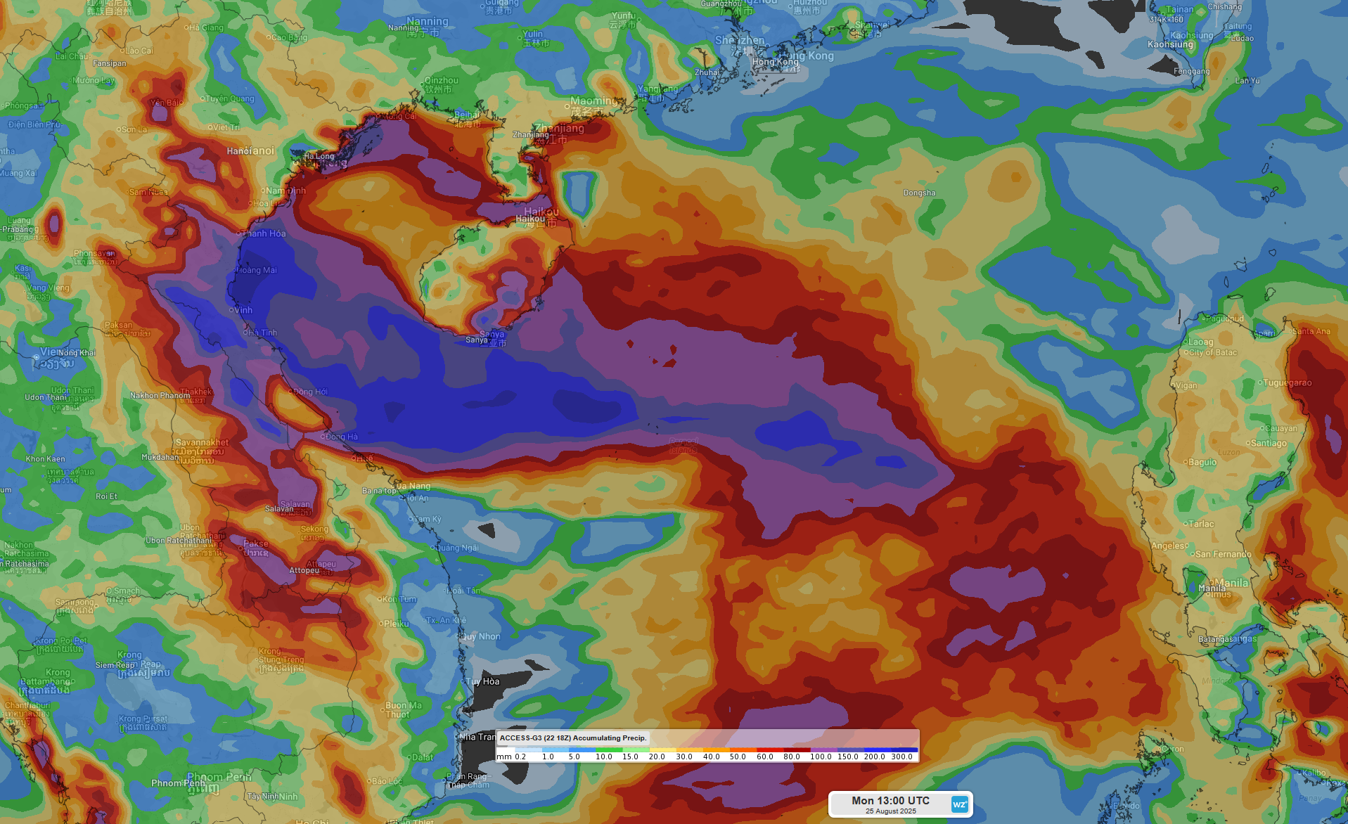
Image: Accumulated rainfall from now to Monday evening using the ACCESS-G model Fri 18Z run.
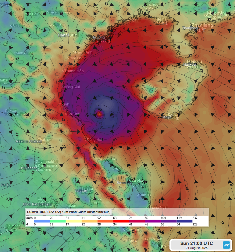
Image: Wind gusts at 10m early Monday morning (local time) using the ECMWF model Fri 12Z run.
While the system looks to breakdown quickly after it makes landfall, heavy rainfall associated with its remnants will persist over Southeast Asia till mid-next week. The rest of the moisture is swept up into the Indian Monsoon, adding to the heavy rainfall and storms over the region with a monsoon burst.