
Shivers! Could snow fall in Western Australia on Sunday night?
Snow in WA - is that really a thing?
Yes it is, and we'll tell you where in a moment. First you need to know that southwest Western Australia has had an exceptionally mild run of weather so far this May, which is about to come to an abrupt halt.
- Perth has had only one day below 20°C this month to date (and that day still made it to 19.9°C).
- Perth has had an average daily maximum of 23.3°C so far this month, compared to the long-term May average max of 20.8°C.
But as mentioned, all that is set to change this weekend, as the strongest cold front of the year moves across the SW corner of the state.
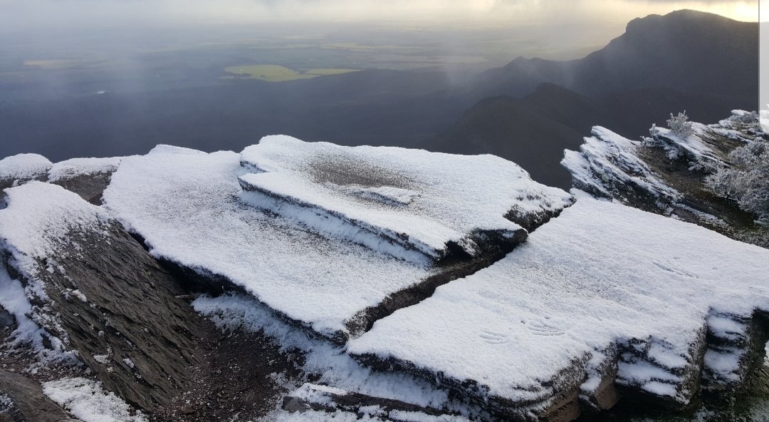
Image: No bluffing, that's actually snow in WA on the top of Bluff Knoll. Source: Jodie Jones.
Blustery winds and showers are expected across the southwest from around the middle of Saturday in most parts. Colder air then arrives overnight on Saturday, with the coldest air moving over the southern ranges from Sunday night into Monday morning.
OK, it's going to get chilly. But what's all this about snow?
WA has a range called the Stirling Range in the southwest, the location of which you can see on the map lower down this story. It's around 100 kilometres north-northeast of Albany, and about 400 kilometres southeast of Perth.
Your reporter has hiked to the top of the highest peak, Bluff Knoll, and it's definitely one of the best day walks in Australia. The views from the top over the nearby Porongorup Range are absolutely spectacular.
Bluff Knoll is 1099m above sea level and is roughly on the same latitude - give or take half a degree - as the Blue Mountains on the other side of the country.
Just as Blue Mountains towns like Katoomba (elevation 1017m) and Blackheath (elevation 1066m) receive flakes occasionally in winter, Bluff Knoll gets the odd winter snowfall and even a light dusting in spring and autumn some years.
That's what could happen on Sunday night. The snow up there never falls too deep. Nor does it last much more than a day, or even just a few hours.
But there is always a snow chaser or two like Albany resident Jodie Jones heading up that way looking to capture the white magic when the weather charts resemble this weekend's charts.
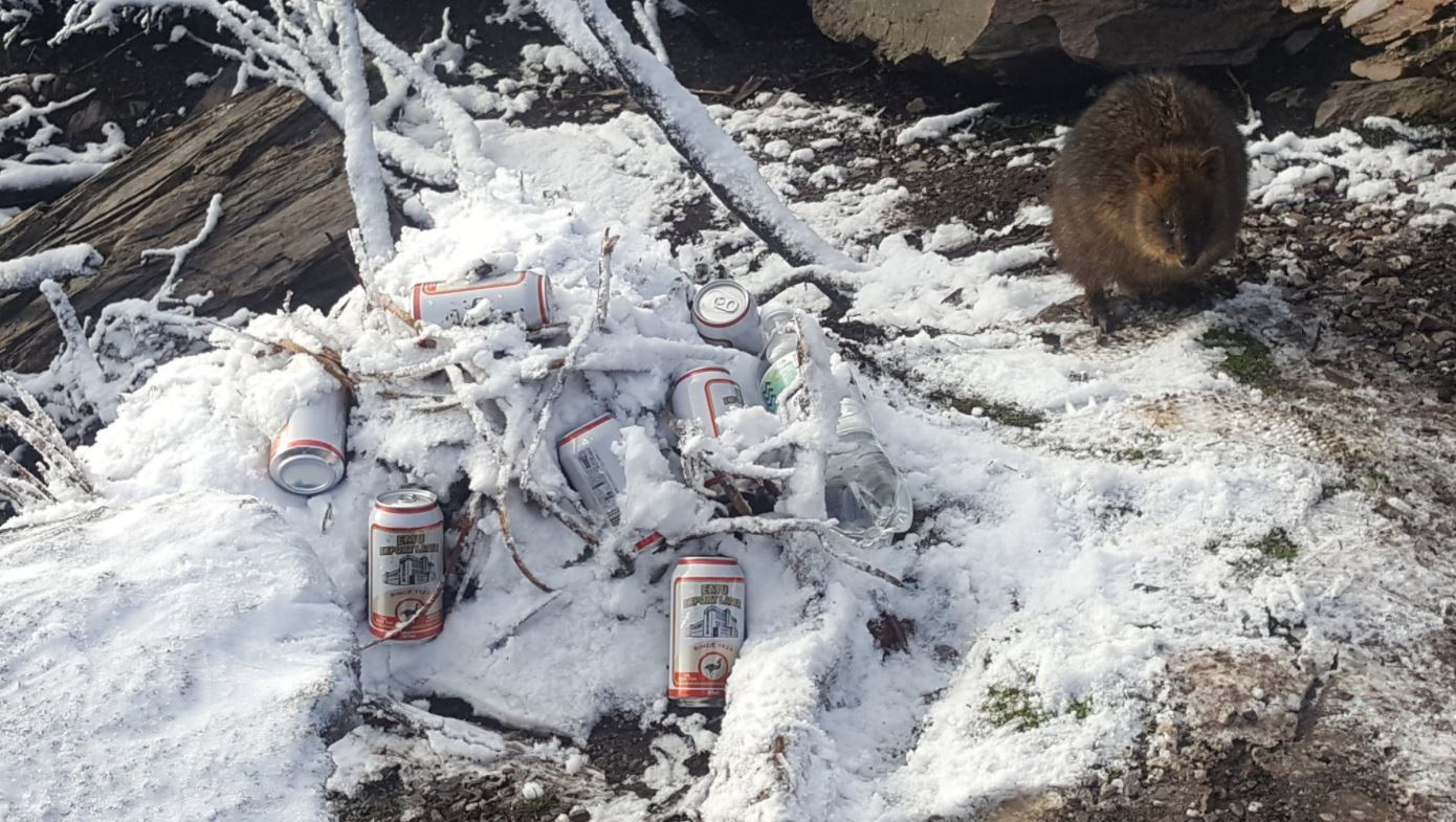
Image: Jodie really wants you to know that neither the beer nor the quokka belong to her! Source: Jodie Jones.
"I've been up there four times to see the snow but never seen it actually snow as such," Jones told Weatherzone.
She's caught the snow on the ground there, though, as the image higher up in this story shows. She also snapped the above image of the beer and the quokkas in the snow. Yep, it's different up there.
"Normally I've left Albany at 4 am for an hour's drive. Then a 5am hike up to the summit at 7 am. It's an awesome experience and should be on everyone's bucket list!"
We'll let you know on Monday morning if Jodie or anybody else comes up with the goods.
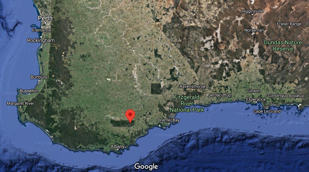
The red pin shows the location of the Stirling Range: Source: Google maps.