
Shiseido Tahiti Surf Pro forecast
After an emotional mid-season cut, and an exciting final which saw Australian Jack Robinson claim the win at Margaret River, the World Surf League tour is off to the spectacular and monstrous waves at Teahupo'o in Tahiti, French Polynesia.
Teahupo'o was for a long time not even considered a wave, with the mass of the ocean folding over itself into deadly shallow reef. Even with the technological advancements in wave riding over the last 40 or so years, it barely remains a rideable wave to us mere mortals, which is why this is one of the most entertaining and jaw-dropping stop on the world tour.
Tahiti, being a volcanic island in the middle of the Pacific Ocean, sees the ocean depth drop rapidly only a few kilometres offshore. This deep water proximity means that open ocean swells can march relatively uninterrupted into the fringing reefs that protect the clear, beautiful waters of the island's lagoons—popular spots for honeymoon snorkelling. Teahupo'o also benefits from more favourable local bathymetry and an optimal angling into the southeasterly trade winds, making it a spectacle of the world tour well worthy of a tune in.
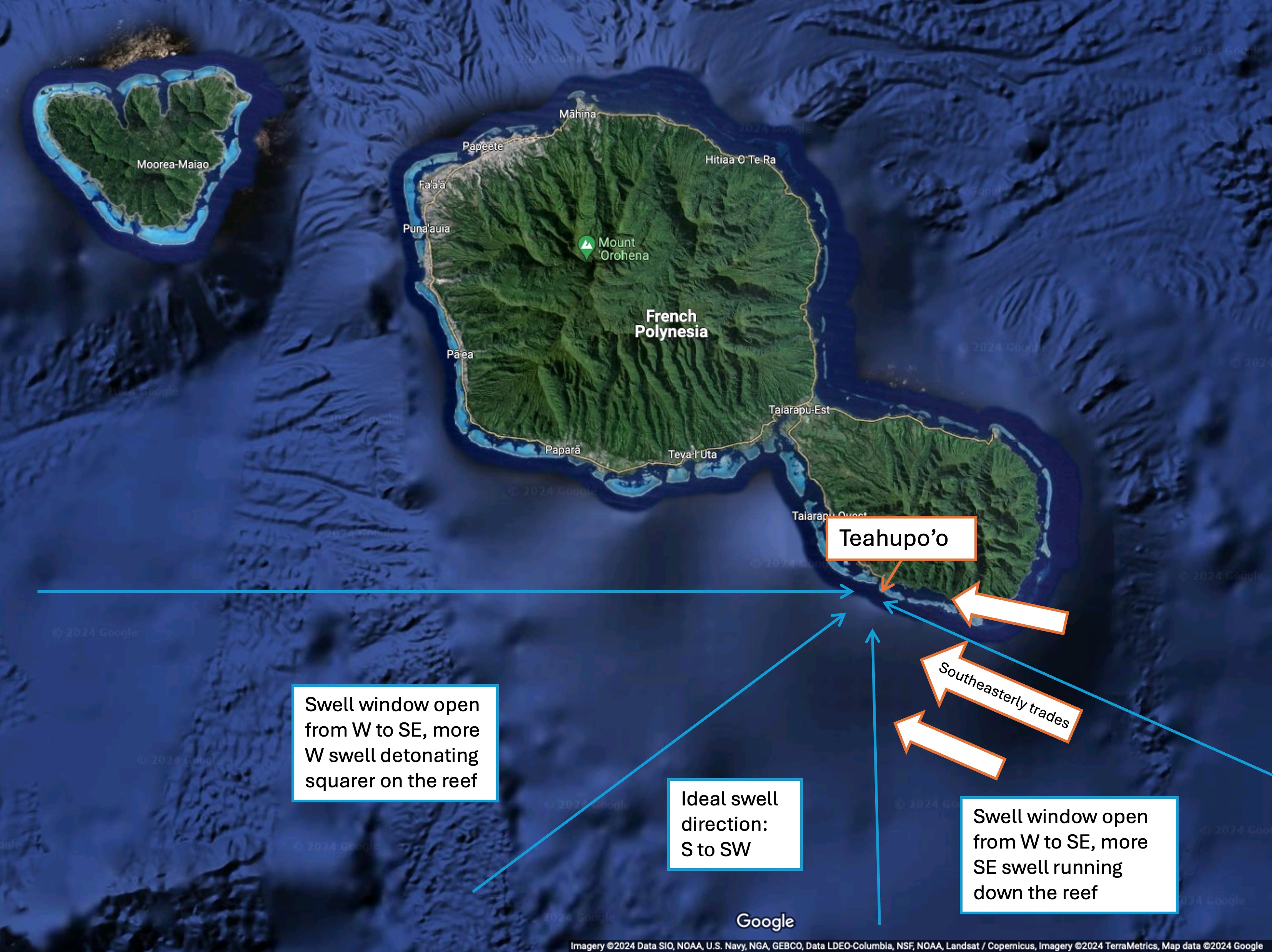 Annotated figure depicting the location of Teahupo'o in Tahiti, as well as the prevailing southeasterly trades and the swell directions that provide surfable waves.
So, what’s the forecast looking like for this year's competition, which runs from this Wednesday 22nd to Friday 31st?
Starting this week, a deep low located about 4,500km east of New Zealand will start sending mid-to-long period southeasterly swell towards Tahiti. This swell should peak on Tuesday, with enough energy remaining at the start of the competition period to possibly get a day of heats going. Southeasterly swell can provide longer rides, but barrels less intensely with the waves peeling down the reef (rather than explosively folding onto it). Conditions will be good otherwise, with trade winds tending more east and possibly northeast, a more offshore direction across the reef.
 Image showing GFS surface winds and Mean Sea Level Pressure (MSLP) on Sunday 19th with a deep low pressure system sending southeasterly swell to Tahiti.
As the southeasterly swell eases off into the late week (and winds turn more northerly and variable), organisers will look with hope towards the southwest with promise, and promise will deliver. A series of fronts crossing to the south of Australia and New Zealand this week will provide a sustained spells of reinforcing mid-to-long period southwesterly swell building from Friday 24th afternoon, extending into the weekend and the following week. From Saturday 25th, a consistent run of head-to-double-overhead high surf is expected across the reef, with generally favourable conditions making for excellent viewing. Another pulse of swell is expected around Tuesday 28th, with another possible pulse at the end of the competition period.
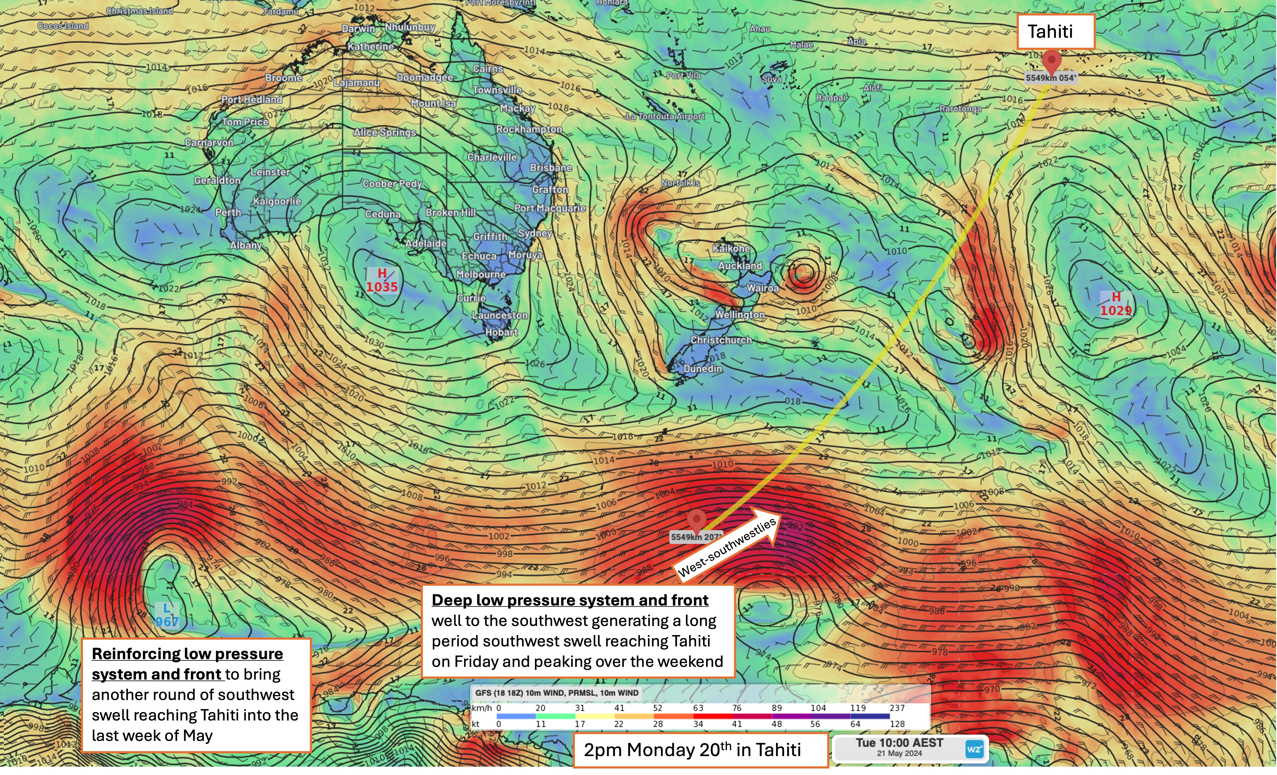 Image showing GFS surface winds and Mean Sea Level Pressure (MSLP) on Monday 20th with a series of low pressure systems and cold fronts sending southwesterly swell to Tahiti.
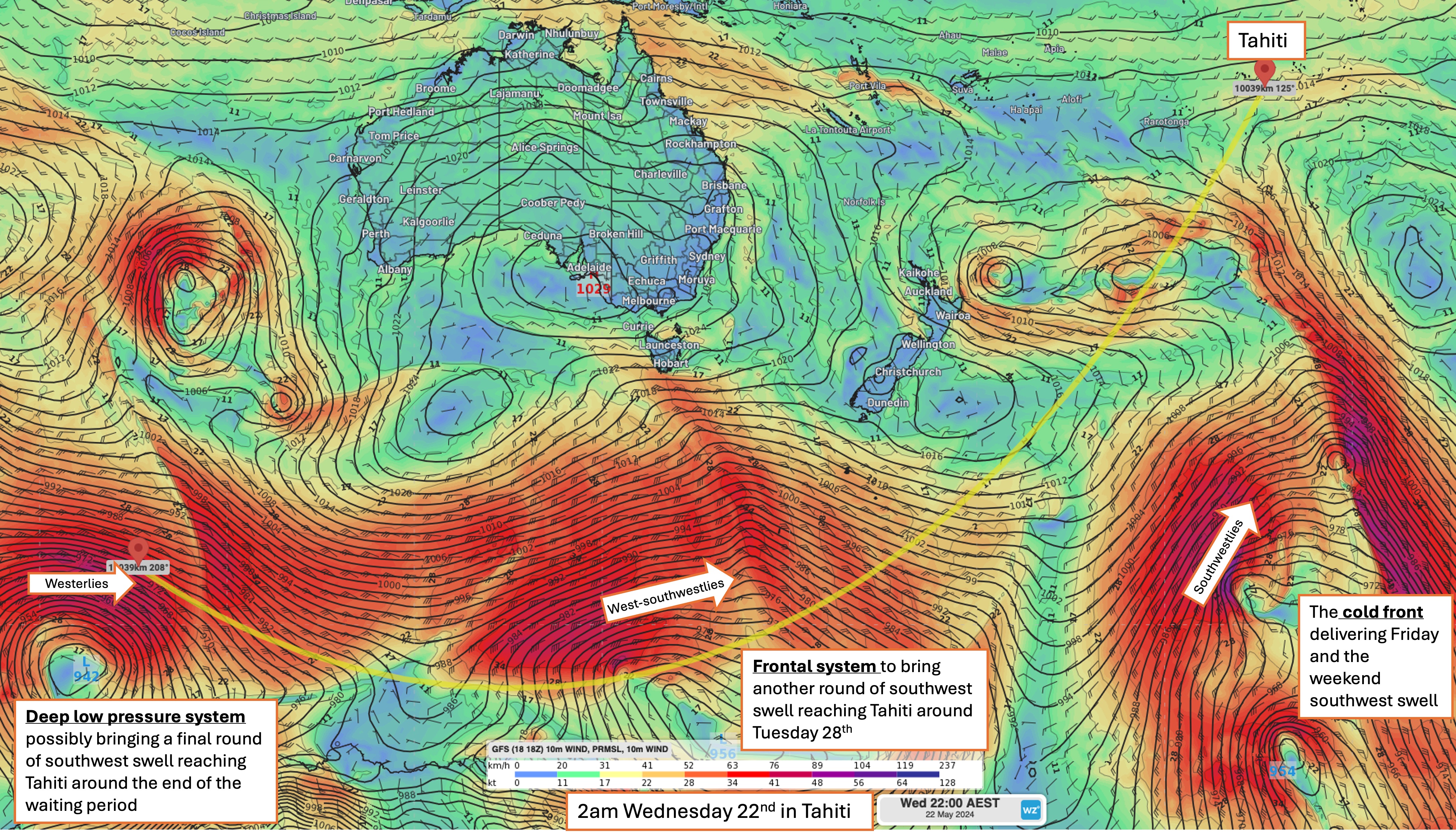 Image showing GFS surface winds and Mean Sea Level Pressure (MSLP) on Wednesday 22nd with a series of low pressure systems and cold fronts sending southwesterly swell to Tahiti.
It’s also important to note that French Polynesia sits to the east of the date line, so the first call of competition on Wednesday 22nd at 7am local time will be Thursday 23rd at 3am AEST. With days of competition usually running until 4 or 5pm local time (around midday in Australia), there will be plenty of action to catch back at home on the broadcast, without having to jet across the South Pacific to be there in person. Teahupo'o will also be the Olympic surfing site in late July and early August this year, nearly 16,000 kilometres around the globe from the host city of Paris.