
Severe weather week ahead for parts of SA
A low and cold front will generate powerful winds, rain and storms as it marches across southern SA this week.
A trough and cold front are currently moving over southwest WA, with lows potentially developing within the system in the coming 24 hours. The system will cross WA on Monday, reaching the SA border late Monday night. Northerly winds will strengthen in western SA on Monday ahead of the trough and front. Winds will strengthen further on Tuesday as the pre-frontal trough crosses the state, with the chance of isolated storms. However, all eyes are on the low and cold front following the trough.
The low will cross the Bight on Wednesday, possibly deepening and sending a surge of powerful winds and rain to the West Coast, Eyre Peninsula and possibly Yorke Peninsula and Kangaroo Island. Wind gusts may exceed 90km/h, which would prompt a severe weather warning. Thunderstorms are a good chance but should remain isolated and mostly offshore.
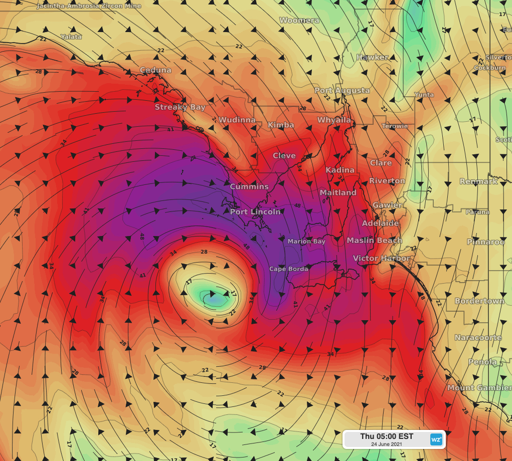 Image: Surface wind gusts on Thursday 24th, 4:30am CST using the ACCESS-G3 model.
Adelaide will really feel the wintry blast on Thursday as the low and front moves over the southeast. A maximum of 15 degrees is forecast for Thursday, however people in Adelaide will feel like it's around 10 degrees at best. Rain and isolated storms are likely in the southeast on Thursday, but thankfully the winds should ease gradually as the low moves over land.
The weakening low will move east of SA on Friday, however rain and chilly winds are likely to remain in southern SA for the following few days.