
Severe weather potential in NSW this week, but uncertainty remains
Rain and thunderstorms will spread across NSW this week as a pair of cold fronts pass over the state. But while some wet weather is guaranteed, there's still a lot of uncertainty about where and how much rain will fall by the end of the week.
The first of two fronts will combine with a low pressure trough to cause showers and thunderstorms over inland districts of NSW on Tuesday and Wednesday. The rain from this system will be hit and miss, with the heaviest falls likely to occur over the state's southern inland. Parts of the South West Slopes could pick up 10-20mm by Wednesday night.
The second, stronger front will pass over NSW on Thursday, causing showers and thunderstorms to increase over the eastern half of the state. The heaviest rain on Thursday is likely to fall over the northern slopes and ranges, particularly with thunderstorms.
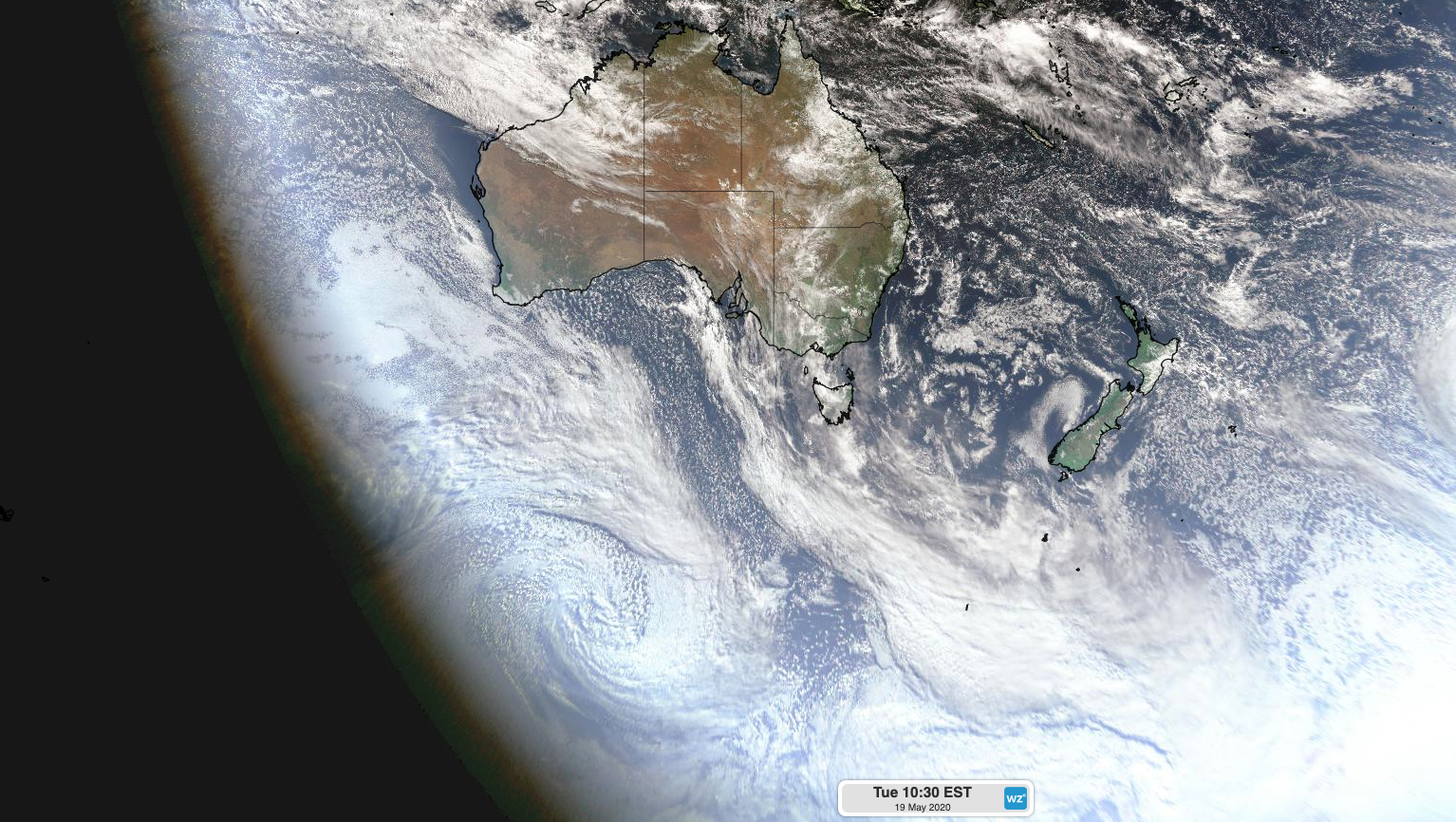
Image: Satellite image shows two cold fronts to the south of Australia on Tuesday morning. These fronts will cross the nation's southeast during the next three days.
Cold air in the wake of Thursday's front will also cause small hail in some southern and central parts of the state and snow on the southern ranges. There's a chance of a few flakes on higher terrain in central NSW as well.
While there is fairly good consensus between forecast models up to Thursday, there is quite a lot of uncertainty regarding what will happen in NSW from Thursday night onwards.
Some models predict that dry weather will return to most of NSW from Friday as the front moves out into the Tasman Sea. However, other models suggest that a low pressure system will strengthen near the NSW coast from Thursday night into Friday, causing a day or two of dangerous wind and rain somewhere south of the Hunter District.
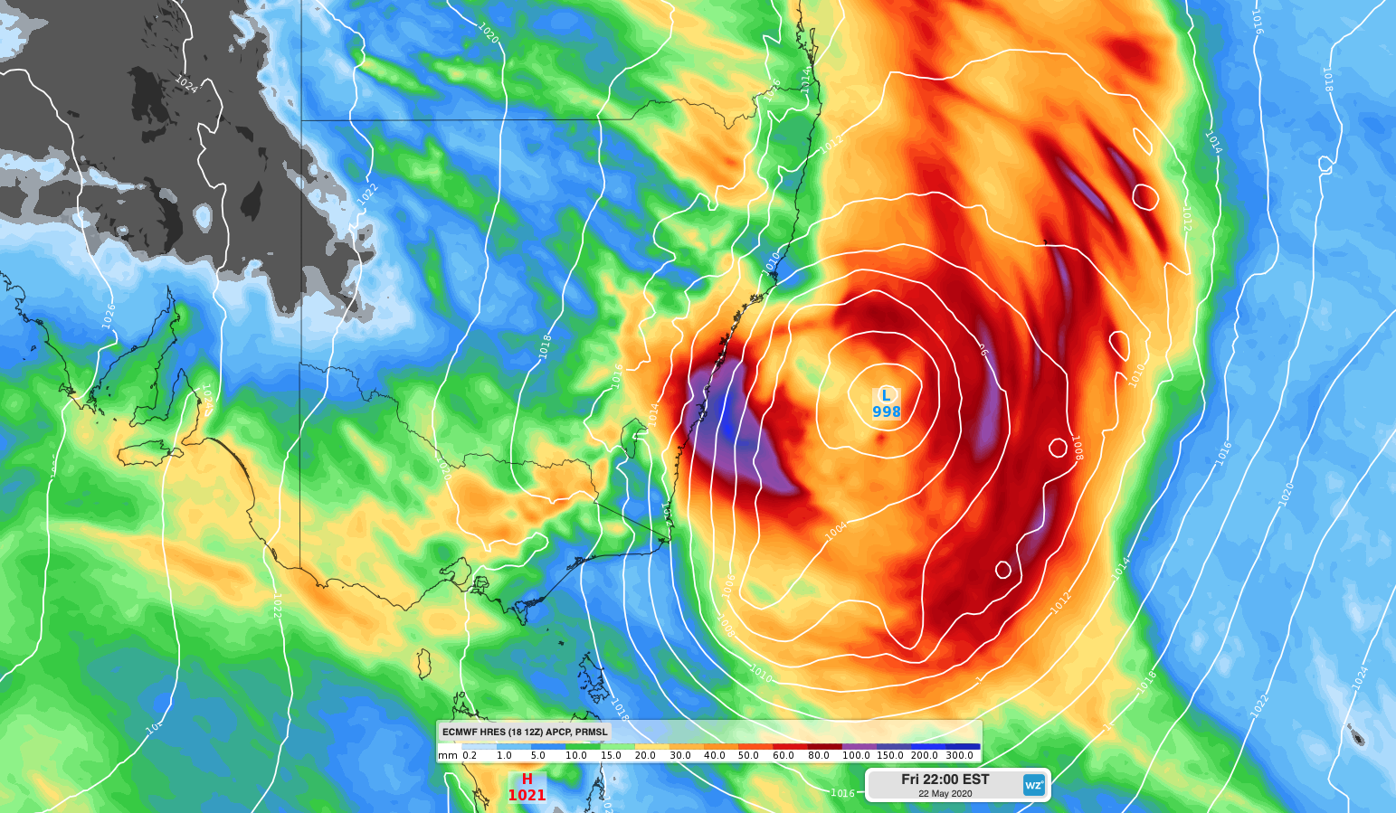
Image:Forecast accumulated rain between Tuesday and Friday and mean sea level pressure on Friday night, according to the ECMWF-HRES model.
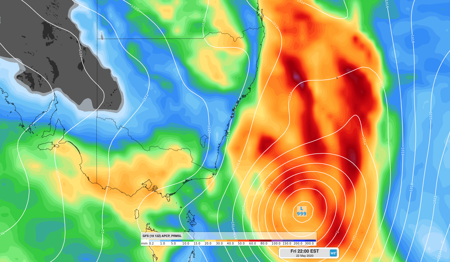
Image: Forecast accumulated rain between Tuesday and Friday and mean sea level pressure on Friday night, according to the GFS model.
While low pressure systems that develop over the western Tasman Sea are notoriously difficult to predict, this event currently has more uncertainty than usual. As a result, you can expect forecasts to jump around during the next few days as new and more accurate forecast information becomes available.
Despite the uncertainty regarding this week’s weather in NSW, there is potential for severe weather in the coming days so be sure to keep up to date with the latest warnings.