
Severe weather continues as low pressure system batters NSW
More than 200mm of rain has fallen in parts of eastern NSW and southeast Queensland during the last few days and more severe weather on the cards today and tomorrow.
A low pressure system embedded within a deep low pressure trough caused heavy rain along parts of Australia's east coast towards the end of last week.
In southeast Queensland, accumulated rainfall totals during the 72 hours to 9am on Sunday included 212mm at Monterey Keys and 175mm at Worongary Creek on the Gold Coast.
In northeast NSW, several rain gauges picked up more than 100mm during the 24 hours to 9am on Sunday and some places have amassed more than 200mm over the last four days.
As the low gained strength and moved further south on Sunday, the heaviest rain spread down the NSW coast and targeted areas south of the Hunter.
More than 100mm of rain fell between Newcastle and Moruya during the 24 hours to 9am on Monday, including 188mm at Nords Wharf Oval near Lake Macquarie, 156mm at Wattamolla, 149mm at Ulladulla, and 136mm at Mangrove Mountain. Williamtown's 133mm was its highest daily total in four years and its highest on record for July. At one stage on Sunday afternoon, Williamtown collected 48.4mm in one hour.
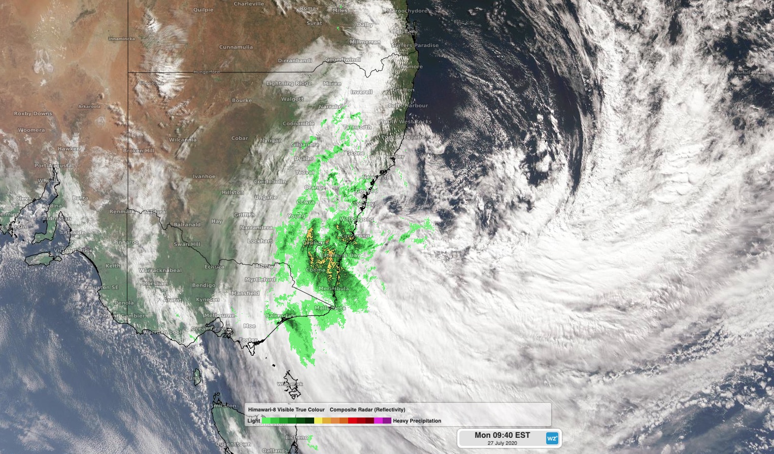
Image: Cloud and rain circulating a low pressure system over the Tasman Sea on Monday morning.
In Sydney, totals during the 24 hours to 9am Monday reached up to 115mm at Turramurra, while Prospect Reservoir's 113mm was its heaviest July rain since 1952.
The heaviest rain today will be focussed on the southern half of the NSW coast and in Victoria's East Gippsland district, where 50-100mm is likely in some areas. This rain, on top of what's already fallen, could cause localised flash flooding.
In addition to the rain, the low is also causing powerful and potentially damaging winds. As of 9am on Monday, wind gusts had already reached 109km/h at Ulladulla and 91km/h at Kiama. These damaging winds will spread along the coast and some adjacent ranges between eastern Victoria up to the Central Coast in NSW on Monday.
These powerful winds are also producing large and dangerous waves along the coastal fringe and offshore waters. A waverider buoy near Batemans Bay was recording maximum wave heights over nine metres on Monday morning, with waves still increasing. Large and damaging surf will continue along the southern half of the NSW coast on Monday.
Looking ahead, rain and wind will both ease on Tuesday as the low pressure system starts to move out into the Tasman Sea. Large surf will continue on Tuesday, before gradually easing during the middle of the week.
Keep up to date with the latest severe weather warning for the most up-to-date information on this system.