
Severe weather and wintry blast to hit southeast Australia
Don't get too comfortable in your T-shirts and shorts just yet. After a summery weekend of finals football, southeast Australia is about to be plunged back into the depths of winter.
As is typical for spring in Australia, the massive temperature difference between the mainland and the Southern Ocean is the main driver for some wild weather systems and this week will be a classic example.
A strong cold front crossing southwest WA will reach SA on Tuesday and set the event into motion. Ahead of the front, a band of rain will develop and winds will increase across inland SA, NSW and Vic and are likely to exceed 100km/h across alpine areas.
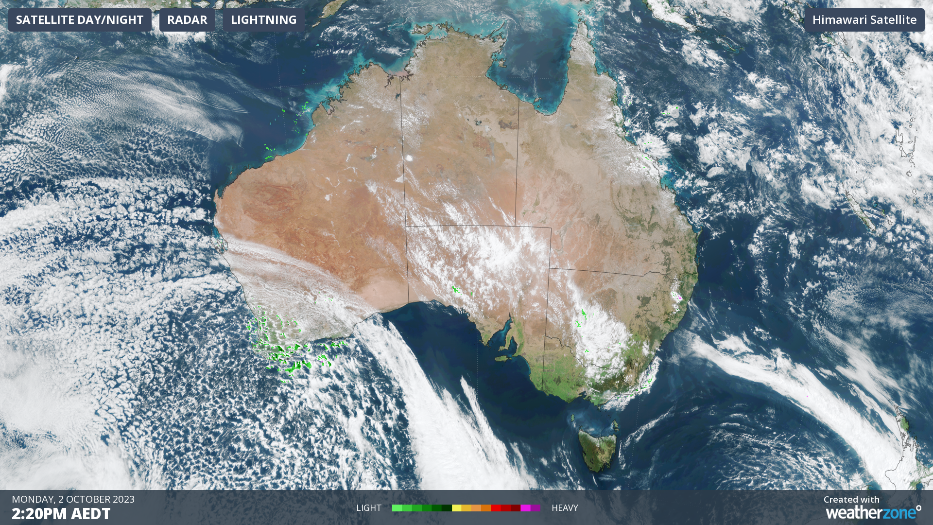
Image: Satellite photo at 1420AEDT Monday showing a cold front crossing WA with a huge mass of cold air over the Southern Ocean.
By Wednesday, the cold air behind the front will reach western NSW and will induce the rapid development of a low-pressure system over southeastern NSW.
This will bring a band of severe thunderstorms to central NSW which will move east during the day, reaching Sydney and coastal NSW later on Wednesday.
Heavy rainfall is also expected across southern NSW and eastern Vic. Strong northerly winds will develop across NSW while cold southwesterly winds extend across SA, Vic and western NSW.
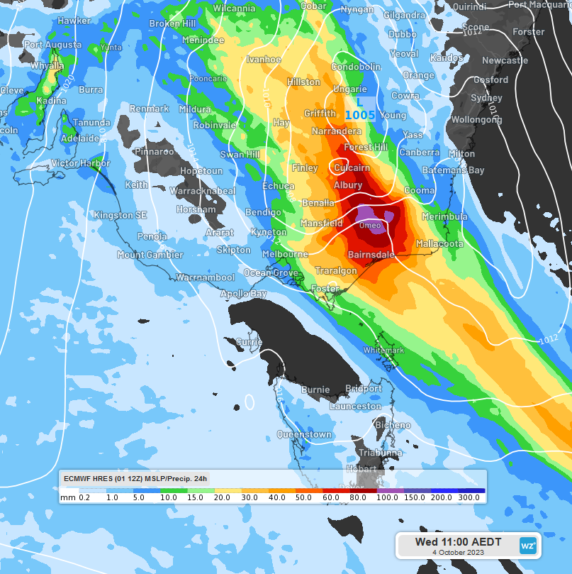
Image: The initial rainband could produce falls of over 100mm in NE Vic and southern NSW (24 hour rainfall to 1100AEDT from the ECMWF model)
On Thursday, the low pressure system will deepen over the Tasman Sea, just off the Gippsland/NSW South Coast.
The low will direct heavy showers and gale force southwesterly winds across East Gippsland, the NSW South Coast and adjacent ranges as well as eastern Tasmania.
Southwesterly winds may even reach storm force over the sea and exposed coast. The exact timing and intensity of rainfall and winds will depend on the exact position where the low develops so keep an eye on the forecast each day this week.

Image: Once the low develops offshore, By 1100AEDT Thursday the ECMWF model forecasts over 100mm in 24 hours for East Gippsland.
Cold southwesterly winds will spread throughout remaining parts of NSW and slowly ease from the west.
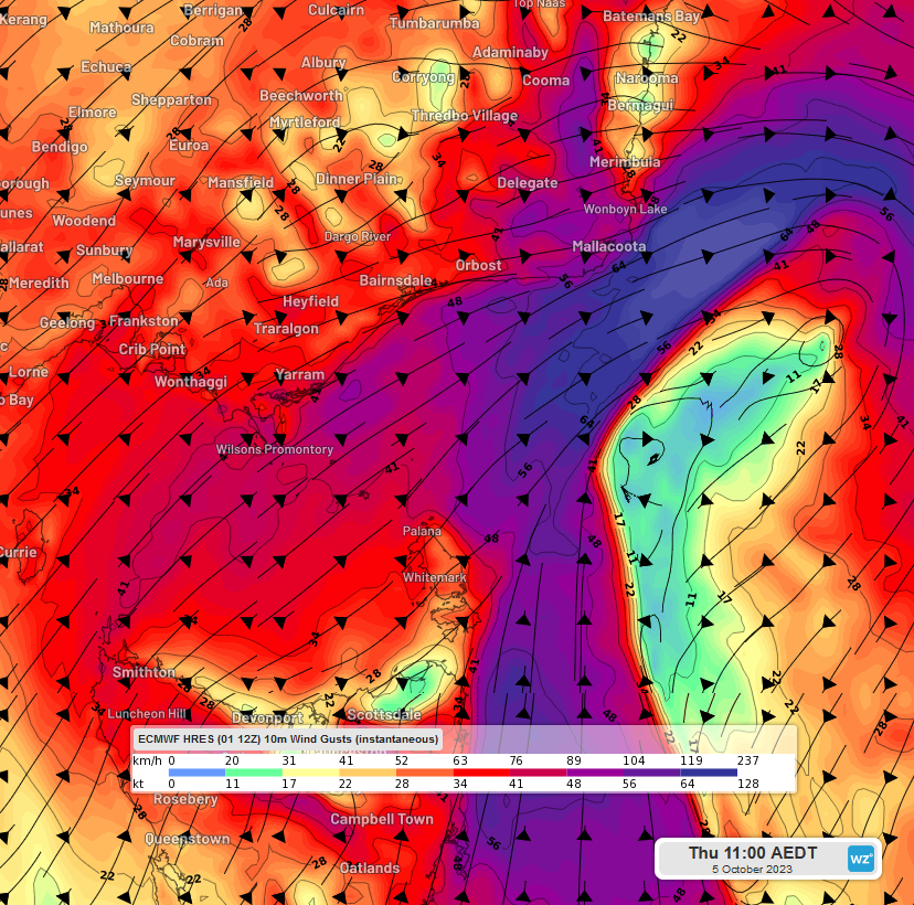
Image: Currently, winds are expected to reach storm force off the coast of Mallacoota on Thursday morning (ECMWF 10m wind gusts 1100AEDT Thursday).
After a burst of record breaking heat in September, temperatures later this week will be well below the October average, with strong winds making it feel even colder. Don't put your puffer jackets away yet!
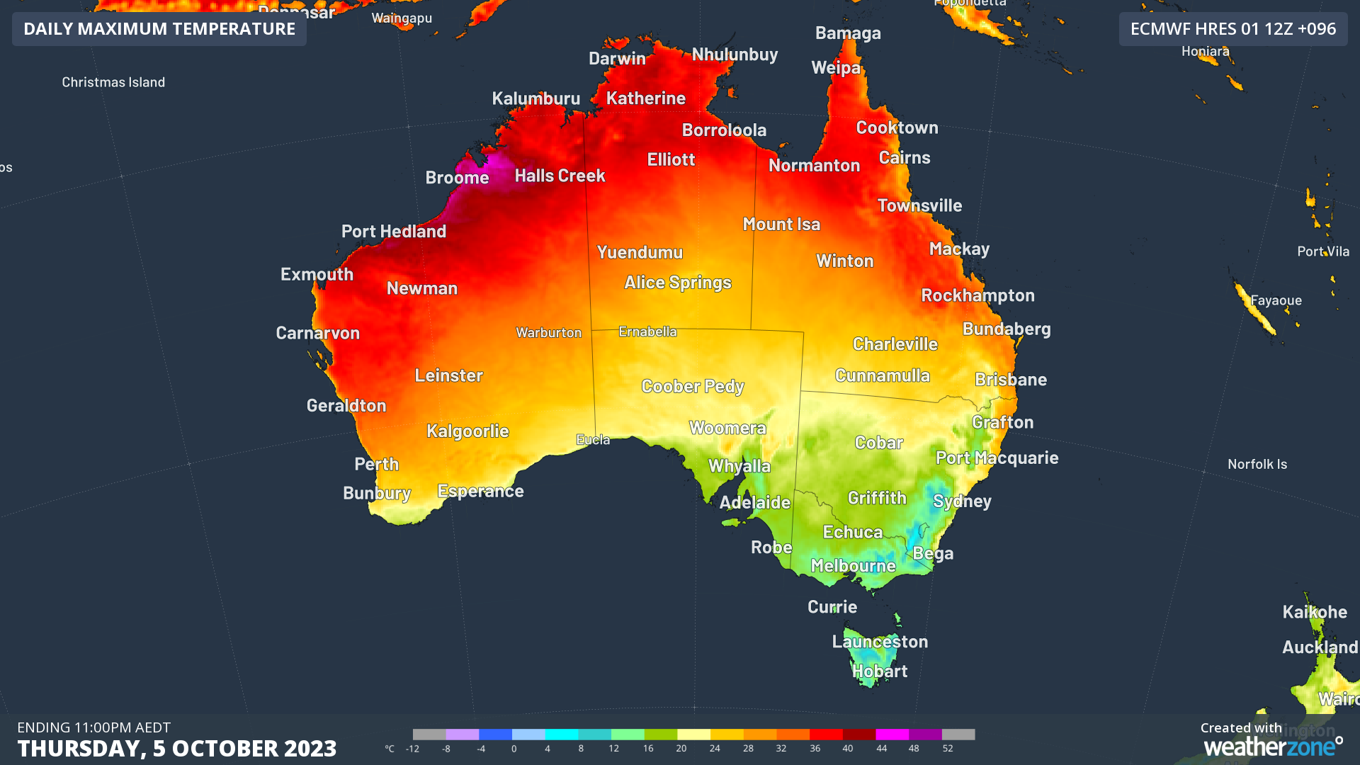
Image: Maximum temperatures on Thursday will be back in the teens across SA, VIC, NSW, ACT and TAS but will feel even colder with the strong winds.
Follow the weather and the latest updates here at Weatherzone or on the WeatherZone app and as always, check the latest warnings on our warings page.