
Severe Tropical Cyclone Narelle batters WA coast
The northwest coast of Western Australia is feeling the full force of Severe Tropical Cyclone Narelle as the system’s very destructive core skirts along the coast.
At 8 am AWST on Friday, Narelle was a category 4 tropical cyclone located about 70 km southwest of Exmouth, with wind speeds near its core averaging 175 km/h and gusts to 250 km/h.
Powerful winds, flooding rain and large storm surge
Numerous weather stations along the Pilbara coast registered destructive (above 125 km/h) to very destructive (above 165 km/h) wind gusts on Friday morning, including:
- 200 km/h at Learmonth
- 163 km/h at Thevenard Island
- 150 km/h at Onslow Airport
- 148 km/h at Barrow Island
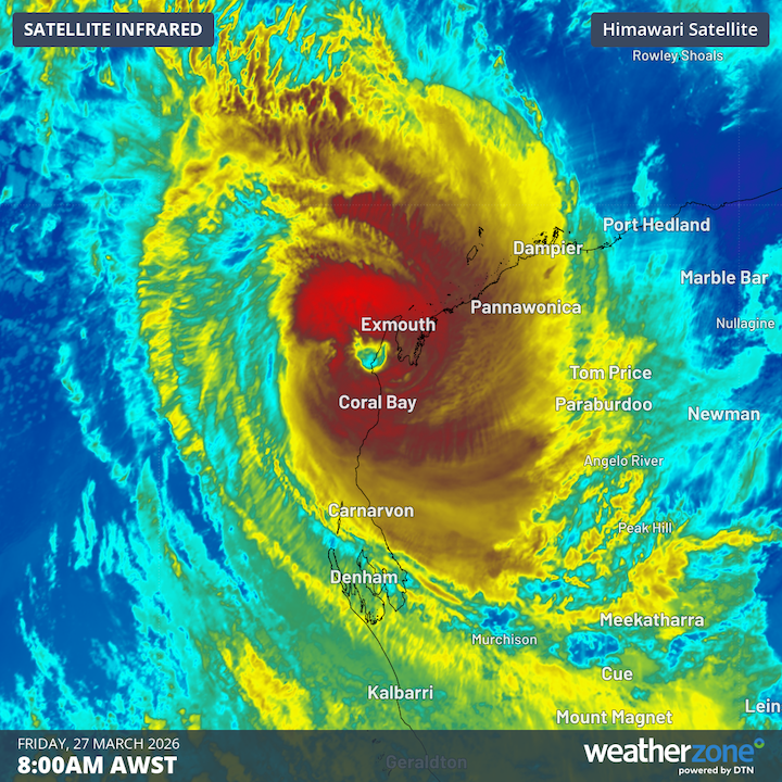
Image: Enhanced infrared satellite image showing Severe Tropical Cyclone Narelle near WA’s North West Cape on Friday. Source: Weatherzone.
Narelle is also causing heavy rain and flooding. During the 24 hours to 9 am AWST on Friday, Barrow Island and Learmonth both received more than 200 mm, while Onslow Airport and Roebourne received more than 100 mm.
Large waves, ferocious onshore winds and Narelle’s low pressure produced a large storm surge, which reached around 3 metres above the normal tide level at Exmouth on Friday morning.
Severe weather spreading south
Severe Tropical Cyclone Narelle will move towards the south on Friday, passing close to the North West Cape before moving over the western Gascoyne district. While the system will weaken as it tracks south, it is expected to be a category 4 or 3 system as it crosses the coast and moves over land into Friday afternoon and evening.
Narelle’s southward track will cause its severe impacts, including ferocious winds, heavy rain and storm surge, to spread further south across the western Pilbara and Gascoyne districts on Friday.
The system will weaken further as it tracks inland across the Central Wheatbelt on Saturday, causing rain to spread across the WA’s South West Land Division and western Goldfields district.
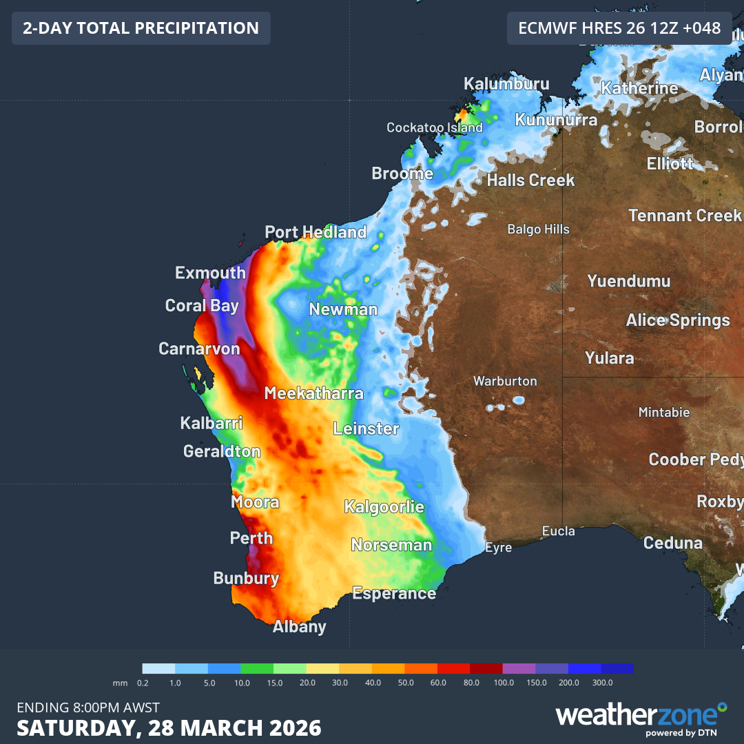
Image: Forecast accumulated rain during the 48 hours ending at 8pm AWST on Saturday, March 29, 2026. Source: Weatherzone.
Landfall in three states and/or territories
Tropical Cyclone Narelle is only the third system since 1980 to make landfall in three Australian states and/or territories.
Narelle’s first coastal crossing was in northern Queensland on March 20. It then crossed the Gulf of Carpentaria and made a second landfall over the eastern Top End of the Northern Territory early on March 22. Its third landfall today over WA makes it the first system since Tropical Cyclone Ingrid in 2005 to make landfall in three Australian states and/or territories as a tropical cyclone. The only other system to do this in records since 1980 was Steve in 2000.