
Severe thunderstorms with giant hailstones lash parts of SE Queensland
Severe thunderstorms brought large hail and heavy rain to southeast Queensland’s Wide Bay and Burnett forecast district on the afternoon of Thursday, October 2, 2025.
Skies were clear at midday with light sea breezes, but as as an upper trough moved over southern Queensland. in the afternoon, the combination of warm and humid conditions at the surface with colder temperatures aloft provided all the elements for an explosive afternoon.
Explosive convection near Childers
Satellite imagery from Thursday shows late morning cumulus cloud with cloud top heights of just over 1,500m rapidly exploding upwards to nearly 10,000m near Childers – roughly halfway between Bundaberg and Maryborough – within a space of just half an hour or so.
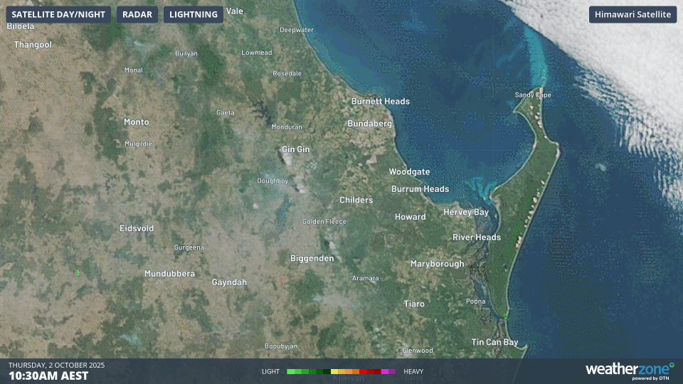
Image: Three-hour satellite loop around the Wide Bay and Burnett region showing explosive thunderstorm development with lightning (purple) on Thursday, October 2, 2025.
After crossing Childers, the thunderstorm split into two supercells, with one cell continuing towards the east, while the more southern cell tracked further south as a dangerous right-moving supercell (a rotating thunderstorm which moves to the right of the main atmospheric wind flow).
Image: Radar imagery on the afternoon of Thursday, October 2, 2025 showing the normal storm motion to the east, with the right-moving supercell splitting off to the southeast towards Maryborough.
This cell intensified strongly as it moved away from its left-moving counterpart, maximising the warm and moist environment all to itself.
Giant hailstones with a diameter as large as 8cm were reported in the Maryborough area, while a total of 204,734 lightning strikes were recorded within 200 kilometres of Hervey Bay over a nine-hour period, with 25,050 of these strikes being ground strikes.
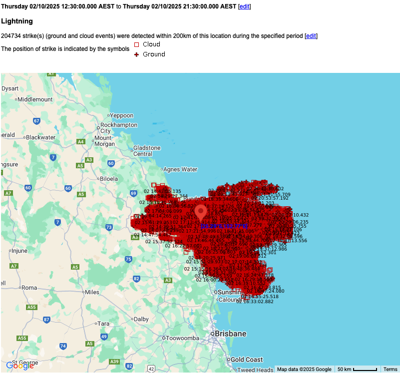
Image: More than 200,000 lightning strikes were detected within 200 kilometres of Hervey Bay between 12:30pm and 9:30pm AEST on Thursday, October 2, 2025.
Skies are clear across virtually all of Queensland this Friday as a ridge of high pressure establishes itself over the state. A continuation of fine, warm weather can be expected across virtually the whole state for much of the weekend.