
Severe thunderstorms hammer eastern Australia during Christmas and Boxing Day
A thunderstorm outbreak across eastern Australia over Christmas has caused destruction and tragically even the deaths of several people with others still missing. Among the severe thunderstorms were rotating supercells, the strongest type of single-cell thunderstorm.
There was an incredible amount of lightning over the two days with the following lightning strike totals:
- Over 225,000 within 100km of Canberra
- Over 115,000 within 100km of Brisbane
- Over 100,000 within 100km of Sydney
- Nearly 20,000 within 100km of Melbourne
Some of the hazards produced by these thunderstorms include:
QLD
Christmas Day:
- 126km/h wind gust at Charleville
- 106 km/h wind gust at Gold Coast Seaway
- 98 km/h wind gust at Mackay
- 96 km/h wind gust at Oakey
There is a report from Higgins Storm Chasing of a tornado tracking across Mt Tamborine in the evening which is consistent with radar imagery and physical damage.
Boxing Day:
- 100 km/h wind gust at Gympie
- 3.5 cm hail at Zillmere
NSW
Christmas Day:
- Golf-ball sized hail at Orange
- 103 km/h wind gust at Inverell
- 41.0 mm in one hour at Lake Bathurst
- 107.0 mm in 2 hours at Eurobodalla (northwest of Narooma)
Boxing Day:
- 4 to 5 cm hailstones in the Rutherford and Maitland area
- 48.0 mm in 30 minutes at Willina (near Forster)
- 50.0 mm in 1 hour at Maroota (Upper Hawkesbury)
VIC
Christmas Day:
- 25.0 mm in 30 minutes at Swan Hill
- 37.4 mm in 2 hours at Rutherglen
- Wettest December day in 143 years of records for Kerang (94.0 mm)
- Wettest December day in 86 years for Ballarat (63.4 mm)
Boxing Day:
- 75.0 mm at East Sale in 3 hours
- 53.2 mm in 2 hours at Balook
- 40.8 mm in 2 hours at Traralgon South
- 111.0 mm in 24 hours to 9am at Mt Sabine
The main driver of the thunderstorm outbreak was the presence of a low in the upper levels above NSW and VIC. The following water vapour satellite imagery from Christmas Day shows air swirling around the low which was centred over northwest VIC. The purple indicates the lightning from thunderstorms as they fired up.
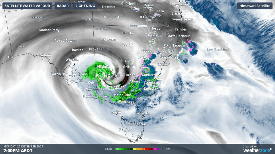
Animation: Himawari-9 water vapour imagery, BOM radar, and Weatherzone lightning from 2pm to 5pm on Monday 25 December
On Boxing Day the low was still present, centred over southern NSW. This upper-level low destabilised the atmosphere and increased the wind shear (change of wind speed and direction with height)—key ingredients for severe thunderstorms.
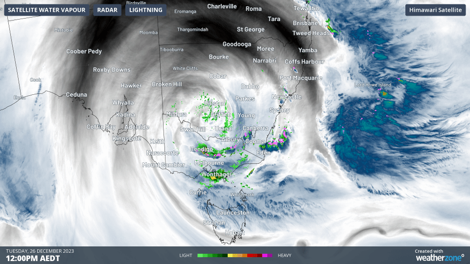
Animation: Himawari-9 water vapour imagery, BOM radar, and Weatherzone lightning from 12pm to 3pm on Tuesday 26 December
In additon to an unstable atmosphere with high wind shear, there was also ‘spin’ in the low levels of the atmosphere over eastern NSW and QLD that was pulled into the updrafts of some thunderstorms, causing them to rotate and become supercells. When this happens the risk of destructive winds, giant hail, intense rainfall and tornadoes increase.
Supercells have a different structure and movement than regular thunderstorm cells. For example, there were two supercells north of Sydney in the afternoon yesterday. The movement of the small clouds in the west is indicated by the white arrow, and this represents the movement of a normal thunderstorm cell. In contrast, the red arrow indicates the movement of one supercell from the west, and the blue arrow the movement of another supercell from the northeast.
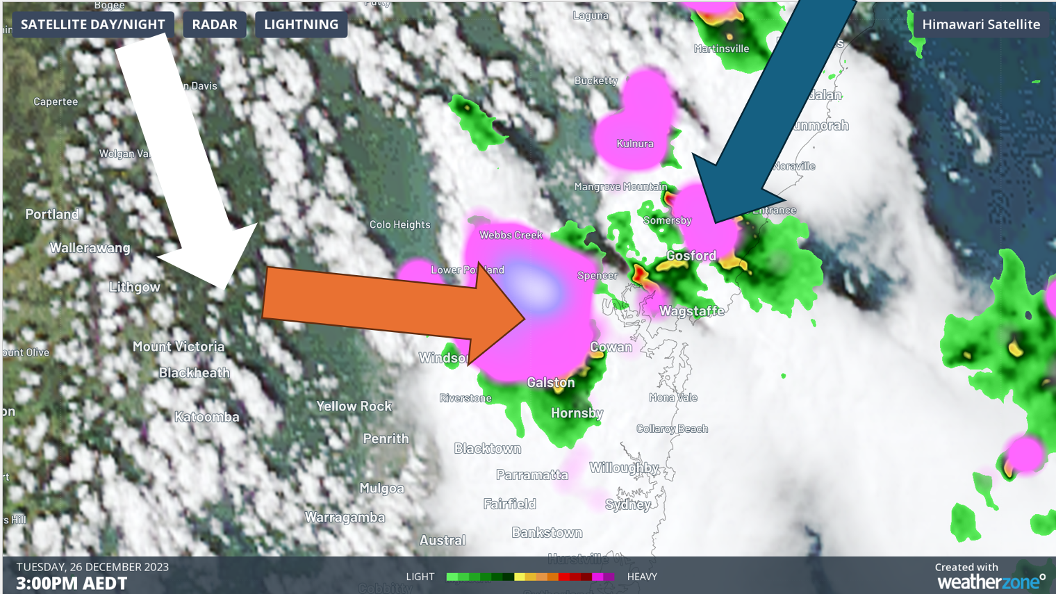
Image: Himawari-9 visible satellite imagery, BOM radar, and Weatherzone lightning at 3pm Tuesday 26th.
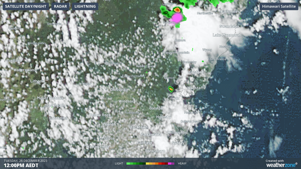
Animation: Himawari-9 visible satellite imagery, BOM radar, and Weatherzone lightning from 12pm to 3pm Tuesday 26
The anomalous movement of supercells is what made the Sydney hailstorm on the 14th of April 1999 so difficult to predict at the time and meant that timely warnings were not issued (this single thunderstorm is Australia’s most costly natural disaster). Fortunately, techniques have since been developed by meteorologists in the US to predict the motion of supercells which now allows for accurate and timely warnings.
Sydney has experienced another round of severe thunderstorm activity today as the upper-level low moves over the NSW coast towards the Tasman Sea. Although thunderstorm activity will ease tomorrow, there will be further thunderstorms for eastern Australia into next week, most significantly for southeast QLD and northeast NSW over the weekend. So please stay up to date with forecasts and warnings at www.weatherzone.com.au/warnings