
Severe storms soaking Sydney, Illawarra with more to come
Parts of eastern NSW received more than 70mm of rain in two hours on Friday morning, with more heavy rain and severe thunderstorms on the way on Friday and the weekend.
A coastal trough being fed with moisture-laden air from the Tasman Sea caused heavy rain and thunderstorms to soak parts of eastern NSW on Thursday night into Friday morning. Another trough extending over the state’s north and into southern Qld also triggered rain and storms over the last 24 hours.
Some of the standout rainfall totals during the 24 hours ending at 9am on Friday included:
- 88.5 mm at Martinsville to the west of Lake Macquarie
- 83.5 mm at Mardi Dam near Tuggerah Lake
- 76.5 mm at Woodford Creek Dam in the Blue Mountains
- 73.6 mm at Norah Head on the Central Coast
- 65.8 mm at Bingara to the southwest of Inverell
- 63 mm at Yamba in the Northern Rivers
Much of the rain that soaked central eastern NSW on Thursday night and Friday morning fell in a short period of time, with Norah Head picking up 44 mm in 30 minutes and Kangy Angy receiving 74.5 mm in two hours. This was enough to cause areas of flash flooding.
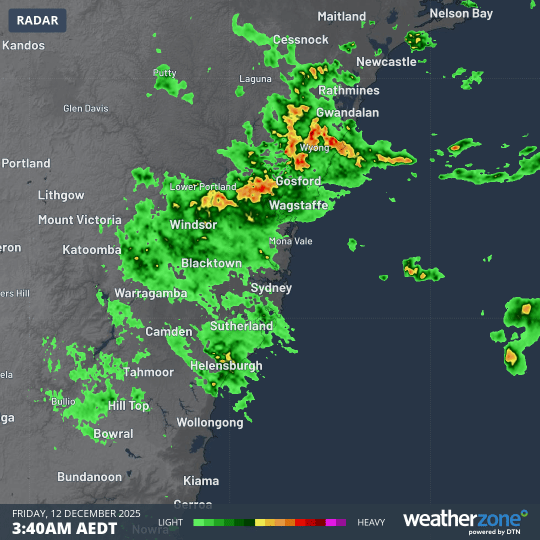
Image: Radar images showing rainfall over central eastern NSW in Friday morning. Source: Weatherzone.
The troughs will continue to trigger rain and thunderstorms over parts of central and northern NSW and southern Qld on Friday. This is likely to include severe thunderstorms in some areas.
The Sydney and Illawarra regions will continue to see areas of heavy rain on Friday due to the lingering coastal trough. As of 10am AEDT, a severe thunderstorm warning was in place for parts of southern and western Sydney and the northern Illawarra district, including Wollongong.
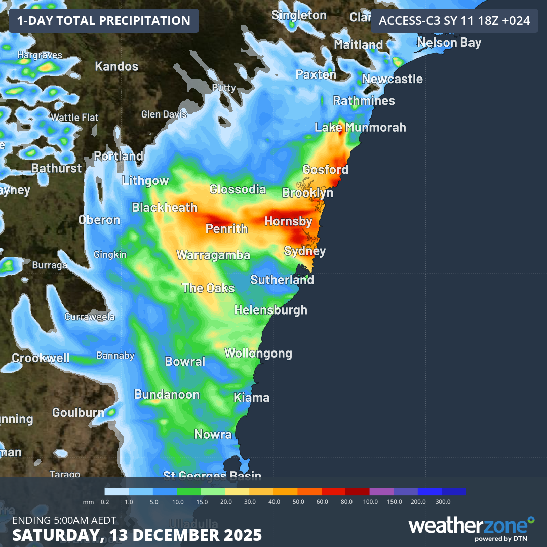
Image: Forecast accumulated rain during the 24 hours ending at 5am AEDT on Saturday, December 13, 2025. Source: Weatherzone.
While the coastal trough should move offshore from Saturday, another trough will move in from the west and cause further showers and thunderstorms across broad areas of NSW, Qld, the ACT and Vic over the weekend.
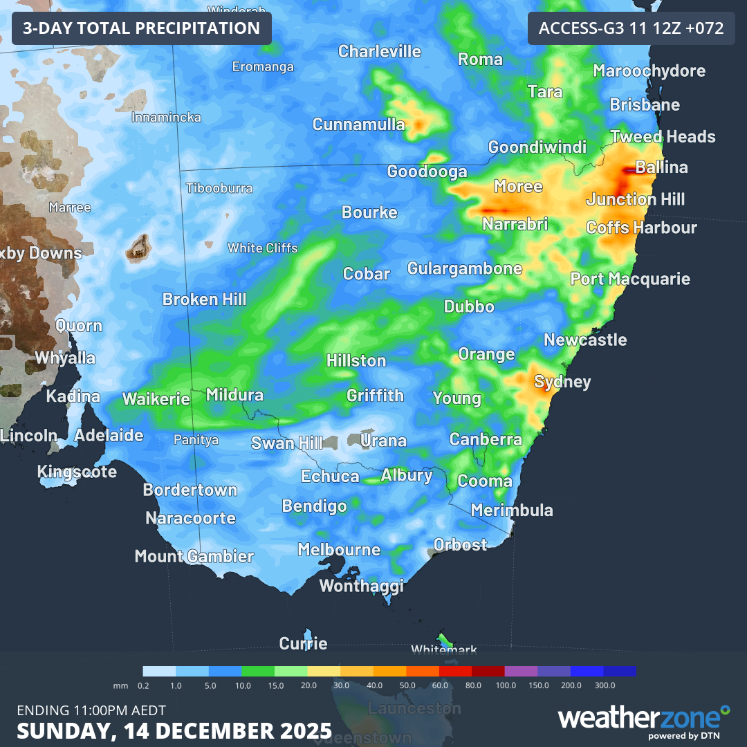
Image: Forecast accumulated rain during the 72 hours ending at 11pm AEDT on Sunday, December 14, 2025. Source: Weatherzone.
Check the latest severe thunderstorm warnings for the most up to date information on storms over the next few days.