
Severe storms hitting WA
A mass of tropical air is plunging over Western Australia today, causing heavy rain and severe thunderstorms across the state's western and southwestern inland.
Images captured by Japan's Himawari-8 satellite on Wednesday showed a large swathe of Western Australia blanketed by thick clouds.
Beneath this cloud cover, many areas were seeing heavy rain and frequent lightning.
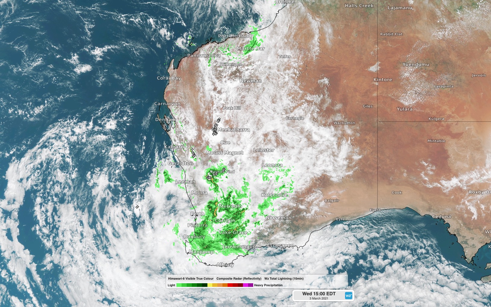
Image: Composite satellite, radar and lightning strike image showing widespread rain and thunderstorms over Western Australia at 12pm WST on Wednesday.
Dalwallinu in the Central Wheat Belt registered 77mm of rain during the 24 hours to 9am on Wednesday, 50mm of which fell in just five hours early on Wednesday morning.
Another rain gauge at Northam to the east of Perth received 57mm between 9am and midday.
The mid-week burst of wet and stormy weather is occurring as an injection of moisture-laden air from the tropics flows south and interacts with an approaching upper-level cut-off low pressure system.
This volatile mix of weather elements has prompted warnings for heavy rain, damaging winds and large hail, which at midday local time stretched from the central Gascoyne down to the Great Southern District.
Warnings will be updated regularly throughout Wednesday as this event unfolds, so be sure to keep up to date with the latest severe weather information for your area.