
Severe storms and heavy rain in NSW
Severe thunderstorms were dumping heavy rain over parts of eastern NSW as the sun rose on Friday, with more rain and storms on the way later in the day.
A deep layer of onshore winds feeding into a low pressure trough caused a few early-morning storms between the Hunter and Northern Rivers districts of NSW on Friday.
One of these storms delivered 52mm of rain in two hours at Dungog, while one-hour rain rates of 40-50mm were recorded at a couple of gauges in the state's far northeast.
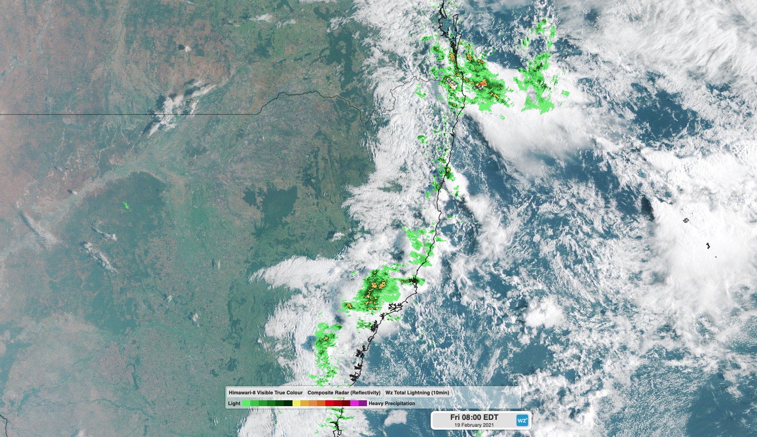
Image: Composite radar, satellite and lightning strike image showing showers and thunderstorms over northeast NSW on Friday morning.
As of 9am AEDT, a severe thunderstorm warning was in place for small areas in the Hunter and lower Mid North Coast and the upper Northern Rivers.
Showers and storms are likely to become more widespread over northeastern and central NSW as the day progresses, both along the coast and on and west of the ranges.
Some of today's storms are likely to be severe, with heavy rain the main threat due to copious moisture in the atmosphere. Be sure to keep up to date with the latest warnings in your area.