
Severe storms and heatwave to end the week in NSW

Severe thunderstorms and a severe heatwave will affect parts of NSW during the second half of this week.
A large pool of hot air from central Australia will sweep over NSW during the coming days, ahead of a broad low pressure trough.
Wednesday is forecast to be the third consecutive day to reach the low to mid forties in Alice Springs. Their top of 44.1 degrees on Tuesday was the site's highest December temperature since 1990 and just 0.1 degree shy of its December record.
This mass of hot air will sweep across NSW between Wednesday and Friday, sending the mercury soaring in the state's north and west.
Bourke could reach the low to mid forties on these three days and may get close the Airport's December record of 46.3 degrees on Thursday.
The hottest day of the week for many parts of the state will be Thursday, with temperatures climbing 6-12 degrees above average in many areas.
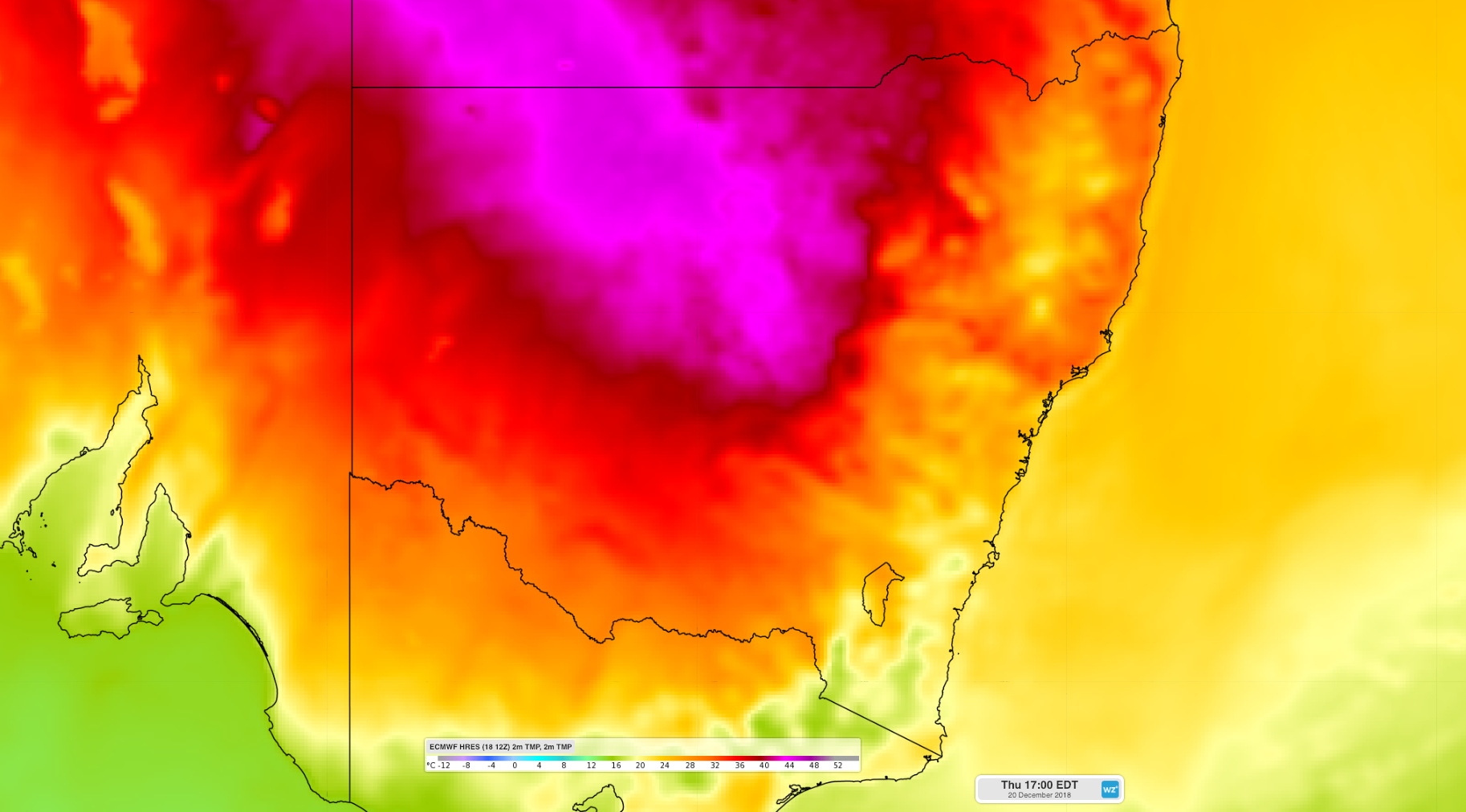
Image: Forecast surface temperatures on Thursday December 20th, 2018 by ACCESS-R model.
Most of northern NSW will experience a severe heatwave between Wednesday and Friday as both maximum and minimum temperatures remain above average. While severe heatwaves are generally not life threatening, they can be challenging for vulnerable people, such as the elderly, pregnant women, young children and people with a chronic illness.
The passage of the trough across NSW will also help trigger showers and thunderstorms, some of which are likely to become severe.
Showers and thunderstorms are likely near the coast, ranges, western slopes and northern plains on Wednesday and Thursday. Severe storms are likely to develop in multiple districts and could produce heavy rain, flash flooding and large hail. Supercell thunderstorms are also possible in some areas.
Showers and storms will develop on and near the ranges again on Friday and Saturday, becoming more confined to northeastern parts of the state and less likely in the south and west.
By Sunday, the atmosphere will become more stable and storms less likely across most of the state.