
Severe fire danger in NSW and Queensland

A burst of early-season heat will elevate fire danger ratings in parts of Queensland and NSW on Tuesday.
A mass of hot air is currently being driven over eastern Australia by a broad low pressure trough. This air mass set new October heat records at a number of locations in NSW during the last two days.
Forbes Airport (38.3C), Orange Airport (28.9C) and Young Airport (35C) all set new October maximum temperature records on Sunday. However, it's worth pointing out that these weather stations only have 23 to 27 years of observations.
On Monday, the heat shifted into northern NSW and southern Queensland, setting new October records in Grafton (40.6C) and Armidale (31.9C). These weather stations have 17 and 25 years of data, respectively. Gatton's 40.9 degrees on was 13 above average and within one degree of their October record.
The low pressure trough will shift further north on Tuesday, causing the heat to spread across Queensland and northeast NSW.
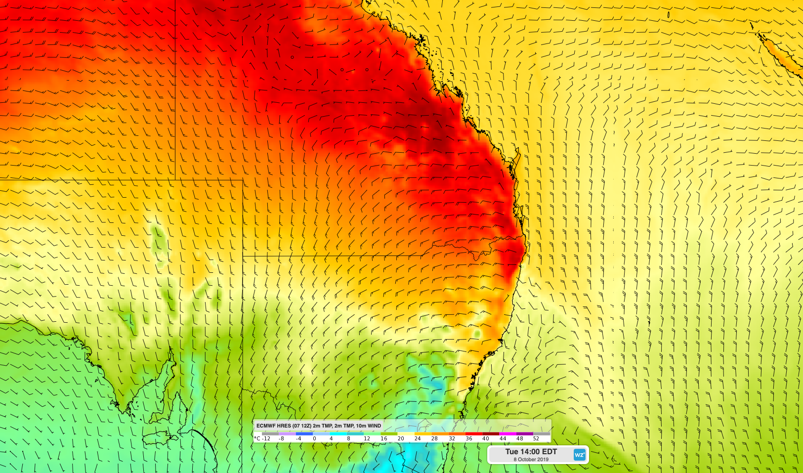
Image: Hot air over Queensland and northeast NSW on Tuesday.
Temperatures are forecast to reach more than 10 degrees above average in parts of both states on Tuesday afternoon. Gatton is expected to nudge 40 degrees once again and Brisbane's forecast top of 36 degrees would be the city's warmest October day in 14 years.
Tuesday's heat will also combine with dry and blustery winds near the trough to cause elevated fire danger ratings in northeast NSW and southern/central Queensland. Some areas could also see raised dust during the day.
Severe fire danger ratings are forecast for the Central Highlands and Coalfields, Darling Downs and Granite Belt, Wide Bay and Burnett and Southeast Coast districts in Queensland and the Far North Coast, North Coast, New England and Northern Slopes fire areas in NSW. Ratings may reach extreme in some areas.
Thunderstorms are also likely to develop as the trough sweeps through northeast NSW and southeast Queensland on Tuesday. These storms will bring little if any rain, meaning dry lightning could ignite new fires.
Visit https://www.qfes.qld.gov.au and https://www.rfs.nsw.gov.au for the latest information about fires in Queensland and NSW.