
Satellites capture colossal cloudband soaking southeastern Australia
The Himawari-8 satellite has captured images of a massive cloud band extending 5,000 kilometres from the Tropical Indian Ocean all the way to southeastern Australia.
As we told you earlier on Wednesday, a slow-moving low pressure system located over the Great Australian Bight is helping to drag a stream of tropical moisture across Australia’s southeastern states. This cloud is going to fuel flooding rain during the next 24 to 48 hours.
One of the wonders of modern meteorology is that we have constant access to high resolution satellite images showing these severe weather events unfold from space.
The videos below show sequence of images captured by the Himawari-8 satellite during the last 24 hours. This geostationary satellite sits roughly 36,000 kilometres above the surface of our planet, capturing images every 10 minutes.
Video: Enhanced water vapour satellite images captured by the Himawari-8 satellite on Tuesday and Wednesday.
Video: Enhanced visible/infrared satellite images captured by the Himawari-8 satellite on Wednesday.
When we play through a sequence of these images rapidly, it shows the fluid state of the atmosphere, with clouds swirling around like currents in a river.
One of the enhanced water vapour satellite image captured at 8am AEDT on Wednesday shows that some of the moisture causing this week’s rain in southeastern Australia has travelled around 5,000 kilometres from the tropical Indian Ocean.
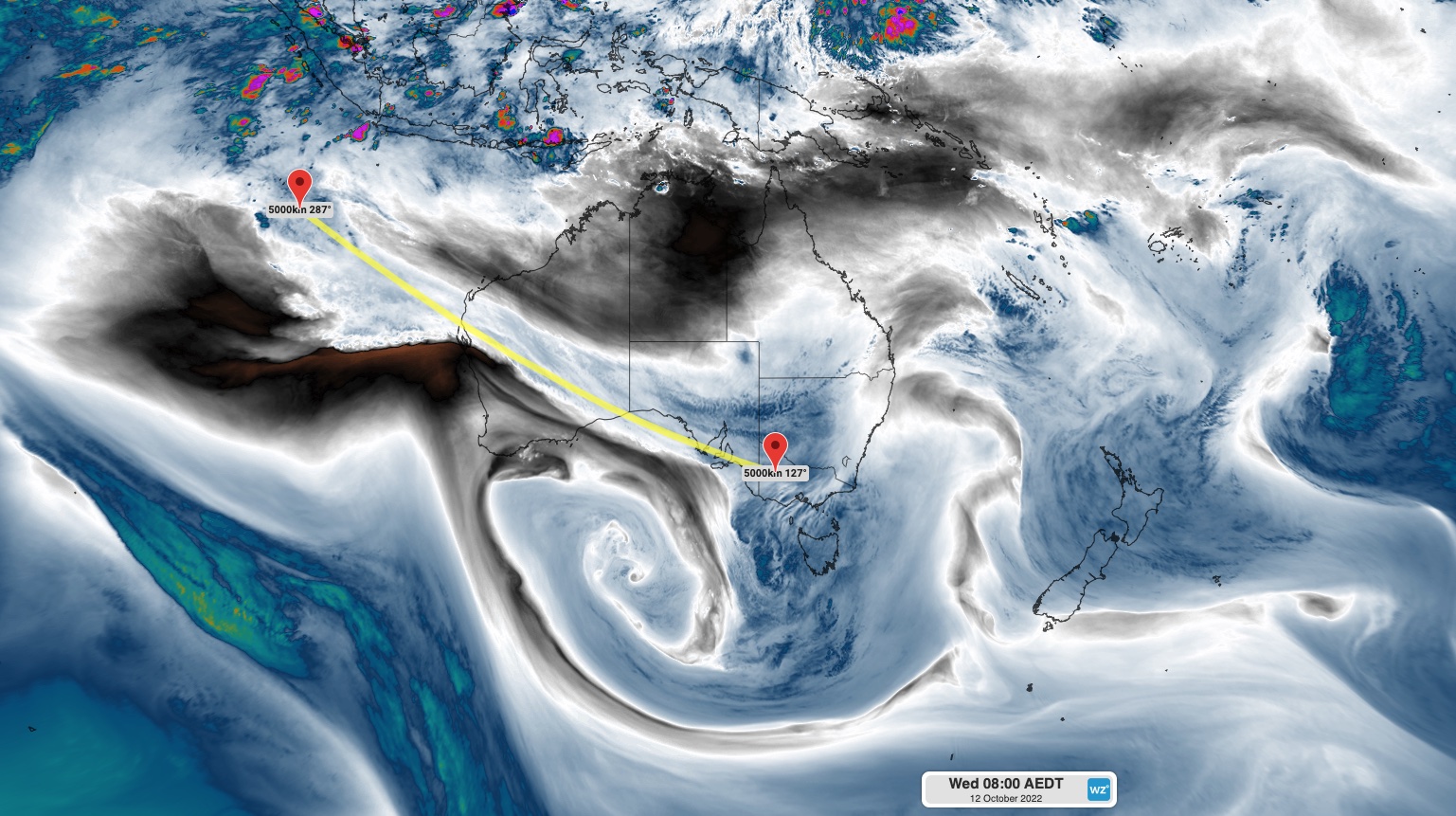
Image: Enhanced water vapour satellite image showing a cloudband extending around 5,000 kilometres from the tropical Indian Ocean to southeastern Australia.
This huge stream of airborne moisture is called an atmospheric river and they are common over Australia at this time of year, particularly during negative phases of the Indian Ocean Dipole.
But as mesmerising as this weather event is when viewed from space, it is going to be life-threatening for people living in parts of Victoria, Tasmania and New South Wales. You can find out more about the impacts of this system in the latest flood and severe weather warnings.